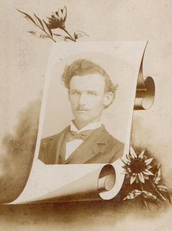
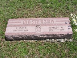
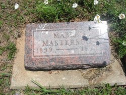
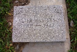
Mahlon Walter Masterson
| Birth | : | 3 Dec 1876 Toronto, Woodson County, Kansas, USA |
| Death | : | 4 Oct 1945 Pittsburg, Crawford County, Kansas, USA |
| Burial | : | All Saints Churchyard, Milford-on-Sea, New Forest District, England |
| Coordinate | : | 50.7278170, -1.5897770 |
| Description | : | Husband to Estelle Flomerfelt & Susanna Short Son to John S. & Lydia Masterson Mahlon W. Masterson died at 10:00 a.m., Thursday, October 4, 1945 at the home of his daughter in Pittsburg, Kansas. He had been ill since July and had been confined to his bed the last six weeks of his illness. Son of John B. & Lydia Masterson. He was born, December 3, 1876, near Toronto, Kansas and moved to the Vicinity of Fall River as a small boy and lived in or near Fall River since that time. For many years he worked as... Read More |
frequently asked questions (FAQ):
-
Where is Mahlon Walter Masterson's memorial?
Mahlon Walter Masterson's memorial is located at: All Saints Churchyard, Milford-on-Sea, New Forest District, England.
-
When did Mahlon Walter Masterson death?
Mahlon Walter Masterson death on 4 Oct 1945 in Pittsburg, Crawford County, Kansas, USA
-
Where are the coordinates of the Mahlon Walter Masterson's memorial?
Latitude: 50.7278170
Longitude: -1.5897770
Family Members:
Parent
Spouse
Siblings
Children
Flowers:
Nearby Cemetories:
1. All Saints Churchyard
Milford-on-Sea, New Forest District, England
Coordinate: 50.7278170, -1.5897770
2. All Saints Churchyard
Hordle, New Forest District, England
Coordinate: 50.7549400, -1.6136200
3. St. Mark's Churchyard
Pennington, New Forest District, England
Coordinate: 50.7545700, -1.5631100
4. Lymington Cemetery
Lymington, New Forest District, England
Coordinate: 50.7576200, -1.5576200
5. Ashley Baptist Cemetery
New Milton, New Forest District, England
Coordinate: 50.7529200, -1.6336400
6. St. Thomas the Apostle Churchyard
Lymington, New Forest District, England
Coordinate: 50.7576410, -1.5451200
7. Milford Road Cemetery
New Milton, New Forest District, England
Coordinate: 50.7472700, -1.6502700
8. St Mary Magdalene Churchyard
New Milton, New Forest District, England
Coordinate: 50.7481200, -1.6645700
9. New Milton Cemetery
New Milton, New Forest District, England
Coordinate: 50.7507690, -1.6650340
10. St Luke Churchyard
Sway, New Forest District, England
Coordinate: 50.7839000, -1.6058800
11. Christ Church Totland Bay
Totland, Isle of Wight Unitary Authority, England
Coordinate: 50.6760770, -1.5448160
12. St Saviour Roman Catholic Churchyard
Totland, Isle of Wight Unitary Authority, England
Coordinate: 50.6762700, -1.5410390
13. St James Churchyard
Yarmouth, Isle of Wight Unitary Authority, England
Coordinate: 50.7055370, -1.4991890
14. All Saints Churchyard
Freshwater, Isle of Wight Unitary Authority, England
Coordinate: 50.6843570, -1.5102280
15. Sway Cemetery
Sway, New Forest District, England
Coordinate: 50.7930690, -1.6131930
16. St Mary Churchyard
South Baddesley, New Forest District, England
Coordinate: 50.7691430, -1.5026160
17. Hinton Park Woodland Burial Ground
Walkford, Christchurch Borough, England
Coordinate: 50.7572900, -1.6907090
18. St. John The Baptist Churchyard
Boldre, New Forest District, England
Coordinate: 50.7924070, -1.5422530
19. St Agnes Churchyard
Freshwater, Isle of Wight Unitary Authority, England
Coordinate: 50.6731050, -1.5173550
20. St. Swithin's Old Churchyard
Thorley, Isle of Wight Unitary Authority, England
Coordinate: 50.7007450, -1.4815300
21. St. Mark Churchyard
Highcliffe, Christchurch Borough, England
Coordinate: 50.7402900, -1.7100050
22. St Michael and All Angels Churchyard
Hinton, New Forest District, England
Coordinate: 50.7623700, -1.7002000
23. St Nicholas Churchyard
Brockenhurst, New Forest District, England
Coordinate: 50.8146060, -1.5681240
24. St Mary the Virgin Churchyard
Bransgore, New Forest District, England
Coordinate: 50.7766150, -1.7302940

