| Birth | : | 28 Sep 1881 |
| Death | : | 6 Sep 1920 |
| Burial | : | St Andrew's Churchyard, Corbridge, Northumberland Unitary Authority, England |
| Coordinate | : | 54.9745300, -2.0197400 |
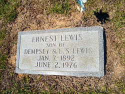
| Description | : | Per Lewis Family Book her full maiden name is: Margaret Loretta Lewis She is the fourth child of Dempsey Lewis # 39073190 & Eliza Jane Stackhouse # 59174216. On Nov. 12, 1919, married Dr. Neil K. Curry of Tabor, N.C. She died Sept. 6, 1920. Thanks Phil Clark (#48217761) |
frequently asked questions (FAQ):
-
Where is Margaret Loretta Lewis Currie's memorial?
Margaret Loretta Lewis Currie's memorial is located at: St Andrew's Churchyard, Corbridge, Northumberland Unitary Authority, England.
-
When did Margaret Loretta Lewis Currie death?
Margaret Loretta Lewis Currie death on 6 Sep 1920 in
-
Where are the coordinates of the Margaret Loretta Lewis Currie's memorial?
Latitude: 54.9745300
Longitude: -2.0197400
Family Members:
Parent
Siblings
Flowers:
Nearby Cemetories:
1. St Andrew's Churchyard
Corbridge, Northumberland Unitary Authority, England
Coordinate: 54.9745300, -2.0197400
2. Corbridge Cemetery
Corbridge, Northumberland Unitary Authority, England
Coordinate: 54.9693100, -2.0263500
3. Dilston Castle Chapelyard
Corbridge, Northumberland Unitary Authority, England
Coordinate: 54.9639270, -2.0393460
4. St Oswalds Churchyard
Halton, Northumberland Unitary Authority, England
Coordinate: 55.0050180, -2.0048830
5. Hexham Abbey
Hexham, Northumberland Unitary Authority, England
Coordinate: 54.9715940, -2.1026190
6. St Mary Roman Catholic Churchyard
Hexham, Northumberland Unitary Authority, England
Coordinate: 54.9697070, -2.1040520
7. St. John Lee of Beverley New Churchyard
Acomb, Northumberland Unitary Authority, England
Coordinate: 54.9861290, -2.1049280
8. St John Lee, St John of Beverley Old Churchyard
Hexham, Northumberland Unitary Authority, England
Coordinate: 54.9860620, -2.1056870
9. St John of Beverley Churchyard
Acomb, Northumberland Unitary Authority, England
Coordinate: 54.9859680, -2.1061560
10. St John's Churchyard
Healey, Northumberland Unitary Authority, England
Coordinate: 54.9200850, -1.9790940
11. St Andrew's Churchyard
Bywell, Northumberland Unitary Authority, England
Coordinate: 54.9482010, -1.9258340
12. St. Peter's Churchyard
Bywell, Northumberland Unitary Authority, England
Coordinate: 54.9476800, -1.9249700
13. Hexham Cemetery
Hexham, Northumberland Unitary Authority, England
Coordinate: 54.9788580, -2.1276740
14. St Andrew's Cemetery
Haydon Bridge, Northumberland Unitary Authority, England
Coordinate: 54.9788680, -2.1276850
15. Hindley and Broomley Churchyard
Broomley, Northumberland Unitary Authority, England
Coordinate: 54.9279100, -1.9339700
16. Holy Trinity Churchyard
Matfen, Northumberland Unitary Authority, England
Coordinate: 55.0403000, -1.9536100
17. St George's Churchyard
Mickley, Northumberland Unitary Authority, England
Coordinate: 54.9498300, -1.8831900
18. St Giles Churchyard
Chollerton, Northumberland Unitary Authority, England
Coordinate: 55.0414100, -2.1094900
19. St Peter's Churchyard
Humshaugh, Northumberland Unitary Authority, England
Coordinate: 55.0368780, -2.1264880
20. Saint Andrew’s Churchyard
Kiln Pit Hill, Northumberland Unitary Authority, England
Coordinate: 54.8916000, -1.9307000
21. Winnowshill Friends' Meeting House
Healey, Northumberland Unitary Authority, England
Coordinate: 54.8706180, -2.0084840
22. St. Mary's Roman Catholic Churchyard
Great Swinburne, Northumberland Unitary Authority, England
Coordinate: 55.0748020, -2.0998430
23. St Bartholomew Churchyard
Kirkheaton, Northumberland Unitary Authority, England
Coordinate: 55.0902060, -1.9740250
24. Church of Saint Mary
Blanchland, Northumberland Unitary Authority, England
Coordinate: 54.8484000, -2.0541000


