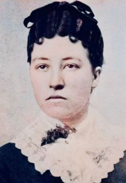
Margaret Willis “Maggie” Margrave Frye
| Birth | : | 12 Mar 1865 Nebraska, USA |
| Death | : | 18 Dec 1896 Brown County, Kansas, USA |
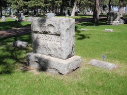
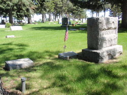
| Burial | : | St John the Baptist Churchyard, South Witham, South Kesteven District, England |
| Inscription | : | Wife of S.B. |
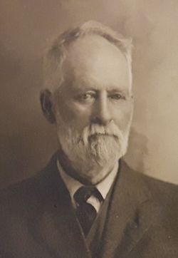
| Description | : | (Her baby died 2 wks before she did) Frye. The infant child of Mr. and Mrs. Samuel Frye of Reserve died Wednesday and was buried Thursday. -Fri Dec 4, 1896 Brown County World, P.3. ...Mrs. Sam'l B. Frye departed this Saturday morning. She had been sick for some time but had not been considered dangerous until Friday evening. The funeral was held from the house Sunday. She leaves four or five small children... -Fri Dec 25, 1896 Brown County World, P.3. (Her husband, son, gr-children, 23 years later) Jan 1, 1920 census. FRYE household. Padonia Twp., Brown Co., KS S. B., head, 62, b.OH, parents b.OH. L.... Read More |
frequently asked questions (FAQ):
-
Where is Margaret Willis “Maggie” Margrave Frye's memorial?
Margaret Willis “Maggie” Margrave Frye's memorial is located at: St John the Baptist Churchyard, South Witham, South Kesteven District, England.
-
When did Margaret Willis “Maggie” Margrave Frye death?
Margaret Willis “Maggie” Margrave Frye death on 18 Dec 1896 in Brown County, Kansas, USA
Family Members:
Parent
Spouse
Siblings
Children
Flowers:
Nearby Cemetories:
1. All Saints Churchyard
Barrowby, South Kesteven District, England
Coordinate: 52.6786110, -0.3200000
2. Saint Andrew Churchyard
Boothby Pagnell, South Kesteven District, England
3. St Stephen Churchyard
Careby, South Kesteven District, England
4. Colsterworth School Lane Cemetery
Colsterworth, South Kesteven District, England
5. Old Post Lane
Colsterworth, South Kesteven District, England
6. St. John the Baptist Churchyard
Colsterworth, South Kesteven District, England
Coordinate: 52.8789250, -0.3583360
7. St. James' Churchyard
Dry Doddington, South Kesteven District, England
8. St Andrew Churchyard
Folkingham, South Kesteven District, England
Coordinate: 52.6522610, -0.4808400
9. Holy Cross Churchyard
Great Ponton, South Kesteven District, England
10. Saint Michael Churchyard
Heydour, South Kesteven District, England
Coordinate: 52.6547990, -0.4697460
11. St. Michael's and All Angels Churchyard
Heydour, South Kesteven District, England
Coordinate: 52.6582800, -0.4542480
12. St Andrew Churchyard
Irnham, South Kesteven District, England
Coordinate: 52.6517890, -0.4801320
13. St Medard and St Gildard Churchyard
Little Bytham, South Kesteven District, England
Coordinate: 52.6786110, -0.3200000
14. Market Deeping Cemetery
Market Deeping, South Kesteven District, England
15. Saint Guthlac's Churchyard
Market Deeping, South Kesteven District, England
16. Bytham Castle
Pickworth, South Kesteven District, England
17. St. Andrew's Churchyard
Pickworth, South Kesteven District, England
18. Sempringham Priory
Sempringham Fen, South Kesteven District, England
Coordinate: 52.8789250, -0.3583360
19. St. Andrew's Churchyard
Sempringham Fen, South Kesteven District, England
20. All Saints Church
Stamford, South Kesteven District, England
Coordinate: 52.6522610, -0.4808400
21. Blackfriars Priory
Stamford, South Kesteven District, England
22. Greyfriars
Stamford, South Kesteven District, England
Coordinate: 52.6547990, -0.4697460
23. Newstead Priory
Stamford, South Kesteven District, England
Coordinate: 52.6582800, -0.4542480
24. Saint John the Baptist Church
Stamford, South Kesteven District, England
Coordinate: 52.6517890, -0.4801320

