
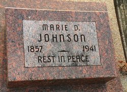
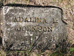
Marie Dorothea Meinke Johnson
| Birth | : | 22 Dec 1857 Clayton County, Iowa, USA |
| Death | : | 19 Jun 1941 Nebraska, USA |
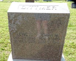
| Burial | : | Saint John Lutheran Church Cemetery, Kramer, Lancaster County, USA |
| Coordinate | : | 40.5972030, -96.8762210 |
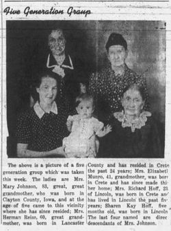
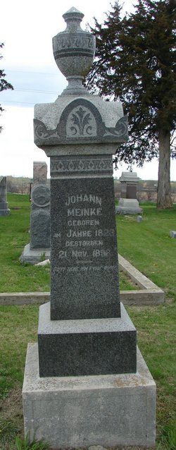
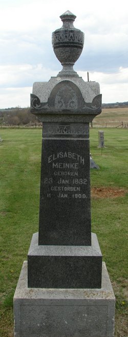
| Description | : | Mrs. Marie D. Johnson, aged pioneer, passed away Thursday, June 19, 1941 at 10 o'clock p.m. following an illness of several months, at the age of 83 years, 5 months, and 28 days. Marie Dorothea Meinke was born December 22, 1857 in Gansville, Clayton County, Iowa, the oldest child of John and Elizabeth Meinke, both deceased. She was instructed and confirmed in the faith of the Lutheran church, April 6, 1873 by Rev. Haessler, first resident pastor at Kramer. At the age of five her parents settled near Nebraska City. There they resided six years, then moving to Lancaster... Read More |
frequently asked questions (FAQ):
-
Where is Marie Dorothea Meinke Johnson's memorial?
Marie Dorothea Meinke Johnson's memorial is located at: Saint John Lutheran Church Cemetery, Kramer, Lancaster County, USA.
-
When did Marie Dorothea Meinke Johnson death?
Marie Dorothea Meinke Johnson death on 19 Jun 1941 in Nebraska, USA
-
Where are the coordinates of the Marie Dorothea Meinke Johnson's memorial?
Latitude: 40.5972030
Longitude: -96.8762210
Family Members:
Parent
Spouse
Siblings
Children

Flowers:


Nearby Cemetories:
1. Saint John Lutheran Church Cemetery
Kramer, Lancaster County, USA
Coordinate: 40.5972030, -96.8762210
2. Kramer Community Cemetery
Kramer, Lancaster County, USA
Coordinate: 40.5952988, -96.8743973
3. Highland PCT Cemetery
Kramer, Lancaster County, USA
Coordinate: 40.6246000, -96.8765000
4. Hartmann Cemetery
Kramer, Lancaster County, USA
Coordinate: 40.6393260, -96.8761110
5. Blue Valley Cemetery
Crete, Saline County, USA
Coordinate: 40.6025009, -96.9392014
6. Olive Branch Cemetery
Hallam, Lancaster County, USA
Coordinate: 40.5675011, -96.8191986
7. Calavan Homestead Cemetery
Centerville, Lancaster County, USA
Coordinate: 40.6175090, -96.7890200
8. John Sothan Family Cemetery
Hallam, Lancaster County, USA
Coordinate: 40.5871030, -96.7819980
9. Buhrmann Cemetery
Sprague, Lancaster County, USA
Coordinate: 40.6167300, -96.7810900
10. Riverside Cemetery
Crete, Saline County, USA
Coordinate: 40.6288986, -96.9756012
11. Sacred Heart Cemetery
Crete, Saline County, USA
Coordinate: 40.6211014, -96.9813995
12. Highland Cemetery
Centerville, Lancaster County, USA
Coordinate: 40.6683006, -96.8189011
13. Hallam Community Cemetery
Hallam, Lancaster County, USA
Coordinate: 40.5419006, -96.7885971
14. Bohemian National Cemetery
Wilber, Saline County, USA
Coordinate: 40.5358009, -96.9685974
15. Hallam Zion Cemetery
Hallam, Lancaster County, USA
Coordinate: 40.5661011, -96.7600021
16. Immanuel Cemetery
Gage County, USA
Coordinate: 40.5088005, -96.8133011
17. Centerville Cemetery
Centerville, Lancaster County, USA
Coordinate: 40.6545677, -96.7482147
18. Sykes Family Cemetery
Clatonia, Gage County, USA
Coordinate: 40.4868330, -96.8186260
19. Marsh Cemetery
Clatonia, Gage County, USA
Coordinate: 40.4867230, -96.8185310
20. Sunny Side Cemetery
Wilber, Saline County, USA
Coordinate: 40.4942017, -96.9685974
21. Stockfeldt Cemetery
Sprague, Lancaster County, USA
Coordinate: 40.6116982, -96.7080994
22. Zion Evangelical Lutheran Cemetery
Clatonia, Gage County, USA
Coordinate: 40.4666910, -96.8749310
23. Princeton Cemetery
Princeton, Lancaster County, USA
Coordinate: 40.5668983, -96.7052994
24. Clatonia Cemetery
Clatonia, Gage County, USA
Coordinate: 40.4614500, -96.8556600