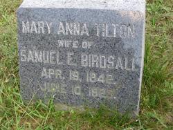
Mary Anna Tilton Birdsall
| Birth | : | 19 Apr 1842 Ocean County, New Jersey, USA |
| Death | : | 10 Jun 1929 Ocean County, New Jersey, USA |
| Burial | : | Waiheke Lawn Cemetery, Auckland Council, New Zealand |
| Coordinate | : | -36.8015370, 175.0656180 |
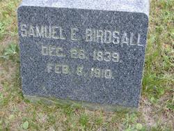
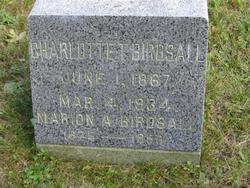
| Description | : | Mary was the daughter of John Tilton and Charlotte A. Pharo. She was the wife of Samuel E. Birdsall. The 1850 Census for Union Township, NJ lists the following Household Members: Tilton, John (48, M, merchant) Tilton, Charlotte (39, F) Tilton, Allen P. (19, M, clerk) Tilton, Harry R. (14, M) Tilton, Mary A. (8, F)<--THIS MARY King, Ann (23, F) The 1870 Federal Census Ocean County, New Jersey lists the following household members, all living in Barnegat, NJ: Tilton, Charlotte - 59 - Housekeeper (Mary Anna's mother) Birdsall, Samuel E. - 30 - Sea Captain Birdsall, Mary A. - 28 - Housekeeper Birdsall, Charlotte - 3 |
frequently asked questions (FAQ):
-
Where is Mary Anna Tilton Birdsall's memorial?
Mary Anna Tilton Birdsall's memorial is located at: Waiheke Lawn Cemetery, Auckland Council, New Zealand.
-
When did Mary Anna Tilton Birdsall death?
Mary Anna Tilton Birdsall death on 10 Jun 1929 in Ocean County, New Jersey, USA
-
Where are the coordinates of the Mary Anna Tilton Birdsall's memorial?
Latitude: -36.8015370
Longitude: 175.0656180
Family Members:
Spouse
Children
Flowers:
Nearby Cemetories:
1. Waiheke Lawn Cemetery
Auckland Council, New Zealand
Coordinate: -36.8015370, 175.0656180
2. Motuihe Island Cemetery
Auckland Council, New Zealand
Coordinate: -36.8000400, 174.9363920
3. Rotoroa Island Cemetery
Auckland Council, New Zealand
Coordinate: -36.8131670, 175.2017830
4. Chamberlin Family Cemetery
Auckland, Auckland Council, New Zealand
Coordinate: -36.8627607, 175.1870226
5. Waikopua Cemetery
Whitford, Auckland Council, New Zealand
Coordinate: -36.9274400, 174.9998900
6. All Saints Cemetery
Howick, Auckland Council, New Zealand
Coordinate: -36.8954260, 174.9337600
7. Our Lady Star of the Sea Parish Cemetery
Howick, Auckland Council, New Zealand
Coordinate: -36.8932940, 174.9307940
8. Howick Cemetery
Howick, Auckland Council, New Zealand
Coordinate: -36.9040400, 174.9380500
9. St. Andrew Presbyterian Cemetery
Howick, Auckland Council, New Zealand
Coordinate: -36.8989900, 174.9201600
10. Howick Historical Village
Pakuranga, Auckland Council, New Zealand
Coordinate: -36.9067680, 174.9027080
11. Pakuranga Methodist Cemetery
Pakuranga, Auckland Council, New Zealand
Coordinate: -36.9054000, 174.8914900
12. Point England Presbyterian Cemetery
Point England, Auckland Council, New Zealand
Coordinate: -36.8823420, 174.8601550
13. Clevedon Cemetery All Souls Church
Clevedon, Auckland Council, New Zealand
Coordinate: -36.9862400, 175.0418100
14. St. Thomas Churchyard
Tamaki, Auckland Council, New Zealand
Coordinate: -36.8675590, 174.8460560
15. St Andrews Presbyterian Cemetery
Clevedon, Auckland Council, New Zealand
Coordinate: -36.9921320, 175.0371370
16. St. John’s College Graveyard
Saint Johns, Auckland Council, New Zealand
Coordinate: -36.8738169, 174.8416826
17. St. Patrick's Roman Catholic Church Cemetery
Panmure, Auckland Council, New Zealand
Coordinate: -36.9029680, 174.8564960
18. St Matthias Churchyard
Panmure, Auckland Council, New Zealand
Coordinate: -36.9053300, 174.8577200
19. Savage Memorial
Auckland, Auckland Council, New Zealand
Coordinate: -36.8462500, 174.8259300
20. Flat Bush Cemetery
East Tamaki, Auckland Council, New Zealand
Coordinate: -36.9563500, 174.9097100
21. Purewa Cemetery
Meadowbank, Auckland Council, New Zealand
Coordinate: -36.8674300, 174.8297900
22. St. John's Church Cemetery
East Tamaki, Auckland Council, New Zealand
Coordinate: -36.9522250, 174.8964540
23. St. Paul's Anglican Cemetery
East Tamaki, Auckland Council, New Zealand
Coordinate: -36.9615200, 174.9082000
24. Ōrākei (Rautara St) Urupā
Orakei, Auckland Council, New Zealand
Coordinate: -36.8610770, 174.8188960


