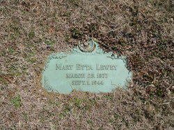
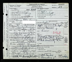
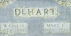
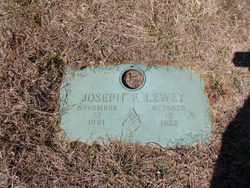
Mary Etta DeHart Lewey
| Birth | : | 1877 Bland County, Virginia, USA |
| Death | : | 1944 Virginia, USA |
| Burial | : | Rovnost National Cemetery, Denmark, Brown County, USA |
| Coordinate | : | 44.3276100, -87.8518500 |
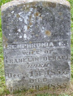
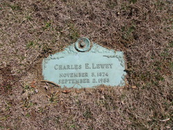
| Description | : | Obituary MRS. LEWEY DIES AT HOME HERE Funeral services were held Sunday afternoon for Mrs. Charles E. Lewey, who died at her home here, on last Friday evening at 11:30 o'clock. The services were held at 4 o'clock from the First Methodist Church and burial was in Birchlawn Burial Park. Death was attributed ti cancer for which she had consulted specialists in Baltimore, Washington and Duke University. Sixty-seven years of age, she was before her marriage fifty years ago, Miss Etta Dehart, daughter of the late Isaac Franklin and Semphronia Eaton Dehart of Bland Co., near White Gate. Besides her husband,... Read More |
frequently asked questions (FAQ):
-
Where is Mary Etta DeHart Lewey's memorial?
Mary Etta DeHart Lewey's memorial is located at: Rovnost National Cemetery, Denmark, Brown County, USA.
-
When did Mary Etta DeHart Lewey death?
Mary Etta DeHart Lewey death on 1944 in Virginia, USA
-
Where are the coordinates of the Mary Etta DeHart Lewey's memorial?
Latitude: 44.3276100
Longitude: -87.8518500
Family Members:
Parent
Spouse
Siblings
Children
Flowers:
Nearby Cemetories:
1. All Saints Catholic Church Cemetery
Denmark, Brown County, USA
Coordinate: 44.3492000, -87.8356500
2. Holy Trinity Catholic Church Cemetery
Denmark, Brown County, USA
Coordinate: 44.3330900, -87.8874100
3. Eastside Cemetery
Cooperstown, Manitowoc County, USA
Coordinate: 44.3269000, -87.8075000
4. Saint Mary Cemetery
Morrison, Brown County, USA
Coordinate: 44.3022700, -87.8884700
5. Saint Johns United Methodist Cemetery
Cooperstown, Manitowoc County, USA
Coordinate: 44.2914990, -87.8685450
6. West Danish Cemetery
Denmark, Brown County, USA
Coordinate: 44.3535995, -87.8058014
7. Saint James Cemetery
Cooperstown, Manitowoc County, USA
Coordinate: 44.3177500, -87.7783400
8. Eastside Cemetery
Denmark, Brown County, USA
Coordinate: 44.3591995, -87.7866974
9. Saint Johns Evangelical Lutheran Cemetery
Maribel, Manitowoc County, USA
Coordinate: 44.2702800, -87.8063900
10. Emanuels Cemetery
Morrison, Brown County, USA
Coordinate: 44.2991982, -87.9503021
11. Immanuel Evangelical Lutheran Church Cemetery
Shirley, Brown County, USA
Coordinate: 44.3575070, -87.9526220
12. Saint Marys Cemetery
Glenmore, Brown County, USA
Coordinate: 44.3725000, -87.9475700
13. Saint Wenceslaus Cemetery
Cooperstown, Manitowoc County, USA
Coordinate: 44.2514000, -87.8073500
14. Zion Lutheran Cemetery
Glenmore, Brown County, USA
Coordinate: 44.3618140, -87.9599760
15. Holy Trinity Cemetery
Pine Grove, Brown County, USA
Coordinate: 44.4124200, -87.8808400
16. Saint Pauls Lutheran Cemetery
Glenmore, Brown County, USA
Coordinate: 44.4200000, -87.8913890
17. Old Morrison Zion Evangelical Lutheran Cemetery
Wayside, Brown County, USA
Coordinate: 44.2702904, -87.9649353
18. Morrison Zion Evangelical Lutheran Cemetery
Morrison, Brown County, USA
Coordinate: 44.2890625, -87.9796677
19. Bolt Bohemian Township Cemetery
Bolt, Kewaunee County, USA
Coordinate: 44.3436012, -87.7092972
20. Zander Cemetery
Zander, Manitowoc County, USA
Coordinate: 44.3250760, -87.7057890
21. Zion Cemetery
Wayside, Brown County, USA
Coordinate: 44.2497300, -87.9505500
22. Saint Johns Evangelical Lutheran Cemetery
Zander, Manitowoc County, USA
Coordinate: 44.3024100, -87.7059100
23. Saint Joseph Cemetery
Kellnersville, Manitowoc County, USA
Coordinate: 44.2231330, -87.8019000
24. Melnik Presbyterian Cemetery
Melnik, Manitowoc County, USA
Coordinate: 44.2470300, -87.7461910

