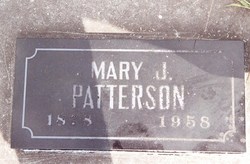
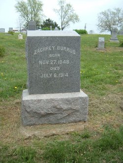
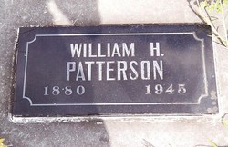
Mary Jane Burrus Patterson
| Birth | : | 28 Aug 1878 Scotland County, Missouri, USA |
| Death | : | 21 May 1958 Kirksville, Adair County, Missouri, USA |
| Burial | : | St. Mary's Churchyard, Stockport, Metropolitan Borough of Stockport, England |
| Coordinate | : | 53.4112340, -2.1555140 |
| Inscription | : | Wife of William H |
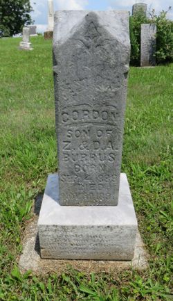
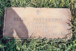
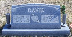
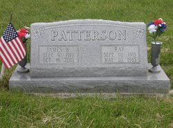
| Description | : | Mrs. Mary Jane Patterson, 79, of Bible Grove died Wednesday morning, May 21, in Laughlin Hosptial in Kirksville. Mrs. Patterson was born in Scotland County, August 28, 1878, a daughter of Zachary and Dora Chapman Burrus. She was married to William H. Patterson, who preceded her in death. Surviving are two daughters, Mrs. Herb Davis of Brashear and Mrs. Verlee Eggers of Memphis; five sons, Ellis of Memphis; Arlie of Ewing; Charlie of Lewistown; and Ray and Jim of Bible Grove; two brothers, Mike Burrus of Glasgow, Montana and Dick Burrus of Baring; two sisters, Mrs. Emma Lyons of Dallas City,... Read More |
frequently asked questions (FAQ):
-
Where is Mary Jane Burrus Patterson's memorial?
Mary Jane Burrus Patterson's memorial is located at: St. Mary's Churchyard, Stockport, Metropolitan Borough of Stockport, England.
-
When did Mary Jane Burrus Patterson death?
Mary Jane Burrus Patterson death on 21 May 1958 in Kirksville, Adair County, Missouri, USA
-
Where are the coordinates of the Mary Jane Burrus Patterson's memorial?
Latitude: 53.4112340
Longitude: -2.1555140
Family Members:
Parent
Spouse
Siblings
Children
Flowers:
Nearby Cemetories:
1. St. Mary's Churchyard
Stockport, Metropolitan Borough of Stockport, England
Coordinate: 53.4112340, -2.1555140
2. Stockport Quaker Burial Ground (Defunct)
Stockport, Metropolitan Borough of Stockport, England
Coordinate: 53.4096205, -2.1555406
3. St. Peter's Churchyard
Stockport, Metropolitan Borough of Stockport, England
Coordinate: 53.4105000, -2.1587000
4. The Parish Church of Saint Peter
Stockport, Metropolitan Borough of Stockport, England
Coordinate: 53.4084880, -2.1492930
5. St Thomas Churchyard
Stockport, Metropolitan Borough of Stockport, England
Coordinate: 53.4036000, -2.1550000
6. Christ Church
Heaton Norris, Metropolitan Borough of Stockport, England
Coordinate: 53.4144000, -2.1678000
7. Wesleyan Chapel
Edgeley, Metropolitan Borough of Stockport, England
Coordinate: 53.4019700, -2.1673860
8. Stockport Cemetery and Crematorium
Stockport, Metropolitan Borough of Stockport, England
Coordinate: 53.3979110, -2.1511430
9. St. Paul's Churchyard
Portwood, Metropolitan Borough of Stockport, England
Coordinate: 53.4215604, -2.1717953
10. Willow Grove Cemetery
Stockport, Metropolitan Borough of Stockport, England
Coordinate: 53.4252900, -2.1508100
11. Saint Thomas the Apostle Heaton Chapel
Heaton Norris, Metropolitan Borough of Stockport, England
Coordinate: 53.4297783, -2.1797558
12. Highfield Cemetery
Bredbury, Metropolitan Borough of Stockport, England
Coordinate: 53.4133310, -2.1111320
13. St Elisabeth Church
Reddish, Metropolitan Borough of Stockport, England
Coordinate: 53.4379400, -2.1633950
14. Heaton Mersey Congregational Churchyard
Stockport, Metropolitan Borough of Stockport, England
Coordinate: 53.4128680, -2.2038150
15. St. John the Baptist Churchyard
Heaton Mersey, Metropolitan Borough of Stockport, England
Coordinate: 53.4124526, -2.2064749
16. Saint Mark Churchyard
Bredbury, Metropolitan Borough of Stockport, England
Coordinate: 53.4241160, -2.1051390
17. Hatherlow Chapel Cemetery
Bredbury, Metropolitan Borough of Stockport, England
Coordinate: 53.4109259, -2.0992592
18. Hatherlow United Reformed Church Cemetery
Romiley, Metropolitan Borough of Stockport, England
Coordinate: 53.4107180, -2.0989830
19. Cheadle Cemetery
Cheadle, Metropolitan Borough of Stockport, England
Coordinate: 53.3927610, -2.2054690
20. Mill Lane Cemetery
Cheadle, Metropolitan Borough of Stockport, England
Coordinate: 53.3992000, -2.2150800
21. Saint Chad's Churchyard
Romiley, Metropolitan Borough of Stockport, England
Coordinate: 53.4128520, -2.0896350
22. St Mary's Churchyard
Cheadle, Metropolitan Borough of Stockport, England
Coordinate: 53.3944820, -2.2176205
23. Denton Cemetery
Denton, Metropolitan Borough of Tameside, England
Coordinate: 53.4424140, -2.1115510
24. Norbury St Thomas Churchyard
Hazel Grove, Metropolitan Borough of Stockport, England
Coordinate: 53.3761440, -2.1160440

