Mary Krei Willman
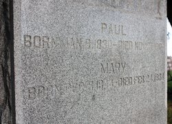
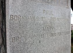
| Birth | : | 4 Dec 1844 Germany |
| Death | : | 24 Feb 1934 Postville, Allamakee County, Iowa, USA |
| Burial | : | St. John's Churchyard, Cononley, Craven District, England |
| Coordinate | : | 53.9187890, -2.0212930 |
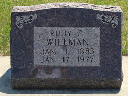
| Description | : | Mary Krei, the subject of this sketch, was born in Mecklenburg Schwerin, Germany, December 5, 1844, of hardy German ancestry, and came to America with her parents, Mr. and Mrs. Fred Krei, in, 1870, settling first on a farm near Gamavlllo, Iowa. June 25,1872, she was united in marriage at Garnavillo with Paul Willman, and to this union were born nine children, of whom the following five survive: Mrs. Bert E. Tuttle, William and Rudolph of Postville; Mrs. J. J. Klein of Port Dodge, and Mrs. Edith Evans of St. Paul, Minn. Later the family occupied farms in the vicinty of... Read More |
frequently asked questions (FAQ):
-
Where is Mary Krei Willman's memorial?
Mary Krei Willman's memorial is located at: St. John's Churchyard, Cononley, Craven District, England.
-
When did Mary Krei Willman death?
Mary Krei Willman death on 24 Feb 1934 in Postville, Allamakee County, Iowa, USA
-
Where are the coordinates of the Mary Krei Willman's memorial?
Latitude: 53.9187890
Longitude: -2.0212930
Family Members:
Parent
Spouse
Siblings
Children
Flowers:
Nearby Cemetories:
1. St. John's Churchyard
Cononley, Craven District, England
Coordinate: 53.9187890, -2.0212930
2. Bradley Cemetery
Bradleys Both, Craven District, England
Coordinate: 53.9306747, -1.9907120
3. Christ Churchyard
Lothersdale, Craven District, England
Coordinate: 53.9097000, -2.0578600
4. St Andrew Churchyard
Kildwick, Craven District, England
Coordinate: 53.9091560, -1.9839700
5. St Mary the Virgin Churchyard
Carleton, Craven District, England
Coordinate: 53.9442300, -2.0417800
6. Cowling Hill Baptist Cemetery
Cowling, Craven District, England
Coordinate: 53.8961550, -2.0536900
7. St. Thomas's Churchyard
Sutton-in-Craven, Craven District, England
Coordinate: 53.8937020, -1.9906290
8. Waltonwrays Cemetery and Skipton Crematorium
Skipton, Craven District, England
Coordinate: 53.9505500, -2.0272300
9. Bethel Chapel Cemetery
Lothersdale, Craven District, England
Coordinate: 53.9102184, -2.0749640
10. Cowling Holy Trinity Churchyard
Cowling, Craven District, England
Coordinate: 53.8836542, -2.0473431
11. St Andrew Methodist Cemetery
Cowling, Craven District, England
Coordinate: 53.8830940, -2.0465580
12. Holy Trinity Churchyard
Cowling, Craven District, England
Coordinate: 53.8837150, -2.0503150
13. Holy Trinity Churchyard
Cowling, Craven District, England
Coordinate: 53.8836930, -2.0502720
14. Christ Churchyard
Skipton, Craven District, England
Coordinate: 53.9581200, -2.0188910
15. Friends Burial Ground at Skipton
Skipton, Craven District, England
Coordinate: 53.9599220, -2.0148630
16. St. Andrew's Churchyard
Skipton, Craven District, England
Coordinate: 53.9609959, -2.0140994
17. Skipton War Memorial
Skipton, Craven District, England
Coordinate: 53.9627100, -2.0161680
18. St Stephen Roman Catholic Churchyard
Skipton, Craven District, England
Coordinate: 53.9631760, -2.0210240
19. Holy Trinity Churchyard
Skipton, Craven District, England
Coordinate: 53.9633250, -2.0161180
20. Raikes Road Burial Ground
Skipton, Craven District, England
Coordinate: 53.9643822, -2.0196819
21. St. Stephen Churchyard
Steeton, Metropolitan Borough of Bradford, England
Coordinate: 53.8968600, -1.9499600
22. St James Churchyard
Silsden, Metropolitan Borough of Bradford, England
Coordinate: 53.9139070, -1.9390650
23. Silsden Cemetery
Silsden, Metropolitan Borough of Bradford, England
Coordinate: 53.9106500, -1.9267000
24. All Saints Churchyard
Broughton, Craven District, England
Coordinate: 53.9492880, -2.1019580


