
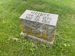


Mary Moeller Klinkenberg
| Birth | : | 21 Nov 1870 Clayton County, Iowa, USA |
| Death | : | 13 May 1917 Missouri, USA |
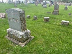
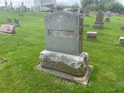
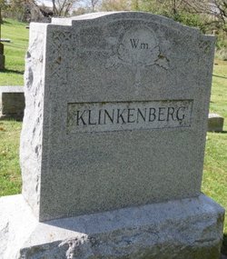
| Burial | : | Zion Lutheran Cemetery, Clayton Center, Clayton County, USA |
| Coordinate | : | 42.8841705, -91.3249969 |
| Description | : | Maiden name also listed as Miller and Mueller. |
frequently asked questions (FAQ):
-
Where is Mary Moeller Klinkenberg's memorial?
Mary Moeller Klinkenberg's memorial is located at: Zion Lutheran Cemetery, Clayton Center, Clayton County, USA.
-
When did Mary Moeller Klinkenberg death?
Mary Moeller Klinkenberg death on 13 May 1917 in Missouri, USA
-
Where are the coordinates of the Mary Moeller Klinkenberg's memorial?
Latitude: 42.8841705
Longitude: -91.3249969
Family Members:
Parent
Spouse
Siblings

Children
Flowers:


Nearby Cemetories:
1. Zion Lutheran Cemetery
Clayton Center, Clayton County, USA
Coordinate: 42.8841705, -91.3249969
2. Clayton Center Cemetery
Clayton Center, Clayton County, USA
Coordinate: 42.8841705, -91.3225021
3. County Home Cemetery
Clayton Center, Clayton County, USA
Coordinate: 42.8916702, -91.3499985
4. Colony Catholic Cemetery (Defunct)
Read Township, Clayton County, USA
Coordinate: 42.8830000, -91.3580000
5. Saint Joseph Cemetery
Garnavillo, Clayton County, USA
Coordinate: 42.8628006, -91.2502975
6. Elkader Cemetery
Elkader, Clayton County, USA
Coordinate: 42.8541718, -91.4000015
7. Garnavillo Community Cemetery
Garnavillo, Clayton County, USA
Coordinate: 42.8656000, -91.2422100
8. Garnavillo Cemetery
Garnavillo, Clayton County, USA
Coordinate: 42.8660300, -91.2390100
9. Saint Josephs Cemetery
Elkader, Clayton County, USA
Coordinate: 42.8488998, -91.4021988
10. Farmersburg-Wagner Cemetery
Farmersburg, Clayton County, USA
Coordinate: 42.9481010, -91.3700027
11. National Cemetery
National, Clayton County, USA
Coordinate: 42.9536018, -91.2902985
12. Hartman Cemetery
Cox Creek Township, Clayton County, USA
Coordinate: 42.8155360, -91.3880840
13. Meenan Cemetery
Communia, Clayton County, USA
Coordinate: 42.7999862, -91.3584693
14. Norway Lutheran Church Cemetery
Saint Olaf, Clayton County, USA
Coordinate: 42.9352798, -91.4302826
15. Krumm Cemetery
Garber, Clayton County, USA
Coordinate: 42.7913760, -91.3023559
16. Bismark Cemetery
Farmersburg, Clayton County, USA
Coordinate: 42.9790000, -91.3500000
17. Patterson Pioneer Cemetery
Saint Olaf, Clayton County, USA
Coordinate: 42.9216000, -91.4489000
18. Communia Cemetery
Volga Township, Clayton County, USA
Coordinate: 42.7868996, -91.3630981
19. McClelland Cemetery
Garnavillo, Clayton County, USA
Coordinate: 42.8249879, -91.2084641
20. Weymouth Cemetery
Saint Olaf, Clayton County, USA
Coordinate: 42.9278799, -91.4583559
21. Giard Cemetery
Farmersburg, Clayton County, USA
Coordinate: 42.9933014, -91.3080978
22. Clark Family Cemetery
Beulah, Clayton County, USA
Coordinate: 42.9166505, -91.4751415
23. Wagner Township Cemetery
Saint Olaf, Clayton County, USA
Coordinate: 42.9519386, -91.4513931
24. Blanchaine Cemetery
Volga, Clayton County, USA
Coordinate: 42.7676210, -91.3389040