Matilda E. Rinker Smith
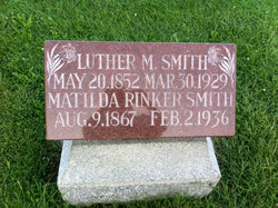
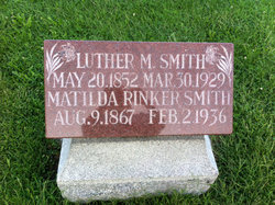
| Birth | : | 9 Aug 1867 White County, Indiana, USA |
| Death | : | 2 Feb 1936 Indianapolis, Marion County, Indiana, USA |
| Burial | : | Bethel Friends Cemetery, Asheboro, Randolph County, USA |
| Coordinate | : | 35.6645700, -79.7391200 |
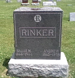
| Description | : | MATILDA E.SMITH DIES IN HOSPITAL Mrs. Matilda E. Smith, 75, life long White county resident, died Sunday in Central hospital, Indianapolis, after a year's illness. Surviving are a brother, Andrew Rinker, north of Monticello, and several nieces and nephews. Funeral services will be held at 1:30 o'clock this afternoon at Prevo and Son funeral home, Monticello, with Rev. John Garretson officiating. Interment will be in Riverview cemetery. THE LOGANSPORT PRESS LOGANSPORT, INDIANA, TUESDAY; FEB. 4, 1936 |
frequently asked questions (FAQ):
-
Where is Matilda E. Rinker Smith's memorial?
Matilda E. Rinker Smith's memorial is located at: Bethel Friends Cemetery, Asheboro, Randolph County, USA.
-
When did Matilda E. Rinker Smith death?
Matilda E. Rinker Smith death on 2 Feb 1936 in Indianapolis, Marion County, Indiana, USA
-
Where are the coordinates of the Matilda E. Rinker Smith's memorial?
Latitude: 35.6645700
Longitude: -79.7391200
Family Members:
Parent
Spouse
Siblings
Flowers:
Nearby Cemetories:
1. Bethel Friends Cemetery
Asheboro, Randolph County, USA
Coordinate: 35.6645700, -79.7391200
2. Spoons Chapel United Church of Christ Cemetery
Asheboro, Randolph County, USA
Coordinate: 35.6763150, -79.7345110
3. Richland Baptist Church Cemetery
Asheboro, Randolph County, USA
Coordinate: 35.6543740, -79.7559120
4. Mountain of Faith Christian Church Cemetery
Asheboro, Randolph County, USA
Coordinate: 35.6760930, -79.7129830
5. Mount Tabor Community Church Cemetery
Asheboro, Randolph County, USA
Coordinate: 35.6892900, -79.7318400
6. Browers Chapel UMC Cemetery
Asheboro, Randolph County, USA
Coordinate: 35.6747290, -79.7854000
7. Goins Family Cemetery
Asheboro, Randolph County, USA
Coordinate: 35.6285300, -79.7079600
8. Panther Creek Baptist Church Cemetery
Asheboro, Randolph County, USA
Coordinate: 35.6176300, -79.7437820
9. Union Grove Christian Church Cemetery
Asheboro, Randolph County, USA
Coordinate: 35.6235200, -79.7106600
10. Shady Grove Community Cemetery
Asheboro, Randolph County, USA
Coordinate: 35.7192180, -79.7287920
11. Holly Spring Friends Meeting Cemetery
Ramseur, Randolph County, USA
Coordinate: 35.6697270, -79.6676470
12. Mitchell United Methodist Church Cemetery #1
Asheboro, Randolph County, USA
Coordinate: 35.6233300, -79.7910600
13. Providence Baptist Church Cemetery
Asheboro, Randolph County, USA
Coordinate: 35.7231400, -79.7237930
14. Stouts Chapel UMC Cemetery
Ramseur, Randolph County, USA
Coordinate: 35.6647210, -79.6646660
15. Mitchell United Methodist Church Cemetery #2
Asheboro, Randolph County, USA
Coordinate: 35.6221700, -79.7929700
16. Pleasant Cross Christian Church Cemetery
Asheboro, Randolph County, USA
Coordinate: 35.7254000, -79.7268740
17. Oddfellow-McAlister Cemetery
Asheboro, Randolph County, USA
Coordinate: 35.7090670, -79.7942090
18. Mount Calvary Cemetery
Asheboro, Randolph County, USA
Coordinate: 35.7095920, -79.7940450
19. First Presbyterian Church Columbarium
Asheboro, Randolph County, USA
Coordinate: 35.6912790, -79.8196490
20. Pleasant Ridge Christian Church Cemetery
Ramseur, Randolph County, USA
Coordinate: 35.7046860, -79.6670060
21. Oaklawn Cemetery
Asheboro, Randolph County, USA
Coordinate: 35.6885986, -79.8246994
22. Billy Trogdon Cemetery
Asheboro, Randolph County, USA
Coordinate: 35.7392800, -79.7219100
23. Asheboro City Cemetery
Asheboro, Randolph County, USA
Coordinate: 35.7090000, -79.8153330
24. Flag Springs United Methodist Church Cemetery
Asheboro, Randolph County, USA
Coordinate: 35.6102860, -79.8068910


