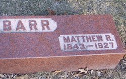
Matthew Reid Barr
| Birth | : | 15 Apr 1843 Paisley, Renfrewshire, Scotland |
| Death | : | 30 Oct 1927 Wells, Faribault County, Minnesota, USA |
| Burial | : | Ashland City Cemetery, Ashland, Clay County, USA |
| Coordinate | : | 33.2778015, -85.8332977 |
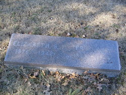
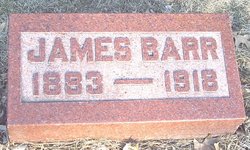
| Description | : | Matthew was the son of Andrew Barr and Agnew Reid. He married Mary G Thompson in 18 Dec 1866 in Canada. They were the parents of Agnes (Shartell), Andrew, and Mary (Snyder). He married 2nd Mary Gardner Hunter in the fall of 1874. They were the parents of Elizabeth, Margaret Hamilton, William, Matt, and James. Nov 2, 1927 - Carroll Times - Matt Barr, Sr., father of Mrs. F.A. Myers of this city, died at his home in Wells, Minn., Sunday, October 30, shortly before noon after being in falling health for over a year. Matthew R. Barr was born... Read More |
frequently asked questions (FAQ):
-
Where is Matthew Reid Barr's memorial?
Matthew Reid Barr's memorial is located at: Ashland City Cemetery, Ashland, Clay County, USA.
-
When did Matthew Reid Barr death?
Matthew Reid Barr death on 30 Oct 1927 in Wells, Faribault County, Minnesota, USA
-
Where are the coordinates of the Matthew Reid Barr's memorial?
Latitude: 33.2778015
Longitude: -85.8332977
Family Members:
Parent
Spouse
Siblings
Children
Flowers:
Nearby Cemetories:
1. Ashland City Cemetery
Ashland, Clay County, USA
Coordinate: 33.2778015, -85.8332977
2. Old Ashland Cemetery
Ashland, Clay County, USA
Coordinate: 33.2721820, -85.8332440
3. Bethel Memorial Garden Cemetery
Ashland, Clay County, USA
Coordinate: 33.2682991, -85.8497009
4. Old Field Cemetery
Ashland, Clay County, USA
Coordinate: 33.2742004, -85.8644028
5. Hassell Cemetery
Ashland, Clay County, USA
Coordinate: 33.3058014, -85.8411026
6. Clay County Memory Gardens
Ashland, Clay County, USA
Coordinate: 33.2825012, -85.7975006
7. Macedonia Primitive Baptist Church Cemetery
Lineville, Clay County, USA
Coordinate: 33.3027938, -85.7985677
8. Olive Branch Baptist Cemetery
Lineville, Clay County, USA
Coordinate: 33.3078003, -85.7966995
9. Wrights Chapel Cemetery
Ashland, Clay County, USA
Coordinate: 33.2398380, -85.7980170
10. Liberty Baptist Church Cemetery
Ashland, Clay County, USA
Coordinate: 33.2717018, -85.8914032
11. Old Noles Cemetery
Clay County, USA
Coordinate: 33.2921982, -85.8927994
12. Lystra Baptist Church Cemetery
Ashland, Clay County, USA
Coordinate: 33.2327995, -85.7996979
13. Old Liberty Hill Cemetery
Clay County, USA
Coordinate: 33.2230988, -85.8632965
14. Mount Zion Cemetery
Ashland, Clay County, USA
Coordinate: 33.2390870, -85.8887200
15. Poplar Springs Cemetery
Ashland, Clay County, USA
Coordinate: 33.3328018, -85.8827972
16. Old Lineville Cemetery
Lineville, Clay County, USA
Coordinate: 33.3102690, -85.7586290
17. Shiloh Baptist Church Cemetery
Lineville, Clay County, USA
Coordinate: 33.2621994, -85.7502975
18. Macedonia Primitive Baptist Church Cemetery Old
Lineville, Clay County, USA
Coordinate: 33.3305370, -85.7741480
19. Lineville Community Cemetery
Lineville, Clay County, USA
Coordinate: 33.3224364, -85.7640623
20. Pleasant Grove Cemetery
Ashland, Clay County, USA
Coordinate: 33.3232994, -85.9019012
21. Faith Christian Fellowship Church Cemetery
Ashland, Clay County, USA
Coordinate: 33.2530620, -85.7497820
22. New Prospect Baptist Church Cemetery
Ashland, Clay County, USA
Coordinate: 33.2038990, -85.8268970
23. Lineville City Cemetery New
Lineville, Clay County, USA
Coordinate: 33.3061000, -85.7508000
24. Burney Family Cemetery
Lineville, Clay County, USA
Coordinate: 33.3136900, -85.7543190

