| Birth | : | 19 Apr 1883 Germany |
| Death | : | 23 Aug 1963 Akron, Plymouth County, Iowa, USA |
| Burial | : | St Mary the Virgin Churchyard, Little Easton, Uttlesford District, England |
| Coordinate | : | 51.8869280, 0.3299070 |
| Inscription | : | Father |
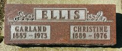
| Description | : | Max the son of Carl Peter & Augusta Dorthy(Jurgenson)Fredrickson.He married Anna Jurgensen on June 5,1905 in Elk Point,South Dakota.They farmed in Union County for several years and later moved to Akron,Iowa.Max and Anna both worked in the Akron area until retirment.Survivors include his beloved wife Anna of Akron;five children still living;Lorraine(Elmer)Dimmick of Union County,South Dakota;Leora(Joseph)McCormick of Downey,Calif.;Carrol & wife Doris Sweeney of Sioux City;Raymond & Darlene(Bird)Fredrickson of Downey,Calif.;and LuVerna who married and lives near Jefferson,South Dakota.three sisters,Margaret(Mrs.Henry Anderson)frist husband,Anderton her second;Christine(Mrs. Garland Ellis);Anna(Mrs.Frank Eden).He preceded in death by his parents,Carl Peter on Dec. 10,1983,Augusta Dorthy died on Apirl 22,1930;sister,Pauline. |
frequently asked questions (FAQ):
-
Where is Max M. Fredrickson's memorial?
Max M. Fredrickson's memorial is located at: St Mary the Virgin Churchyard, Little Easton, Uttlesford District, England.
-
When did Max M. Fredrickson death?
Max M. Fredrickson death on 23 Aug 1963 in Akron, Plymouth County, Iowa, USA
-
Where are the coordinates of the Max M. Fredrickson's memorial?
Latitude: 51.8869280
Longitude: 0.3299070
Family Members:
Parent
Spouse
Siblings
Children
Flowers:
Nearby Cemetories:
1. St Mary the Virgin Churchyard
Little Easton, Uttlesford District, England
Coordinate: 51.8869280, 0.3299070
2. St John and St Giles Churchyard
Great Easton, Uttlesford District, England
Coordinate: 51.9046125, 0.3354719
3. Great Dunmow Cemetery
Great Dunmow, Uttlesford District, England
Coordinate: 51.8825180, 0.3652100
4. St Mary the Virgin Churchyard
Great Dunmow, Uttlesford District, England
Coordinate: 51.8813920, 0.3660360
5. All Saints Churchyard
Little Canfield, Uttlesford District, England
Coordinate: 51.8645410, 0.3033900
6. St Mary the Virgin Churchyard
Lindsell, Uttlesford District, England
Coordinate: 51.9183600, 0.3886400
7. St Mary Churchyard
Great Canfield, Uttlesford District, England
Coordinate: 51.8388000, 0.3110930
8. St Mary Churchyard
Little Dunmow, Uttlesford District, England
Coordinate: 51.8654120, 0.4036350
9. St Mary the Virgin Churchyard
Stebbing, Uttlesford District, England
Coordinate: 51.8895200, 0.4165300
10. All Saints Churchyard
High Roding, Uttlesford District, England
Coordinate: 51.8246620, 0.3083740
11. Congregational Chapelyard
Thaxted, Uttlesford District, England
Coordinate: 51.9536600, 0.3396500
12. St John the Baptist Churchyard
Thaxted, Uttlesford District, England
Coordinate: 51.9543000, 0.3422000
13. St Mary the Virgin Churchyard
Henham, Uttlesford District, England
Coordinate: 51.9342500, 0.2456300
14. Holy Cross Churchyard
Felsted, Uttlesford District, England
Coordinate: 51.8569970, 0.4335410
15. Felsted Congregational Burial Ground
Felsted, Uttlesford District, England
Coordinate: 51.8524490, 0.4358640
16. St. Mary the Virgin Churchyard
Stansted Mountfitchet, Uttlesford District, England
Coordinate: 51.8953440, 0.2091880
17. St Mary the Virgin Churchyard
Aythorpe Roding, Uttlesford District, England
Coordinate: 51.8143370, 0.2971010
18. St Katherine Churchyard
Little Bardfield, Uttlesford District, England
Coordinate: 51.9504800, 0.4080100
19. St Mary the Virgin Churchyard
High Easter, Uttlesford District, England
Coordinate: 51.8078590, 0.3485370
20. St Mary the Virgin Churchyard
Hatfield Broad Oak, Uttlesford District, England
Coordinate: 51.8268330, 0.2430400
21. St Mary the Virgin Churchyard
Birchanger, Uttlesford District, England
Coordinate: 51.8831930, 0.1885850
22. St Peter Churchyard
Ugley, Uttlesford District, England
Coordinate: 51.9364900, 0.2086500
23. St Giles Churchyard
Great Hallingbury, Uttlesford District, England
Coordinate: 51.8546820, 0.1932020
24. St Mary the Virgin Churchyard
Widdington, Uttlesford District, England
Coordinate: 51.9629600, 0.2397600


