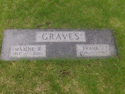
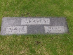
Maxine R. Sidney Graves
| Birth | : | 23 Mar 1917 Bancroft, Kossuth County, Iowa, USA |
| Death | : | 19 May 2010 Boone, Boone County, Iowa, USA |
| Burial | : | Gedling Cemetery, Gedling, Gedling Borough, England |
| Coordinate | : | 52.9806930, -1.0870670 |
| Description | : | Maxine Graves, age 93, died at the Home on May 19, 2010. Her body has been cremated. Burial will be in the Ames Municipal Cemetery in Ames. Maxine was born in Bancroft, Iowa, on March 23, 1917, the daughter of Robert and Martha (Knary) Sidney. She graduated from Lu Verne High School in Lu Verne in 1935. On October 21, 1941, Maxine married Frank J. Graves in Albany, Missouri. In 1950, the couple moved to Boone from Ames. Maxine was the director of the Boone County Homemaker-Health Aid Service, Congregate Meals, and Meals-on-Wheels for 16 years. During her tenure as... Read More |
frequently asked questions (FAQ):
-
Where is Maxine R. Sidney Graves's memorial?
Maxine R. Sidney Graves's memorial is located at: Gedling Cemetery, Gedling, Gedling Borough, England.
-
When did Maxine R. Sidney Graves death?
Maxine R. Sidney Graves death on 19 May 2010 in Boone, Boone County, Iowa, USA
-
Where are the coordinates of the Maxine R. Sidney Graves's memorial?
Latitude: 52.9806930
Longitude: -1.0870670
Family Members:
Parent
Spouse
Siblings
Children
Flowers:
Nearby Cemetories:
1. Gedling Cemetery
Gedling, Gedling Borough, England
Coordinate: 52.9806930, -1.0870670
2. All Hallows Churchyard
Gedling, Gedling Borough, England
Coordinate: 52.9769400, -1.0805130
3. Carlton Cemetery
Nottingham, Nottingham Unitary Authority, England
Coordinate: 52.9682820, -1.0900230
4. St. Paul's Churchyard
Nottingham Unitary Authority, England
Coordinate: 52.9667590, -1.1172140
5. Burton Joyce Cemetery
Burton Joyce, Gedling Borough, England
Coordinate: 52.9863100, -1.0370710
6. St. Helen's Churchyard
Burton Joyce, Gedling Borough, England
Coordinate: 52.9866700, -1.0365400
7. St Luke's Churchyard
Stoke Bardolph, Gedling Borough, England
Coordinate: 52.9680500, -1.0389300
8. St. Luke's Churchyard
Stoke Bardolph, Gedling Borough, England
Coordinate: 52.9659896, -1.0404380
9. St. John's Carrington Churchyard
Nottingham, Nottingham Unitary Authority, England
Coordinate: 52.9755350, -1.1506790
10. St. Mary Rest Ground
Nottingham, Nottingham Unitary Authority, England
Coordinate: 52.9568310, -1.1406580
11. Redhill Cemetery
Arnold, Nottingham Unitary Authority, England
Coordinate: 53.0066910, -1.1382950
12. National Ice Centre
Nottingham, Nottingham Unitary Authority, England
Coordinate: 52.9527790, -1.1394460
13. SS Peter & Paul Churchyard
Shelford, Rushcliffe Borough, England
Coordinate: 52.9745600, -1.0161200
14. St Mary's Burial Grounds
Nottingham, Nottingham Unitary Authority, England
Coordinate: 52.9527860, -1.1419160
15. St Mary Churchyard
Radcliffe-on-Trent, Rushcliffe Borough, England
Coordinate: 52.9464660, -1.0419420
16. Nottingham Church Cemetery
Nottingham, Nottingham Unitary Authority, England
Coordinate: 52.9649830, -1.1558070
17. Radcliffe-on-Trent Cemetery
Radcliffe-on-Trent, Rushcliffe Borough, England
Coordinate: 52.9459200, -1.0409700
18. National Justice Museum High Pavement Nottingham
Nottingham Unitary Authority, England
Coordinate: 52.9510680, -1.1443050
19. St Peters Church Yard
Nottingham, Nottingham Unitary Authority, England
Coordinate: 52.9522800, -1.1486940
20. St Nicholas Churchyard
Nottingham, Nottingham Unitary Authority, England
Coordinate: 52.9504780, -1.1509220
21. Woodborough Cemetery
Woodborough, Gedling Borough, England
Coordinate: 53.0272840, -1.0600540
22. Nottingham General Cemetery
Nottingham, Nottingham Unitary Authority, England
Coordinate: 52.9575370, -1.1594236
23. Cathedral Church of St. Barnabas
Nottingham, Nottingham Unitary Authority, England
Coordinate: 52.9546750, -1.1570460
24. General Cemetery
Nottingham, Nottingham Unitary Authority, England
Coordinate: 52.9561430, -1.1615420


