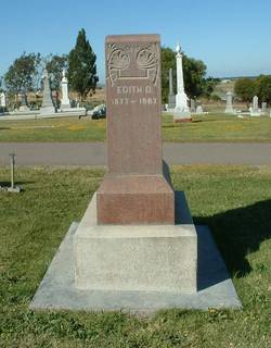
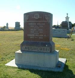
Mrs Edith Osborne Cooley Westgate
| Birth | : | 6 Aug 1878 Canada |
| Death | : | 28 Feb 1967 San Joaquin County, California, USA |
| Burial | : | St John Churchyard, Belton, North West Leicestershire District, England |
| Coordinate | : | 52.7830810, -1.3374590 |
| Description | : | Note: There is confusion on Edith's birth year amongst the available sources. The headstone shows just the year, 1877. The CA Death Index shows August 6, 1878. The SSDI shows August 6, 1875. And one detailed family tree on ancestry.com shows August 6, 1877. For now I have listed the date from the CA Death Index pending additional data. |
frequently asked questions (FAQ):
-
Where is Mrs Edith Osborne Cooley Westgate's memorial?
Mrs Edith Osborne Cooley Westgate's memorial is located at: St John Churchyard, Belton, North West Leicestershire District, England.
-
When did Mrs Edith Osborne Cooley Westgate death?
Mrs Edith Osborne Cooley Westgate death on 28 Feb 1967 in San Joaquin County, California, USA
-
Where are the coordinates of the Mrs Edith Osborne Cooley Westgate's memorial?
Latitude: 52.7830810
Longitude: -1.3374590
Family Members:
Parent
Spouse
Siblings
Children
Flowers:
Nearby Cemetories:
1. St John Churchyard
Belton, North West Leicestershire District, England
Coordinate: 52.7830810, -1.3374590
2. St Mary the Blessed Virgin Church
Osgathorpe, North West Leicestershire District, England
Coordinate: 52.7715890, -1.3623270
3. Grace-Dieu Priory
Thringstone, North West Leicestershire District, England
Coordinate: 52.7609720, -1.3566830
4. Shepshed Cemetery
Shepshed, Charnwood Borough, England
Coordinate: 52.7640470, -1.2963120
5. St. Botolph’s Churchyard
Shepshed, Charnwood Borough, England
Coordinate: 52.7726830, -1.2885670
6. St Michael & All Angels Churchyard
Long Whatton, North West Leicestershire District, England
Coordinate: 52.8164170, -1.3282730
7. St. Andrew's Churchyard
Thringstone, North West Leicestershire District, England
Coordinate: 52.7529090, -1.3692140
8. Methodist Church Churchyard
Griffydam, North West Leicestershire District, England
Coordinate: 52.7629060, -1.3894370
9. All Saints Churchyard
Long Whatton, North West Leicestershire District, England
Coordinate: 52.8052840, -1.2859690
10. St George Churchyard
Swannington, North West Leicestershire District, England
Coordinate: 52.7530997, -1.3865110
11. Mount St Bernard Abbey
Whitwick, North West Leicestershire District, England
Coordinate: 52.7413880, -1.3234470
12. St John the Baptist Churchyard
Whitwick, North West Leicestershire District, England
Coordinate: 52.7416040, -1.3571200
13. All Saints Churchyard
Isley Walton, North West Leicestershire District, England
Coordinate: 52.8211576, -1.3710891
14. Breedon Priory
Breedon on the Hill, North West Leicestershire District, England
Coordinate: 52.8060120, -1.3999600
15. Whitwick Cemetery
Whitwick, North West Leicestershire District, England
Coordinate: 52.7395560, -1.3623360
16. St. James the Greater Oaks in Charnwood
Whitwick, North West Leicestershire District, England
Coordinate: 52.7425430, -1.3008590
17. Greenhill Rise Cemetery
Hathern, Charnwood Borough, England
Coordinate: 52.7990180, -1.2576160
18. St. Peters & St. Paul Cemetery
Hathern, Charnwood Borough, England
Coordinate: 52.7970560, -1.2558040
19. St. John Churchyard
Coleorton, North West Leicestershire District, England
Coordinate: 52.7486100, -1.4124400
20. Broomleys Cemetery
Coalville, North West Leicestershire District, England
Coordinate: 52.7255540, -1.3402280
21. All Saints' Church Dishley
Hathern, Charnwood Borough, England
Coordinate: 52.7860705, -1.2412000
22. St. Edward King & Martyr Churchyard
Castle Donington, North West Leicestershire District, England
Coordinate: 52.8417000, -1.3383000
23. Castle Donington Cemetery
Castle Donington, North West Leicestershire District, England
Coordinate: 52.8431520, -1.3307570
24. St. Mary's Churchyard
Coleorton, North West Leicestershire District, England
Coordinate: 52.7513600, -1.4224500


