| Memorials | : | 20 |
| Location | : | Castle Donington, North West Leicestershire District, England |
| Website | : | www.cdpc.org.uk/cemeteries.html |
| Coordinate | : | 52.8431520, -1.3307570 |
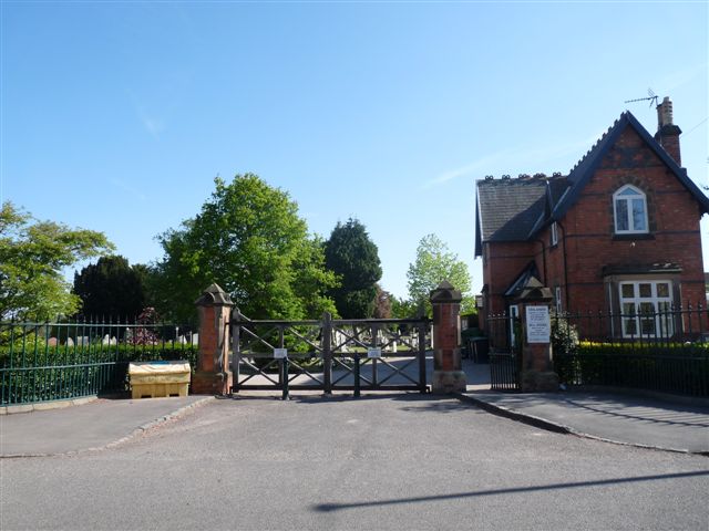
| Description | : | The cemetery with two chapels and a lodge opened in 1881. The duties of the Burial Board were transferred to the Parish Council in 1894 The chapels were demolished in 1964. The lodge still exists. The cemetery is still in operation as of 2021. |
frequently asked questions (FAQ):
-
Where is Castle Donington Cemetery?
Castle Donington Cemetery is located at Hemington Hill Castle Donington, North West Leicestershire District ,Leicestershire ,England.
-
Castle Donington Cemetery cemetery's updated grave count on graveviews.com?
19 memorials
-
Where are the coordinates of the Castle Donington Cemetery?
Latitude: 52.8431520
Longitude: -1.3307570
Nearby Cemetories:
1. Quaker Burial Ground
Castle Donington, North West Leicestershire District, England
Coordinate: 52.8435100, -1.3328900
2. St. Edward King & Martyr Churchyard
Castle Donington, North West Leicestershire District, England
Coordinate: 52.8417000, -1.3383000
3. St. Nicholas' Churchyard
Lockington, North West Leicestershire District, England
Coordinate: 52.8468300, -1.3065600
4. Saint Nicholas Churchyard
Lockington, North West Leicestershire District, England
Coordinate: 52.8468883, -1.3063910
5. St Michael & All Angels Churchyard
Long Whatton, North West Leicestershire District, England
Coordinate: 52.8164170, -1.3282730
6. St James Churchyard
Shardlow, South Derbyshire District, England
Coordinate: 52.8686280, -1.3508150
7. Kegworth Cemetery
Kegworth, North West Leicestershire District, England
Coordinate: 52.8332680, -1.2816790
8. Saint Andrew's Churchyard
Kegworth, North West Leicestershire District, England
Coordinate: 52.8358160, -1.2780850
9. All Saints Churchyard
Isley Walton, North West Leicestershire District, England
Coordinate: 52.8211576, -1.3710891
10. All Saints Churchyard
Aston on Trent, South Derbyshire District, England
Coordinate: 52.8606040, -1.3866670
11. Moor Lane
Aston on Trent, South Derbyshire District, England
Coordinate: 52.8651600, -1.3826900
12. All Saints Churchyard
Sawley, Erewash Borough, England
Coordinate: 52.8776016, -1.2995000
13. Holy Trinity Churchyard
Ratcliffe-on-Soar, Rushcliffe Borough, England
Coordinate: 52.8553380, -1.2665520
14. Sawley Baptist Churchyard
Sawley, Erewash Borough, England
Coordinate: 52.8799410, -1.3009980
15. All Saints Churchyard
Long Whatton, North West Leicestershire District, England
Coordinate: 52.8052840, -1.2859690
16. St Mary the Virgin Churchyard
Weston on Trent, South Derbyshire District, England
Coordinate: 52.8444900, -1.4105600
17. St. Michael's Churchyard
Sutton Bonington, Rushcliffe Borough, England
Coordinate: 52.8240654, -1.2529907
18. Marle Pit Hill Cemetery
Sutton Bonington, Rushcliffe Borough, England
Coordinate: 52.8241820, -1.2525970
19. St. Michael Churchyard
Breaston, Erewash Borough, England
Coordinate: 52.8969700, -1.3176200
20. St. Anne's Churchyard
Sutton Bonington, Rushcliffe Borough, England
Coordinate: 52.8206200, -1.2485400
21. Breedon Priory
Breedon on the Hill, North West Leicestershire District, England
Coordinate: 52.8060120, -1.3999600
22. Melbourne Cemetery
Melbourne, South Derbyshire District, England
Coordinate: 52.8291310, -1.4271470
23. St Michael & St Mary Old Churchyard
Melbourne, South Derbyshire District, England
Coordinate: 52.8221000, -1.4240900
24. St John Churchyard
Belton, North West Leicestershire District, England
Coordinate: 52.7830810, -1.3374590


