
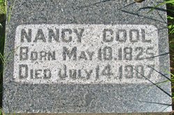
Nancy Bates Cool
| Birth | : | 10 May 1825 Herkimer County, New York, USA |
| Death | : | 14 Jul 1907 |
| Burial | : | Wellow & Shoscombe Cemetery, Wellow, Bath and North East Somerset Unitary Authority, England |
| Coordinate | : | 51.3165527, -2.3916632 |
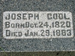
| Description | : | Married to Joseph Cool March 30, 1847. Mother of 6 daughters and one son. Lived in Iowa before coming to Kansas in 1876. Glasco Sun, Cloud County, Kansas, July 19, 1907, page 2: Nancy Bates was born in Herkimer county, New York, May 10th, 1825 where, during her young womanhood, she taught school. On March 30, 1847, she was married to Joseph Cool. After a few years they moved to Delaware county, Iowa, and in that new country Mrs. Cool was ever known as a helpful friend and neighbor, taking advantage of every opportunity to assist the sick... Read More |
frequently asked questions (FAQ):
-
Where is Nancy Bates Cool's memorial?
Nancy Bates Cool's memorial is located at: Wellow & Shoscombe Cemetery, Wellow, Bath and North East Somerset Unitary Authority, England.
-
When did Nancy Bates Cool death?
Nancy Bates Cool death on 14 Jul 1907 in
-
Where are the coordinates of the Nancy Bates Cool's memorial?
Latitude: 51.3165527
Longitude: -2.3916632
Family Members:
Parent
Spouse
Siblings

Children
Flowers:


Nearby Cemetories:
1. Wellow & Shoscombe Cemetery
Wellow, Bath and North East Somerset Unitary Authority, England
Coordinate: 51.3165527, -2.3916632
2. St Julian's Churchyard
Wellow, Bath and North East Somerset Unitary Authority, England
Coordinate: 51.3240160, -2.3717630
3. Ashgrove Cemetery
Peasedown St John, Bath and North East Somerset Unitary Authority, England
Coordinate: 51.3181600, -2.4150760
4. Foxcote St James' The Less Churchyard
Shoscombe, Bath and North East Somerset Unitary Authority, England
Coordinate: 51.2985762, -2.4092987
5. St. James the Less Churchyard
Foxcote, Mendip District, England
Coordinate: 51.2985540, -2.4093370
6. Combe Hay Parish Churchyard
Combe Hay, Bath and North East Somerset Unitary Authority, England
Coordinate: 51.3371120, -2.3817390
7. All Saints Church
Dunkerton, Bath and North East Somerset Unitary Authority, England
Coordinate: 51.3320390, -2.4158600
8. Combe Hay Cemetery
Combe Hay, Bath and North East Somerset Unitary Authority, England
Coordinate: 51.3397819, -2.3814323
9. St. John the Baptist Churchyard
Peasedown St John, Bath and North East Somerset Unitary Authority, England
Coordinate: 51.3164630, -2.4327370
10. Withyditch Baptist Chapel
Bath, Bath and North East Somerset Unitary Authority, England
Coordinate: 51.3328833, -2.4273859
11. St. Mary Magdalene Churchyard
Writhlington, Bath and North East Somerset Unitary Authority, England
Coordinate: 51.2938240, -2.4262230
12. St. Peter's Churchyard
Camerton, Bath and North East Somerset Unitary Authority, England
Coordinate: 51.3150300, -2.4503700
13. St. James' Churchyard
South Stoke, Bath and North East Somerset Unitary Authority, England
Coordinate: 51.3497220, -2.3652780
14. Midford Burial Ground
Bath, Bath and North East Somerset Unitary Authority, England
Coordinate: 51.3394360, -2.3391424
15. Saint Luke & Saint Andrew
Priston, Bath and North East Somerset Unitary Authority, England
Coordinate: 51.3419170, -2.4421910
16. Blessed St Mary the Virgin Churchyard
Hemington, Mendip District, England
Coordinate: 51.2758698, -2.3925455
17. Bath Union Workhouse Burial Ground
Bath, Bath and North East Somerset Unitary Authority, England
Coordinate: 51.3570889, -2.3773370
18. Norton St. Philip Churchyard
Norton St Philip, Mendip District, England
Coordinate: 51.3001680, -2.3279700
19. Bath Union Workhouse Graveyard
Bath, Bath and North East Somerset Unitary Authority, England
Coordinate: 51.3584160, -2.3711140
20. St. John the Baptist Churchyard
Hinton Charterhouse, Bath and North East Somerset Unitary Authority, England
Coordinate: 51.3233330, -2.3219440
21. St. Nicholas' Churchyard
Radstock, Bath and North East Somerset Unitary Authority, England
Coordinate: 51.2900740, -2.4488510
22. Holy Trinity Churchyard
Clandown, Bath and North East Somerset Unitary Authority, England
Coordinate: 51.3024050, -2.4611700
23. St Peter Churchyard
Englishcombe, Bath and North East Somerset Unitary Authority, England
Coordinate: 51.3640600, -2.4088700
24. Jewish Burial Ground
Combe Down, Bath and North East Somerset Unitary Authority, England
Coordinate: 51.3599170, -2.3534670