Nancy H. Drake Moore
| Birth | : | 15 Nov 1933 Prairieton, Vigo County, Indiana, USA |
| Death | : | 2 May 2010 Terre Haute, Vigo County, Indiana, USA |
| Burial | : | West Saint Olaf Cemetery, Vernon, Dodge County, USA |
| Coordinate | : | 43.9266701, -92.7177811 |
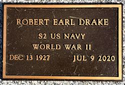
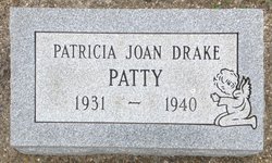
| Description | : | Nancy H. Moore Nancy H. Moore, 76, of Terre Haute, passed away at 8:12 a.m. Sunday, May 2, 2010, at Union Hospital. She was born in Prairieton, on Nov. 15, 1933, to Thomas Earl Drake and Bernice Harvey Drake. She is survived by her husband, Charles E. Moore, whom she married June 5, 1953; four daughters, Susan Bliss and husband James of Bowling Green, Ky., Jane Richardson of Lafayette, Joyce Seidle and husband Scott of West Lafayette, and Mary Moore of Terre Haute; two brothers, Bob Drake and John Drake; one sister, Virginia Rockwood; six grandchildren,... Read More |
frequently asked questions (FAQ):
-
Where is Nancy H. Drake Moore's memorial?
Nancy H. Drake Moore's memorial is located at: West Saint Olaf Cemetery, Vernon, Dodge County, USA.
-
When did Nancy H. Drake Moore death?
Nancy H. Drake Moore death on 2 May 2010 in Terre Haute, Vigo County, Indiana, USA
-
Where are the coordinates of the Nancy H. Drake Moore's memorial?
Latitude: 43.9266701
Longitude: -92.7177811
Family Members:
Parent
Siblings
Flowers:
Nearby Cemetories:
1. South Zumbro Lutheran Church Cemetery
Salem Corners, Olmsted County, USA
Coordinate: 43.9517670, -92.6777878
2. East Saint Olaf Lutheran Church Cemetery
Rock Dell, Olmsted County, USA
Coordinate: 43.9327812, -92.6383286
3. Zion Cemetery
Rock Dell, Olmsted County, USA
Coordinate: 43.9297218, -92.6377792
4. Evanger Lutheran Church Cemetery
Sargeant, Mower County, USA
Coordinate: 43.8416710, -92.7300034
5. Riverside Cemetery
Salem Corners, Olmsted County, USA
Coordinate: 43.9785995, -92.6074982
6. Maple Grove Cemetery
Kasson, Dodge County, USA
Coordinate: 44.0214005, -92.7553024
7. Fairview Cemetery
Hayfield, Dodge County, USA
Coordinate: 43.8849983, -92.8585968
8. Byron Cemetery
Byron, Olmsted County, USA
Coordinate: 44.0359459, -92.6424713
9. Oakridge Farm Cemetery
Rochester, Olmsted County, USA
Coordinate: 43.9479480, -92.5435090
10. Saint Margaret Cemetery
Mantorville, Dodge County, USA
Coordinate: 44.0616989, -92.7435989
11. Evergreen Cemetery
Mantorville, Dodge County, USA
Coordinate: 44.0619011, -92.7418976
12. Zion Lutheran Church Cemetery
Sargeant, Mower County, USA
Coordinate: 43.7891693, -92.7161102
13. Pleasant Valley Cemetery
Racine, Mower County, USA
Coordinate: 43.8116989, -92.6074982
14. Immanuel Cemetery
Racine, Mower County, USA
Coordinate: 43.8107986, -92.6089020
15. High Forest Cemetery
High Forest, Olmsted County, USA
Coordinate: 43.8472214, -92.5413895
16. Riverside Cemetery
Dodge Center, Dodge County, USA
Coordinate: 44.0393982, -92.8597031
17. Mayowood Cemetery
Rochester, Olmsted County, USA
Coordinate: 43.9909500, -92.5218800
18. Saint Johns Lutheran Cemetery
Sargeant, Mower County, USA
Coordinate: 43.7751083, -92.7908936
19. Wildwood Cemetery
Wasioja, Dodge County, USA
Coordinate: 44.0713997, -92.8142014
20. Saint Johns Evangelical Cemetery
Racine, Mower County, USA
Coordinate: 43.8053017, -92.5586014
21. Saint Bernard Catholic Cemetery
Stewartville, Olmsted County, USA
Coordinate: 43.8624992, -92.4942017
22. Waltham Cemetery
Waltham, Mower County, USA
Coordinate: 43.7905998, -92.8685989
23. Woodlawn Cemetery
Stewartville, Olmsted County, USA
Coordinate: 43.8561707, -92.4966507
24. Mount Hope Cemetery
Rochester, Olmsted County, USA
Coordinate: 44.0703011, -92.5783005


