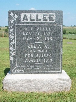
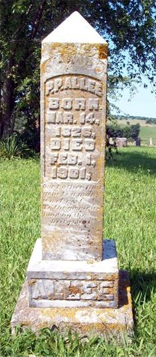
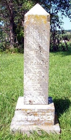
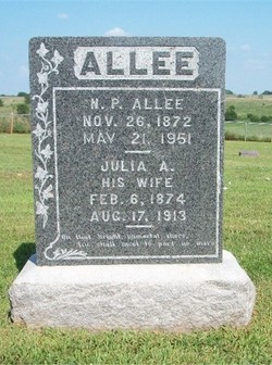
Nicholas Presley Allee
| Birth | : | 26 Nov 1872 California, Moniteau County, Missouri, USA |
| Death | : | 21 May 1951 Kansas City, Jackson County, Missouri, USA |
| Burial | : | Ashburton Public Cemetery, Ashburton, Ashburton District, New Zealand |
| Coordinate | : | -43.8903240, 171.7702810 |
| Description | : | Name: Nicholas D. Allee Wife: Julia A. Allee Father: Presley Allee Mother: Julia A. Stout (incorrect - should have been Martha Stout) Informant: Julia Allee Occupation: Retired Marital Status: Married Age: 79 Years Cause Of Death: Carcinoma Of Jaw and Mouth Place Of Burial: Flagspring Cemetery Burial: May 22, 1951 Source: Death Certificate: #26397 RESEARCHED BY RICHARD PARKER |
frequently asked questions (FAQ):
-
Where is Nicholas Presley Allee's memorial?
Nicholas Presley Allee's memorial is located at: Ashburton Public Cemetery, Ashburton, Ashburton District, New Zealand.
-
When did Nicholas Presley Allee death?
Nicholas Presley Allee death on 21 May 1951 in Kansas City, Jackson County, Missouri, USA
-
Where are the coordinates of the Nicholas Presley Allee's memorial?
Latitude: -43.8903240
Longitude: 171.7702810
Family Members:
Parent
Spouse
Siblings
Children
Flowers:
Nearby Cemetories:
1. Ashburton Public Cemetery
Ashburton, Ashburton District, New Zealand
Coordinate: -43.8903240, 171.7702810
2. Pioneer Park Memorial
Ashburton, Ashburton District, New Zealand
Coordinate: -43.9106400, 171.7485300
3. Winslow Cemetery
Winslow, Ashburton District, New Zealand
Coordinate: -43.9576290, 171.6522810
4. Windermere Cemetery
Windermere, Ashburton District, New Zealand
Coordinate: -43.9874945, 171.6232358
5. Chertsey Cemetery
Chertsey, Ashburton District, New Zealand
Coordinate: -43.8030500, 171.9319400
6. Westerfield Cemetery
Westerfield, Ashburton District, New Zealand
Coordinate: -43.8324380, 171.5806230
7. Waterton Cemetery
Eiffelton, Ashburton District, New Zealand
Coordinate: -44.0640000, 171.7260000
8. Hinds Cemetery
Hinds, Ashburton District, New Zealand
Coordinate: -44.0075580, 171.5735400
9. Rakaia Cemetery
Rakaia, Ashburton District, New Zealand
Coordinate: -43.7548910, 171.9939270
10. Longbeach Estate Chapel
Longbeach, Ashburton District, New Zealand
Coordinate: -44.0941090, 171.6884504
11. Barrhill Cemetery
Barrhill, Ashburton District, New Zealand
Coordinate: -43.6756950, 171.8480790
12. Dorie Cemetery
Dorie, Ashburton District, New Zealand
Coordinate: -43.8772900, 172.0862500
13. Kyle Cemetery
Dorie, Ashburton District, New Zealand
Coordinate: -43.9193236, 172.0979192
14. Highbank Cemetery
Highbank, Ashburton District, New Zealand
Coordinate: -43.6228060, 171.7387780
15. Methven Cemetery
Methven, Ashburton District, New Zealand
Coordinate: -43.6346810, 171.6563070
16. Ruapuna Cemetery
Ruapuna, Ashburton District, New Zealand
Coordinate: -43.8436110, 171.3680400
17. Alford Forest Cemetery
Alford Forest, Ashburton District, New Zealand
Coordinate: -43.6428200, 171.4933300
18. Mount Somers Cemetery
Mount Somers, Ashburton District, New Zealand
Coordinate: -43.7093900, 171.3962830
19. Mt Somers Old Cemetery
Mount Somers, Ashburton District, New Zealand
Coordinate: -43.7050700, 171.3969000
20. Cracroft Cemetery
Ruapuna, Ashburton District, New Zealand
Coordinate: -43.9341900, 171.2989500
21. Dunsandel Cemetery
Dunsandel, Selwyn District, New Zealand
Coordinate: -43.6710940, 172.1382620
22. St James Churchyard
Southbridge, Selwyn District, New Zealand
Coordinate: -43.8092360, 172.2502680
23. Bishops Corner Cemetery
Southbridge, Selwyn District, New Zealand
Coordinate: -43.7824100, 172.2422900
24. Arundel Cemetery
Arundel, Timaru District, New Zealand
Coordinate: -43.9785690, 171.2838900

