
| Memorials | : | 27 |
| Location | : | Southbridge, Selwyn District, New Zealand |
| Website | : | www.selwyn.govt.nz/facilities-and-parks/cemeteries |
| Coordinate | : | -43.7824100, 172.2422900 |
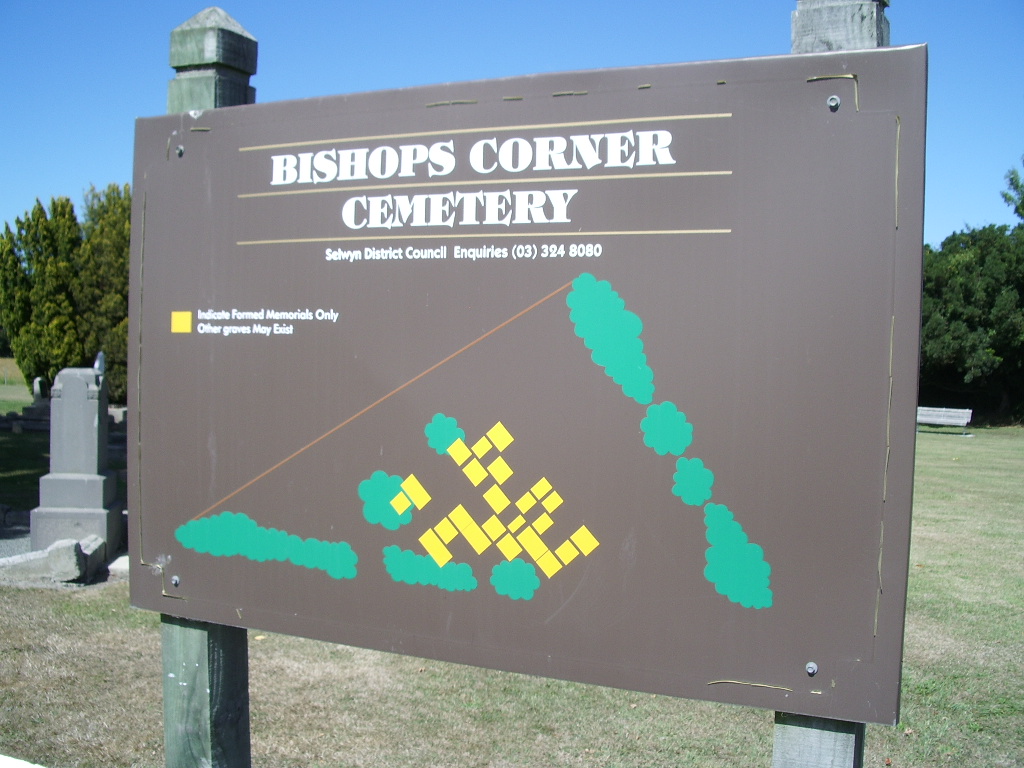
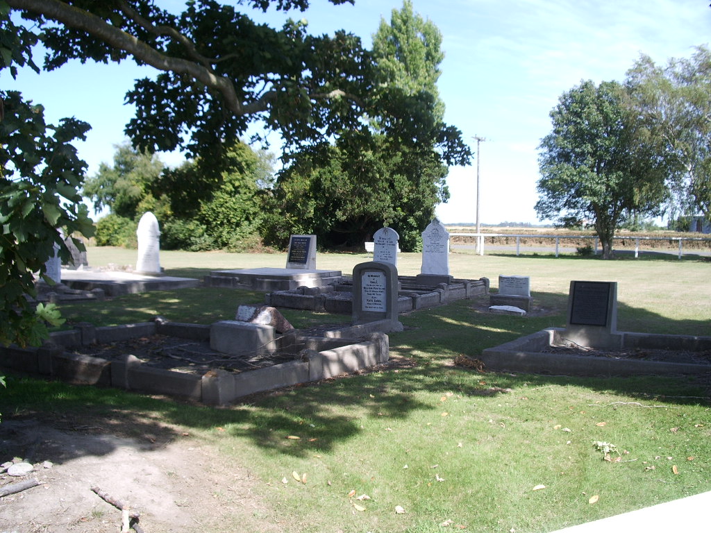
| Description | : | This site was first used for burials in 1872. A Methodist church had been built here, but was shifted to Southbridge in 1875. From the 1880's, when the Methodist section of the Ellesmere Cemetery was developed, the cemetery had little use. The Ellesmere County Council took over its administration in 1981, and since then, the only burials permitted are for families with pre-purchased plots. Despite the large number of burials in the cemetery, only around 20 headstones remain as at January 2019. The remainder have unmarked graves. |
frequently asked questions (FAQ):
-
Where is Bishops Corner Cemetery?
Bishops Corner Cemetery is located at Corner of Willis Road and Cowans Road Southbridge, Selwyn District ,Canterbury , 7683New Zealand.
-
Bishops Corner Cemetery cemetery's updated grave count on graveviews.com?
27 memorials
-
Where are the coordinates of the Bishops Corner Cemetery?
Latitude: -43.7824100
Longitude: 172.2422900
Nearby Cemetories:
1. Ellesmere Public Cemetery
Leeston, Selwyn District, New Zealand
Coordinate: -43.7775690, 172.2599220
2. Ellesmere Catholic Cemetery
Leeston, Selwyn District, New Zealand
Coordinate: -43.7845860, 172.2690990
3. St James Churchyard
Southbridge, Selwyn District, New Zealand
Coordinate: -43.8092360, 172.2502680
4. Killinchy Cemetery
Leeston, Selwyn District, New Zealand
Coordinate: -43.7325610, 172.2411540
5. Sedgemere Cemetery
Sedgemere, Selwyn District, New Zealand
Coordinate: -43.8366600, 172.3149500
6. St Luke's Anglican Churchyard
Brookside, Selwyn District, New Zealand
Coordinate: -43.6903100, 172.3029000
7. Brookside Cemetery
Brookside, Selwyn District, New Zealand
Coordinate: -43.6751800, 172.2683700
8. Hone Wetere Churchyard
Taumutu, Selwyn District, New Zealand
Coordinate: -43.8567680, 172.3586330
9. Dunsandel Cemetery
Dunsandel, Selwyn District, New Zealand
Coordinate: -43.6710940, 172.1382620
10. Dorie Cemetery
Dorie, Ashburton District, New Zealand
Coordinate: -43.8772900, 172.0862500
11. Kyle Cemetery
Dorie, Ashburton District, New Zealand
Coordinate: -43.9193236, 172.0979192
12. Rakaia Cemetery
Rakaia, Ashburton District, New Zealand
Coordinate: -43.7548910, 171.9939270
13. St Mary's Churchyard
Springston, Selwyn District, New Zealand
Coordinate: -43.6446560, 172.4263590
14. Springston Cemetery
Lincoln, Selwyn District, New Zealand
Coordinate: -43.6404360, 172.4509420
15. Chertsey Cemetery
Chertsey, Ashburton District, New Zealand
Coordinate: -43.8030500, 171.9319400
16. Lincoln Cemetery
Lincoln, Selwyn District, New Zealand
Coordinate: -43.6311790, 172.4862570
17. Weedons Cemetery
Weedons, Selwyn District, New Zealand
Coordinate: -43.5670010, 172.4015870
18. Greendale Cemetery
Greendale, Selwyn District, New Zealand
Coordinate: -43.5447560, 172.0772460
19. Shands Road Cemetery
Prebbleton, Selwyn District, New Zealand
Coordinate: -43.5792540, 172.4888630
20. Prebbleton Cemetery
Prebbleton, Selwyn District, New Zealand
Coordinate: -43.5887200, 172.5053500
21. St Paul's Anglican Church Cemetery
West Melton, Selwyn District, New Zealand
Coordinate: -43.5261700, 172.3701800
22. All Saint's Churchyard
Prebbleton, Selwyn District, New Zealand
Coordinate: -43.5781040, 172.5131430
23. Church of the Epiphany Churchyard
Teddington, Christchurch City, New Zealand
Coordinate: -43.7016200, 172.6182200
24. St Saviours Churchyard
Templeton, Christchurch City, New Zealand
Coordinate: -43.5501420, 172.4714620