
| Birth | : | 9 May 1853 Warren County, Iowa, USA |
| Death | : | 14 Mar 1900 Cass County, Iowa, USA |
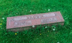
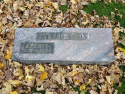
| Burial | : | Kingston Cemetery, Portsmouth, Portsmouth Unitary Authority, England |
| Coordinate | : | 50.8031440, -1.0683260 |
| Description | : | Nomon was the first born child of Lazarus's third marriage to Ruth Marie Surber. There were 6 more children born in Warren County on the farm where they lived, although two died as infants. In 1866, the family moved to a farm near Atlantic in Cass County where 2 more children were born. Nomon's mother died in September of 1870, leaving Lazarus with 7 children (girls 15,8 and 2 mos; boys, 17,14,7 and 3 yrs.). The four older children from Lazarus's first marriage, had married in Warren County and John (from 2nd marr.) stayed there as a farm... Read More |
frequently asked questions (FAQ):
-
Where is Nomon Whited's memorial?
Nomon Whited's memorial is located at: Kingston Cemetery, Portsmouth, Portsmouth Unitary Authority, England.
-
When did Nomon Whited death?
Nomon Whited death on 14 Mar 1900 in Cass County, Iowa, USA
-
Where are the coordinates of the Nomon Whited's memorial?
Latitude: 50.8031440
Longitude: -1.0683260
Family Members:
Parent

Spouse
Siblings
Children
Flowers:


Nearby Cemetories:
1. Kingston Cemetery
Portsmouth, Portsmouth Unitary Authority, England
Coordinate: 50.8031440, -1.0683260
2. St. Mary's Churchyard
Portsea, Portsmouth Unitary Authority, England
Coordinate: 50.8035350, -1.0763490
3. Milton Cemetery
Portsmouth, Portsmouth Unitary Authority, England
Coordinate: 50.7988700, -1.0608030
4. St James Churchyard
Eastney, Portsmouth Unitary Authority, England
Coordinate: 50.7940650, -1.0581150
5. Mile End Cemetery
Portsea, Portsmouth Unitary Authority, England
Coordinate: 50.8108900, -1.0876400
6. Old Jewish Cemetery
Portsmouth, Portsmouth Unitary Authority, England
Coordinate: 50.7887000, -1.0738800
7. Highland Road Cemetery
Portsmouth, Portsmouth Unitary Authority, England
Coordinate: 50.7860500, -1.0671790
8. HMS Victoria Monument
Portsmouth, Portsmouth Unitary Authority, England
Coordinate: 50.7997200, -1.0950800
9. Portsmouth Unitarian Church
Portsmouth, Portsmouth Unitary Authority, England
Coordinate: 50.7915640, -1.1011840
10. Portsmouth Cathedral Churchyard
Portsmouth, Portsmouth Unitary Authority, England
Coordinate: 50.7904650, -1.1043720
11. HMS Victory Ship
Portsmouth, Portsmouth Unitary Authority, England
Coordinate: 50.8017290, -1.1095590
12. Royal Garrison Church Churchyard
Plymouth, Plymouth Unitary Authority, England
Coordinate: 50.7889690, -1.1039650
13. Royal Garrison Churchyard
Portsmouth, Portsmouth Unitary Authority, England
Coordinate: 50.7890180, -1.1040520
14. Portsmouth Naval Memorial
Portsmouth, Portsmouth Unitary Authority, England
Coordinate: 50.7824440, -1.0957720
15. Holy Trinity Churchyard
Gosport, Gosport Borough, England
Coordinate: 50.7930600, -1.1207620
16. St Peter and St Paul Churchyard
Wymering, Portsmouth Unitary Authority, England
Coordinate: 50.8457490, -1.0777170
17. St. Mary's Churchyard
Portchester, Fareham Borough, England
Coordinate: 50.8366280, -1.1134270
18. St John the Evangelist Churchyard
Gosport, Gosport Borough, England
Coordinate: 50.7995600, -1.1397800
19. Clayhall Naval Cemetery
Gosport, Gosport Borough, England
Coordinate: 50.7833862, -1.1373420
20. Turkish Naval Cemetery
Gosport, Gosport Borough, England
Coordinate: 50.7840710, -1.1383980
21. Roman Grove Cemetery
Portchester, Fareham Borough, England
Coordinate: 50.8384600, -1.1206200
22. St. Andrew's Churchyard
Farlington, Portsmouth Unitary Authority, England
Coordinate: 50.8477200, -1.0274510
23. St Thomas the Apostle Churchyard
Gosport, Gosport Borough, England
Coordinate: 50.8137570, -1.1484570
24. St. Mark's Churchyard
Alverstoke, Gosport Borough, England
Coordinate: 50.7826800, -1.1436100