
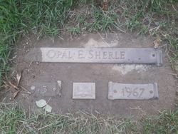
Opal Eloida McLain Sherle
| Birth | : | 7 Jun 1913 Liberty County, Montana, USA |
| Death | : | 12 Mar 1967 Havre, Hill County, Montana, USA |
| Burial | : | Highland Cemetery, Havre, Hill County, USA |
| Coordinate | : | 48.5463982, -109.6900024 |
| Plot | : | Space 452, Block 31 |
| Description | : | Havre Daily News (MT), 13 March 1967 Opal Sherle Dies Here Mrs. Opal Eloida Sherle, 53, former Hill County Superintendent of Schools, died Sunday at a local hospital. Mrs. Sherle was born June 7, 1913, at Minneota, Mont. She attended Havre schools and graduated from Northern Montana College in 1936. She taught schools in Hill and Toole counties, and served as chairman of the Hill County Textbook Commission from 1950 until 1954. She was Hill County Superintendent of Schools for 11 years and was a member of the County Superintendents Association and the Montana School Administrators Association. She retired from teaching... Read More |
frequently asked questions (FAQ):
-
Where is Opal Eloida McLain Sherle's memorial?
Opal Eloida McLain Sherle's memorial is located at: Highland Cemetery, Havre, Hill County, USA.
-
When did Opal Eloida McLain Sherle death?
Opal Eloida McLain Sherle death on 12 Mar 1967 in Havre, Hill County, Montana, USA
-
Where are the coordinates of the Opal Eloida McLain Sherle's memorial?
Latitude: 48.5463982
Longitude: -109.6900024
Family Members:
Parent

Spouse
Siblings
Children

Flowers:


Nearby Cemetories:
1. Highland Cemetery
Havre, Hill County, USA
Coordinate: 48.5463982, -109.6900024
2. Calvary Cemetery
Havre, Hill County, USA
Coordinate: 48.5457000, -109.6883000
3. Mount Hope Cemetery
Havre, Hill County, USA
Coordinate: 48.5540000, -109.7050000
4. Sunset Garden Park
Havre, Hill County, USA
Coordinate: 48.5531006, -109.8019028
5. North Havre Lutheran Church Graveyard (Defunct)
Havre, Hill County, USA
Coordinate: 48.6538903, -109.6815870
6. Grainbelt Cemetery
Hill County, USA
Coordinate: 48.6828003, -109.8657990
7. Andrew S. Lohman Grave Site
Lohman, Blaine County, USA
Coordinate: 48.5903520, -109.4073350
8. East End Colony Cemetery
East End Colony, Hill County, USA
Coordinate: 48.7485000, -109.5474000
9. Hilldale Hutterite Colony Cemetery
Hilldale Colony, Hill County, USA
Coordinate: 48.7997000, -109.7872000
10. Saint Johns Catholic Cemetery
Havre, Hill County, USA
Coordinate: 48.7625008, -109.9638977
11. Saint Gabriel Cemetery
Chinook, Blaine County, USA
Coordinate: 48.6065200, -109.2531200
12. Kuper Memorial Cemetery
Chinook, Blaine County, USA
Coordinate: 48.6083100, -109.2531200
13. Rocky Boy Cemetery
Rocky Boy, Hill County, USA
Coordinate: 48.2572410, -109.7923690
14. Box Elder Cemetery
Box Elder, Hill County, USA
Coordinate: 48.3274000, -110.0095000
15. Rocky Boy Gravel Cemetery
Rocky Boy, Hill County, USA
Coordinate: 48.2427720, -109.7596500
16. Cottonwood Lutheran Church Cemetery
Havre, Hill County, USA
Coordinate: 48.4545000, -110.1748000
17. Bear Paw Battlefield
Chinook, Blaine County, USA
Coordinate: 48.3780070, -109.2121290
18. Hungry Hollow Cemetery
Blaine County, USA
Coordinate: 48.2103004, -109.4677963
19. Milk River Valley Church Graveyard
Hill County, USA
Coordinate: 48.6787180, -110.2261080
20. Hollandville Cemetery
Chinook, Blaine County, USA
Coordinate: 48.6960310, -109.1557200
21. Gildford Hill County Cemetery
Gildford, Hill County, USA
Coordinate: 48.5778008, -110.2957993
22. Prairie Chapel United Brethren Cemetery
Chinook, Blaine County, USA
Coordinate: 48.8860000, -109.3414000
23. Mennonite Brethren Cemetery
Chinook, Blaine County, USA
Coordinate: 48.8012560, -109.1980620
24. Bethel Bruderthaler Mennonite Church Cemetery
Chinook, Blaine County, USA
Coordinate: 48.7552000, -109.1345000