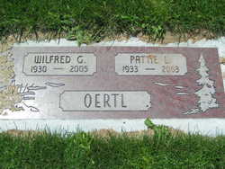
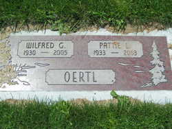
Pattie Lavon Crawford Oertl
| Birth | : | 17 Mar 1933 Woods County, Oklahoma, USA |
| Death | : | 20 Nov 2003 East Wenatchee, Douglas County, Washington, USA |
| Burial | : | Littles Pond Cemetery, Sandwich, Carroll County, USA |
| Coordinate | : | 43.7915600, -71.4034200 |
| Description | : | m: 21 Mar 1952 in Chelan Co, WA Pattie L. Oertl, 70, of East Wenatchee, died Thursday, Nov. 20, 2003. She was a longtime East Wenatchee resident, and had worked as a sorter at packing sheds in the Wenatchee Valley. Survivors include her husband, Wilfred "Willy" Oertl of East Wenatchee; two sons, Brian Oertl of Wenatchee, and Kevin Oertl of Port Orchard; and two daughters, Patricia Oertl of Aloha, Ore., and Brenda Sturm of Wenatchee. At her request, there will be no service. A private interment will be at Evergreen Memorial Park in East Wenatchee. Arrangements are by Telford's Chapel of the Valley, East... Read More |
frequently asked questions (FAQ):
-
Where is Pattie Lavon Crawford Oertl's memorial?
Pattie Lavon Crawford Oertl's memorial is located at: Littles Pond Cemetery, Sandwich, Carroll County, USA.
-
When did Pattie Lavon Crawford Oertl death?
Pattie Lavon Crawford Oertl death on 20 Nov 2003 in East Wenatchee, Douglas County, Washington, USA
-
Where are the coordinates of the Pattie Lavon Crawford Oertl's memorial?
Latitude: 43.7915600
Longitude: -71.4034200
Family Members:
Parent
Spouse
Siblings
Flowers:
Nearby Cemetories:
1. Beede Cemetery
Sandwich, Carroll County, USA
Coordinate: 43.8013890, -71.4166670
2. Nathanial Fry Family Plot
Sandwich, Carroll County, USA
Coordinate: 43.7875872, -71.3844592
3. Mears-Nelson Cemetery
Sandwich, Carroll County, USA
Coordinate: 43.7932790, -71.3820560
4. Mason Cemetery
Center Sandwich, Carroll County, USA
Coordinate: 43.7858000, -71.4258000
5. Richard Fry Cemetery
Sandwich, Carroll County, USA
Coordinate: 43.7822817, -71.3830099
6. Cemetery of the Religious Society of Friends
Sandwich, Carroll County, USA
Coordinate: 43.7994400, -71.4266700
7. Moulton-Beede Cemetery
Sandwich, Carroll County, USA
Coordinate: 43.7774000, -71.4276000
8. Smith-Morse Cemetery
Sandwich, Carroll County, USA
Coordinate: 43.7768000, -71.4301000
9. Haines Cemetery
Union, Carroll County, USA
Coordinate: 43.7734000, -71.4331000
10. Cram-Webster Cemetery
Sandwich, Carroll County, USA
Coordinate: 43.7972220, -71.3641670
11. Holland Hill Cemetery
Moultonborough, Carroll County, USA
Coordinate: 43.7620300, -71.3995400
12. Hubbard Cemetery
Center Sandwich, Carroll County, USA
Coordinate: 43.7855988, -71.3628006
13. Freese Cemetery
Moultonborough, Carroll County, USA
Coordinate: 43.7616670, -71.4008330
14. Baptist Burial Ground
Center Sandwich, Carroll County, USA
Coordinate: 43.8079900, -71.4392600
15. Rogers Cemetery
Moultonborough, Carroll County, USA
Coordinate: 43.7707400, -71.3693100
16. Elm Hill Cemetery
Center Sandwich, Carroll County, USA
Coordinate: 43.8158000, -71.4336000
17. Elm Hill Cemetery
Sandwich, Carroll County, USA
Coordinate: 43.8158330, -71.4338890
18. Grove Cemetery
Sandwich, Carroll County, USA
Coordinate: 43.8101100, -71.4445200
19. Mason Cemetery
Moultonborough, Carroll County, USA
Coordinate: 43.7574500, -71.4184000
20. Clement Cemetery
Moultonborough, Carroll County, USA
Coordinate: 43.7586110, -71.3827780
21. Vittum Hill Cemetery
Sandwich, Carroll County, USA
Coordinate: 43.8096700, -71.3578100
22. Wallace-Vittum Cemetery
Sandwich, Carroll County, USA
Coordinate: 43.8110897, -71.3536102
23. Chase Cemetery
Moultonborough, Carroll County, USA
Coordinate: 43.7618000, -71.3635000
24. Paine-Chase Cemetery
Moultonborough, Carroll County, USA
Coordinate: 43.7617000, -71.3635000


