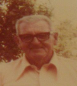
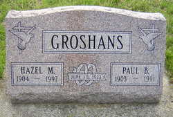
Paul Bennett Groshans
| Birth | : | 31 Oct 1903 North Judson, Starke County, Indiana, USA |
| Death | : | 31 Dec 1991 South Bend, St. Joseph County, Indiana, USA |
| Burial | : | All Saints Churchyard, Barlby, Selby District, England |
| Coordinate | : | 53.7987840, -1.0415840 |
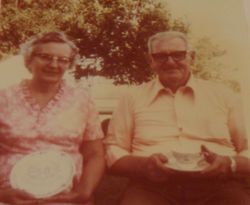
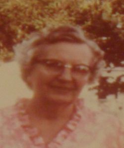
| Description | : | New Carlisle, IN – Paul Bennett Groshans, 88, of Miller's Merry Manor, died at 6 a.m. New Year's eve day in Memorial Hospital, South Bend. He was born Oct. 31, 1903, in North Judson, and lived in New Carlisle since 1945, coming from South Bend. Paul retired in 1965 from Bock Industries and was an elder of the Seventh Day Church of God. On June 10, 1923, in South Bend, he married Hazel Mae Blair. She survives with two daughters, Juanita (Paul) Williams and Darlene (Ben) Annable, both of New Carlisle; five grandchildren, Wayne, Sandy, Gregory, Denise, Nancy... Read More |
frequently asked questions (FAQ):
-
Where is Paul Bennett Groshans's memorial?
Paul Bennett Groshans's memorial is located at: All Saints Churchyard, Barlby, Selby District, England.
-
When did Paul Bennett Groshans death?
Paul Bennett Groshans death on 31 Dec 1991 in South Bend, St. Joseph County, Indiana, USA
-
Where are the coordinates of the Paul Bennett Groshans's memorial?
Latitude: 53.7987840
Longitude: -1.0415840
Family Members:
Parent
Spouse
Siblings
Children
Flowers:
Nearby Cemetories:
1. All Saints Churchyard
Barlby, Selby District, England
Coordinate: 53.7987840, -1.0415840
2. Selby Abbey
Selby, Selby District, England
Coordinate: 53.7840990, -1.0670270
3. Selby Cemetery
Selby, Selby District, England
Coordinate: 53.7766610, -1.0775960
4. St. Mary's Churchyard
Riccall, Selby District, England
Coordinate: 53.8330620, -1.0601630
5. St. Wilfrid's Parish Churchyard
Brayton, Selby District, England
Coordinate: 53.7718060, -1.0849010
6. All Saints Churchyard
Wistow, Selby District, England
Coordinate: 53.8134750, -1.1014755
7. St. Helen's Churchyard
Skipwith, Selby District, England
Coordinate: 53.8386300, -1.0022900
8. St Mary the Virgin Churchyard
Hemingbrough, Selby District, England
Coordinate: 53.7672100, -0.9796300
9. All Saints Churchyard
Cawood, Selby District, England
Coordinate: 53.8331970, -1.1235660
10. Rythergate Cemetery
Cawood, Selby District, England
Coordinate: 53.8356000, -1.1347700
11. St Helen Churchyard
Stillingfleet, Selby District, England
Coordinate: 53.8618710, -1.0994760
12. St. Helen's Churchyard
Barmby on the Marsh, East Riding of Yorkshire Unitary Authority, England
Coordinate: 53.7476490, -0.9549090
13. All Saints Churchyard
Bubwith, East Riding of Yorkshire Unitary Authority, England
Coordinate: 53.8170680, -0.9200130
14. All Saints Churchyard
Aughton, East Riding of Yorkshire Unitary Authority, England
Coordinate: 53.8393490, -0.9352200
15. Hambleton Cemetery
Hambleton, Selby District, England
Coordinate: 53.7715910, -1.1624600
16. St Mary Churchyard
Hambleton, Selby District, England
Coordinate: 53.7715910, -1.1624600
17. Drax Cemetery
Drax, Selby District, England
Coordinate: 53.7272540, -0.9875330
18. Barmby on the Marsh Parish Burial Ground
Barmby on the Marsh, East Riding of Yorkshire Unitary Authority, England
Coordinate: 53.7472990, -0.9401910
19. St Peter and St Paul Churchyard
Drax, Selby District, England
Coordinate: 53.7293790, -0.9771560
20. Friends Burial Ground
Drax, Selby District, England
Coordinate: 53.7291640, -0.9771490
21. St John Churchyard
Acaster Selby, Selby District, England
Coordinate: 53.8614750, -1.1283740
22. St Mary and St Lawrence Churchyard
Ellerton, East Riding of Yorkshire Unitary Authority, England
Coordinate: 53.8499000, -0.9347520
23. St. Helen's Churchyard
Escrick, Selby District, England
Coordinate: 53.8805200, -1.0460990
24. St John The Baptist Churchyard
Chapel Haddlesey, Selby District, England
Coordinate: 53.7279200, -1.1185700

