


Paul Richard “Dick” Sims
| Birth | : | 25 Apr 1928 Petersburg, Pike County, Indiana, USA |
| Death | : | 8 Oct 1998 Terre Haute, Vigo County, Indiana, USA |
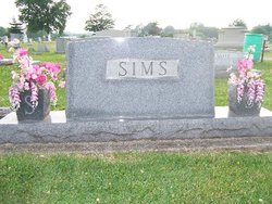
| Burial | : | Second English Presbyterian Church Cemetery, Amwell, Hunterdon County, USA |
| Coordinate | : | 40.3984718, -74.9072189 |
| Description | : | Son of Paul W. Sims and Cecil D. (Webb) Sims. Married to Betty Jane (Engle) Sims on September 17, 1946. Father of James Richard, Paula Jane, and Betsy Ann Sims. OBITUARY: Paul R. "Dick" Sims Paul R. "Dick" Sims, 70, Sullivan, died at 1:23 p.m. Thursday, Oct. 8, 1998, at Union Hospital, Terre Haute. He was born April 25, 1928, in Petersburg to Paul W. and Cecil D. Webb Sims. He was a retired construction superintendent for C.D.I. in Terre Haute, and a member of the First United Methodist Church. He was a U.S. Army veteran of World War II, a... Read More |
frequently asked questions (FAQ):
-
Where is Paul Richard “Dick” Sims's memorial?
Paul Richard “Dick” Sims's memorial is located at: Second English Presbyterian Church Cemetery, Amwell, Hunterdon County, USA.
-
When did Paul Richard “Dick” Sims death?
Paul Richard “Dick” Sims death on 8 Oct 1998 in Terre Haute, Vigo County, Indiana, USA
-
Where are the coordinates of the Paul Richard “Dick” Sims's memorial?
Latitude: 40.3984718
Longitude: -74.9072189
Family Members:
Parent

Spouse

Siblings

Children
Flowers:


Nearby Cemetories:
1. Second English Presbyterian Church Cemetery
Amwell, Hunterdon County, USA
Coordinate: 40.3984718, -74.9072189
2. Rocks Methodist Episcopal Cemetery
Mount Airy, Hunterdon County, USA
Coordinate: 40.3844986, -74.8835983
3. Winder Phillips Grave Yard
Mount Airy, Hunterdon County, USA
Coordinate: 40.3847222, -74.8833333
4. Barber Burying Ground
Sandy Ridge, Hunterdon County, USA
Coordinate: 40.4190292, -74.9282608
5. Rockefeller-Wikoff Burying Ground
Rocktown, Hunterdon County, USA
Coordinate: 40.3978424, -74.8675385
6. Stevenson Family Burying Ground
Mount Airy, Hunterdon County, USA
Coordinate: 40.3685188, -74.8912277
7. Union Cemetery
Ringoes, Hunterdon County, USA
Coordinate: 40.4261017, -74.8732986
8. Holcombe Riverview Cemetery
Lambertville, Hunterdon County, USA
Coordinate: 40.3828011, -74.9535980
9. Opdycke Cemetery
Hunterdon County, USA
Coordinate: 40.4375000, -74.9250000
10. First Presbyterian Church Cemetery
Lambertville, Hunterdon County, USA
Coordinate: 40.3667700, -74.9456300
11. Moore Family Burying Ground
Sergeantsville, Hunterdon County, USA
Coordinate: 40.4414400, -74.9008720
12. Sandy Ridge Cemetery
Sandy Ridge, Hunterdon County, USA
Coordinate: 40.4232178, -74.9541168
13. Mount Hope Cemetery
Lambertville, Hunterdon County, USA
Coordinate: 40.3630562, -74.9405594
14. Saint John the Evangelist Cemetery
Lambertville, Hunterdon County, USA
Coordinate: 40.3621100, -74.9412000
15. Servis-Quick Family Cemetery
Ringoes, Hunterdon County, USA
Coordinate: 40.4375000, -74.8722220
16. Saint Philips Episcopal Church Columbarium
New Hope, Bucks County, USA
Coordinate: 40.3783500, -74.9661800
17. Lower Amwell Cemetery - New Yard
Sergeantsville, Hunterdon County, USA
Coordinate: 40.4475098, -74.9133453
18. Saint Andrews Episcopal Churchyard
Ringoes, Hunterdon County, USA
Coordinate: 40.4406586, -74.8734360
19. Lower Amwell Cemetery - Old Yard
Sergeantsville, Hunterdon County, USA
Coordinate: 40.4479866, -74.9134750
20. Saint Martin of Tours Cemetery
New Hope, Bucks County, USA
Coordinate: 40.3614000, -74.9536000
21. New Hope Cemetery
New Hope, Bucks County, USA
Coordinate: 40.3552742, -74.9526825
22. Mount Moriah AME Church Cemetery
New Hope, Bucks County, USA
Coordinate: 40.3608900, -74.9619190
23. Amwell Ridge Cemetery
Ringoes, Hunterdon County, USA
Coordinate: 40.4415970, -74.8554840
24. Prallsville Cemetery
Hunterdon County, USA
Coordinate: 40.4090300, -74.9827760