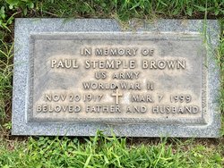
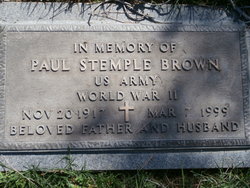
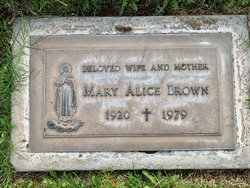
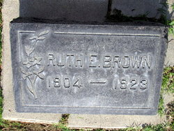
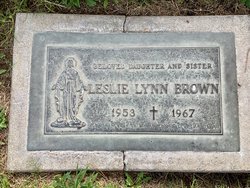
Paul Stemple Brown
| Birth | : | 20 Nov 1917 Fort Madison, Lee County, Iowa, USA |
| Death | : | 7 Mar 1999 Bakersfield, Kern County, California, USA |
| Burial | : | Hillcrest Memorial Park, Bakersfield, Kern County, USA |
| Coordinate | : | 35.3814316, -118.9012527 |
| Plot | : | Holy Cross Lawns Lot 608 Sp 3 |
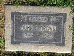
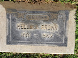
| Description | : | Paul Stemple Brown was born Nov. 20, 1917 to John and Nell Brown in Fort Madison, Iowa. His family moved from Iowa to Kern County, California in 1924, operating the first general store in the town of Tupman, CA. From here the family moved to Taft, CA. where Paul met and married Phyllis Rockholt, and to this union one daughter, Nicola Rae Brown -(Zwaschka) was born. Paul was a Second Lieutenant with the United States Army and was the first civilian assigned as a navigation instructor at Gardner Field, CA. during WWII. Paul and Phyllis divorced and he... Read More |
frequently asked questions (FAQ):
-
Where is Paul Stemple Brown's memorial?
Paul Stemple Brown's memorial is located at: Hillcrest Memorial Park, Bakersfield, Kern County, USA.
-
When did Paul Stemple Brown death?
Paul Stemple Brown death on 7 Mar 1999 in Bakersfield, Kern County, California, USA
-
Where are the coordinates of the Paul Stemple Brown's memorial?
Latitude: 35.3814316
Longitude: -118.9012527
Family Members:
Parent
Spouse
Siblings
Children
Flowers:
Nearby Cemetories:
1. Hillcrest Memorial Park
Bakersfield, Kern County, USA
Coordinate: 35.3814316, -118.9012527
2. Kuntz Ranch Cemetery
Bakersfield, Kern County, USA
Coordinate: 35.4373560, -118.9390180
3. Greenlawn Cemetery and Mortuary
Bakersfield, Kern County, USA
Coordinate: 35.4067001, -118.9856033
4. Union Cemetery
Bakersfield, Kern County, USA
Coordinate: 35.3646500, -118.9948700
5. Home of Peace Jewish Cemetery
Bakersfield, Kern County, USA
Coordinate: 35.3631500, -118.9987400
6. Saint Pauls Episcopal Church Columbarium
Bakersfield, Kern County, USA
Coordinate: 35.3746120, -119.0277940
7. Chinese Cemetery
Bakersfield, Kern County, USA
Coordinate: 35.3510550, -119.0273380
8. Greenlawn Southwest Mortuary and Cemetery
Bakersfield, Kern County, USA
Coordinate: 35.2948990, -119.0330810
9. Arvin Cemetery
Arvin, Kern County, USA
Coordinate: 35.2132300, -118.8952700
10. Long Tom Mine Cemetery
Woody, Kern County, USA
Coordinate: 35.5495600, -118.8308700
11. Bakersfield National Cemetery
Arvin, Kern County, USA
Coordinate: 35.2559600, -118.6693480
12. Engle Family Cemetery
Bakersfield, Kern County, USA
Coordinate: 35.6392060, -118.9231180
13. Shafter Memorial Park
Shafter, Kern County, USA
Coordinate: 35.4728012, -119.2341995
14. Rankin Cemetery
Walker Basin, Kern County, USA
Coordinate: 35.3844560, -118.5388890
15. Fickert Family Cemetery
Bear Valley Springs, Kern County, USA
Coordinate: 35.1697260, -118.6443350
16. Cesar E. Chavez National Monument
Keene, Kern County, USA
Coordinate: 35.2236000, -118.5592400
17. Weringer Cemetery
Woody, Kern County, USA
Coordinate: 35.7062100, -118.8320800
18. Blue Mountain Cemetery
Woody, Kern County, USA
Coordinate: 35.7065500, -118.8322400
19. Saint Joseph Cemetery
Havilah, Kern County, USA
Coordinate: 35.5147500, -118.5177700
20. Williams Burial Site
Walker Basin, Kern County, USA
Coordinate: 35.4320950, -118.4815680
21. Pomfret Memorial Cemetery
Famoso, Kern County, USA
Coordinate: 35.6313580, -119.2064460
22. Tehachapi Cove Cemetery
Tehachapi, Kern County, USA
Coordinate: 35.1190000, -118.5724600
23. Paris-Loraine Cemetery
Loraine, Kern County, USA
Coordinate: 35.3059000, -118.4355000
24. Oak Grove Cemetery
Glennville, Kern County, USA
Coordinate: 35.7414017, -118.7157974

