Pauline Caroline Poush Craig
| Birth | : | 24 Dec 1863 Iowa, USA |
| Death | : | 3 Sep 1917 Davis City, Decatur County, Iowa, USA |
| Burial | : | St. Peter and St. Paul's Churchyard, Edgefield, North Norfolk District, England |
| Coordinate | : | 52.8645320, 1.1089840 |
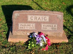
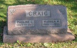
| Description | : | Wife of William "Warren" Craig (1861-1940); mother of Frank L. Craig and Sarah Lillian (Craig) Clark Leon Reporter,Leon, Decatur County, Iowa, September 20, 1917 MRS. W. W. CRAIG Pauline Catherine Poush was born in Harrison county, MO., Dec. 25, 1862 [24 Dec 1863, per gravestone], passed from this life Sept. 3, 1917, aged 54 years 8 months and 9 days. She was united in marriage to Warren William Craig on July 4, 1884. To this union were born two children, Frank L. and Boyd E. She has lived in her present home during her married life with the exception of the... Read More |
frequently asked questions (FAQ):
-
Where is Pauline Caroline Poush Craig's memorial?
Pauline Caroline Poush Craig's memorial is located at: St. Peter and St. Paul's Churchyard, Edgefield, North Norfolk District, England.
-
When did Pauline Caroline Poush Craig death?
Pauline Caroline Poush Craig death on 3 Sep 1917 in Davis City, Decatur County, Iowa, USA
-
Where are the coordinates of the Pauline Caroline Poush Craig's memorial?
Latitude: 52.8645320
Longitude: 1.1089840
Family Members:
Parent
Spouse
Siblings
Children
Flowers:
Nearby Cemetories:
1. St. Peter and St. Paul's Churchyard
Edgefield, North Norfolk District, England
Coordinate: 52.8645320, 1.1089840
2. Edgefield Old Churchyard
Edgefield, North Norfolk District, England
Coordinate: 52.8687300, 1.1001800
3. St Andrew Churchyard
Hempstead, North Norfolk District, England
Coordinate: 52.8895750, 1.1270070
4. All Saints Churchyard
Hempstead, North Norfolk District, England
Coordinate: 52.8895200, 1.1274620
5. St Lawrence Churchyard
Hunworth, North Norfolk District, England
Coordinate: 52.8772530, 1.0673080
6. All Saints Churchyard
Briston, North Norfolk District, England
Coordinate: 52.8511120, 1.0617870
7. St. Michael's Churchyard
Plumstead, North Norfolk District, England
Coordinate: 52.8691700, 1.1669320
8. Saint Mary's Churchyard
Baconsthorpe, North Norfolk District, England
Coordinate: 52.8872500, 1.1606900
9. St. Andrew's Churchyard
Saxthorpe, North Norfolk District, England
Coordinate: 52.8299250, 1.1398600
10. Saint Andrew the Apostle
Holt, North Norfolk District, England
Coordinate: 52.9063400, 1.0933500
11. St. Andrew’s Churchyard
Little Barningham, North Norfolk District, England
Coordinate: 52.8547270, 1.1795150
12. Methodist Memorial Gardens
Holt, North Norfolk District, England
Coordinate: 52.9067730, 1.0878360
13. St Mary Churchyard Burgh Parva
Melton Constable, North Norfolk District, England
Coordinate: 52.8605700, 1.0337300
14. St. Peter's Churchyard
Corpusty, North Norfolk District, England
Coordinate: 52.8207280, 1.1371910
15. St Mary's Church
Mannington, North Norfolk District, England
Coordinate: 52.8418580, 1.1786460
16. St. Mary's Churchyard
Barningham, North Norfolk District, England
Coordinate: 52.8757410, 1.1882470
17. Holt Town Cemetery
Holt, North Norfolk District, England
Coordinate: 52.9117900, 1.0850400
18. St Maurice Churchyard
Briningham, North Norfolk District, England
Coordinate: 52.8682680, 1.0271340
19. All Saints Churchyard
Bodham, North Norfolk District, England
Coordinate: 52.9057700, 1.1596200
20. St. Andrew's Churchyard
Brinton, North Norfolk District, England
Coordinate: 52.8803690, 1.0274610
21. St. Peter's Churchyard
Matlaske, North Norfolk District, England
Coordinate: 52.8683511, 1.1946365
22. St. Andrews Churchyard
Letheringsett, North Norfolk District, England
Coordinate: 52.9081600, 1.0623490
23. St Peter's Churchyard
Melton Constable, North Norfolk District, England
Coordinate: 52.8462900, 1.0247300
24. St Mary Churchyard
Itteringham, North Norfolk District, England
Coordinate: 52.8334650, 1.1826370


