
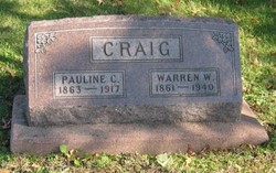
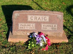
William Warren Craig
| Birth | : | 21 Jun 1861 Decatur County, Iowa, USA |
| Death | : | 3 Nov 1940 Davis City, Decatur County, Iowa, USA |
| Burial | : | St. Peter and St. Paul's Churchyard, Edgefield, North Norfolk District, England |
| Coordinate | : | 52.8645320, 1.1089840 |
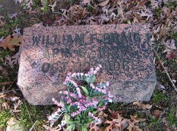
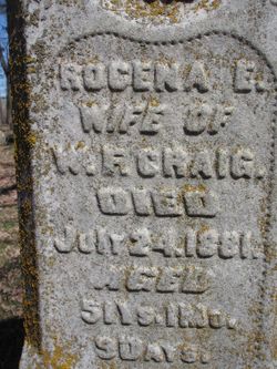
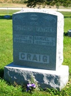
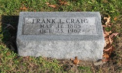
| Description | : | William went by his middle name "Warren." Son of William Filander Craig (1827-1906) and Rocena (Patterson) Craig (1830-1881) both interred at Old Davis City Cemetery; husband of Paulina C. Poush (1863-1917); father of Frank L. Craig and Sarah Lillian (Craig) Clark. |
frequently asked questions (FAQ):
-
Where is William Warren Craig's memorial?
William Warren Craig's memorial is located at: St. Peter and St. Paul's Churchyard, Edgefield, North Norfolk District, England.
-
When did William Warren Craig death?
William Warren Craig death on 3 Nov 1940 in Davis City, Decatur County, Iowa, USA
-
Where are the coordinates of the William Warren Craig's memorial?
Latitude: 52.8645320
Longitude: 1.1089840
Family Members:
Parent
Spouse
Siblings

Children
Flowers:


Nearby Cemetories:
1. St. Peter and St. Paul's Churchyard
Edgefield, North Norfolk District, England
Coordinate: 52.8645320, 1.1089840
2. Edgefield Old Churchyard
Edgefield, North Norfolk District, England
Coordinate: 52.8687300, 1.1001800
3. St Andrew Churchyard
Hempstead, North Norfolk District, England
Coordinate: 52.8895750, 1.1270070
4. All Saints Churchyard
Hempstead, North Norfolk District, England
Coordinate: 52.8895200, 1.1274620
5. St Lawrence Churchyard
Hunworth, North Norfolk District, England
Coordinate: 52.8772530, 1.0673080
6. All Saints Churchyard
Briston, North Norfolk District, England
Coordinate: 52.8511120, 1.0617870
7. St. Michael's Churchyard
Plumstead, North Norfolk District, England
Coordinate: 52.8691700, 1.1669320
8. Saint Mary's Churchyard
Baconsthorpe, North Norfolk District, England
Coordinate: 52.8872500, 1.1606900
9. St. Andrew's Churchyard
Saxthorpe, North Norfolk District, England
Coordinate: 52.8299250, 1.1398600
10. Saint Andrew the Apostle
Holt, North Norfolk District, England
Coordinate: 52.9063400, 1.0933500
11. St. Andrew’s Churchyard
Little Barningham, North Norfolk District, England
Coordinate: 52.8547270, 1.1795150
12. Methodist Memorial Gardens
Holt, North Norfolk District, England
Coordinate: 52.9067730, 1.0878360
13. St Mary Churchyard Burgh Parva
Melton Constable, North Norfolk District, England
Coordinate: 52.8605700, 1.0337300
14. St. Peter's Churchyard
Corpusty, North Norfolk District, England
Coordinate: 52.8207280, 1.1371910
15. St Mary's Church
Mannington, North Norfolk District, England
Coordinate: 52.8418580, 1.1786460
16. St. Mary's Churchyard
Barningham, North Norfolk District, England
Coordinate: 52.8757410, 1.1882470
17. Holt Town Cemetery
Holt, North Norfolk District, England
Coordinate: 52.9117900, 1.0850400
18. St Maurice Churchyard
Briningham, North Norfolk District, England
Coordinate: 52.8682680, 1.0271340
19. All Saints Churchyard
Bodham, North Norfolk District, England
Coordinate: 52.9057700, 1.1596200
20. St. Andrew's Churchyard
Brinton, North Norfolk District, England
Coordinate: 52.8803690, 1.0274610
21. St. Peter's Churchyard
Matlaske, North Norfolk District, England
Coordinate: 52.8683511, 1.1946365
22. St. Andrews Churchyard
Letheringsett, North Norfolk District, England
Coordinate: 52.9081600, 1.0623490
23. St Peter's Churchyard
Melton Constable, North Norfolk District, England
Coordinate: 52.8462900, 1.0247300
24. St Mary Churchyard
Itteringham, North Norfolk District, England
Coordinate: 52.8334650, 1.1826370