

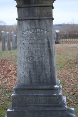
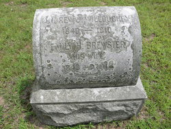
Phebe Howard Carey Willoughby
| Birth | : | 17 Dec 1805 Canterbury, Windham County, Connecticut, USA |
| Death | : | 6 Jul 1891 Canterbury, Windham County, Connecticut, USA |
| Burial | : | St Martin Churchyard, Womersley, Selby District, England |
| Coordinate | : | 53.6646000, -1.1959000 |
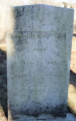
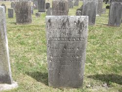
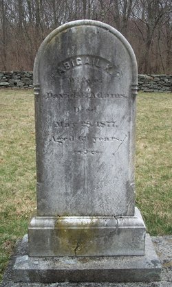
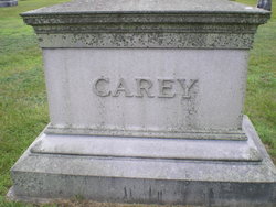
| Description | : | Phebe Howard [Cary]Willoughby was born 17 Dec 1805 in Canterbury. She is the daughter of James Cary and Phebe Howard. She married William Frederick Willoughby 15 Oct 1827 in Windham Co., CT. Phebe died 6 Jul 1891 in Canterbury. She is my direct ancestor through the Cary family. - BevsMom |
frequently asked questions (FAQ):
-
Where is Phebe Howard Carey Willoughby's memorial?
Phebe Howard Carey Willoughby's memorial is located at: St Martin Churchyard, Womersley, Selby District, England.
-
When did Phebe Howard Carey Willoughby death?
Phebe Howard Carey Willoughby death on 6 Jul 1891 in Canterbury, Windham County, Connecticut, USA
-
Where are the coordinates of the Phebe Howard Carey Willoughby's memorial?
Latitude: 53.6646000
Longitude: -1.1959000
Family Members:
Parent
Spouse
Siblings
Children

Flowers:


Nearby Cemetories:
1. St Martin Churchyard
Womersley, Selby District, England
Coordinate: 53.6646000, -1.1959000
2. Womersley Cemetery
Womersley, Selby District, England
Coordinate: 53.6655100, -1.1967300
3. St Peter Churchyard
Kirk Smeaton, Selby District, England
Coordinate: 53.6436580, -1.2148560
4. St John the Evangelist Churchyard
Wentbridge, Metropolitan Borough of Wakefield, England
Coordinate: 53.6507600, -1.2591930
5. Campsall Old Cemetery
Campsall, Metropolitan Borough of Doncaster, England
Coordinate: 53.6241000, -1.1801000
6. Campsall New Cemetery
Campsall, Metropolitan Borough of Doncaster, England
Coordinate: 53.6239500, -1.1804250
7. St. Luke and All Saints Churchyard
Darrington, Metropolitan Borough of Wakefield, England
Coordinate: 53.6756540, -1.2673490
8. Knottingley Cemetery
Knottingley, Metropolitan Borough of Wakefield, England
Coordinate: 53.7018600, -1.2363390
9. St. Mary Magdalene Churchyard
Campsall, Metropolitan Borough of Doncaster, England
Coordinate: 53.6203680, -1.1779620
10. Askern Cemetery
Askern, Metropolitan Borough of Doncaster, England
Coordinate: 53.6187830, -1.1637670
11. St. Edmund's Churchyard
Kellington, Selby District, England
Coordinate: 53.7142600, -1.1710500
12. Ropewalk Methodist Church Burial Ground
Knottingley, Metropolitan Borough of Wakefield, England
Coordinate: 53.7092850, -1.2408320
13. United Reformed Churchyard
Knottingley, Metropolitan Borough of Wakefield, England
Coordinate: 53.7104820, -1.2397270
14. St. Peter's Churchyard
Askern, Metropolitan Borough of Doncaster, England
Coordinate: 53.6169240, -1.1524250
15. St. Botolph Churchyard
Knottingley, Metropolitan Borough of Wakefield, England
Coordinate: 53.7108080, -1.2441680
16. St Paul Churchyard
Hensall, Selby District, England
Coordinate: 53.6967500, -1.1185900
17. St Michael the Archangel Churchyard
Carleton, Metropolitan Borough of Wakefield, England
Coordinate: 53.6762860, -1.2934180
18. St Michael the Archangel Church Cemetery
Carleton, Metropolitan Borough of Wakefield, England
Coordinate: 53.6740180, -1.2951080
19. St Stephen Churchyard
East Hardwick, Metropolitan Borough of Wakefield, England
Coordinate: 53.6617000, -1.3005910
20. St. Helen's Churchyard
Burghwallis, Metropolitan Borough of Doncaster, England
Coordinate: 53.6020620, -1.1899730
21. St. John's Churchyard
Fenwick, Metropolitan Borough of Doncaster, England
Coordinate: 53.6284191, -1.1091576
22. St. Michael's Churchyard
Skelbrooke, Metropolitan Borough of Doncaster, England
Coordinate: 53.6029400, -1.2293000
23. Sacred Heart of Jesus Roman Catholic Chapel
Ackworth, Metropolitan Borough of Wakefield, England
Coordinate: 53.6516190, -1.3063760
24. Ferrybridge Cemetery
Ferrybridge, Metropolitan Borough of Wakefield, England
Coordinate: 53.7102530, -1.2795200