
| Memorials | : | 0 |
| Location | : | Knottingley, Metropolitan Borough of Wakefield, England |
| Coordinate | : | 53.7104820, -1.2397270 |
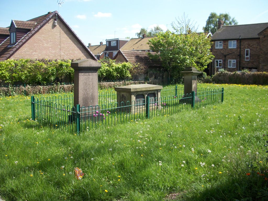
| Description | : | These memorials were mapped and transcribed in the 1980s by Ron Gosney. When they were photographed in 2014 they were overgrown and a metal railing had been placed in front of them, hence the odd photograph angles. |
frequently asked questions (FAQ):
-
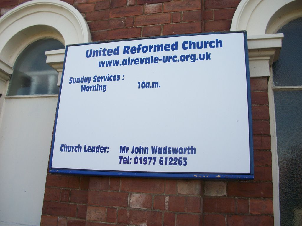
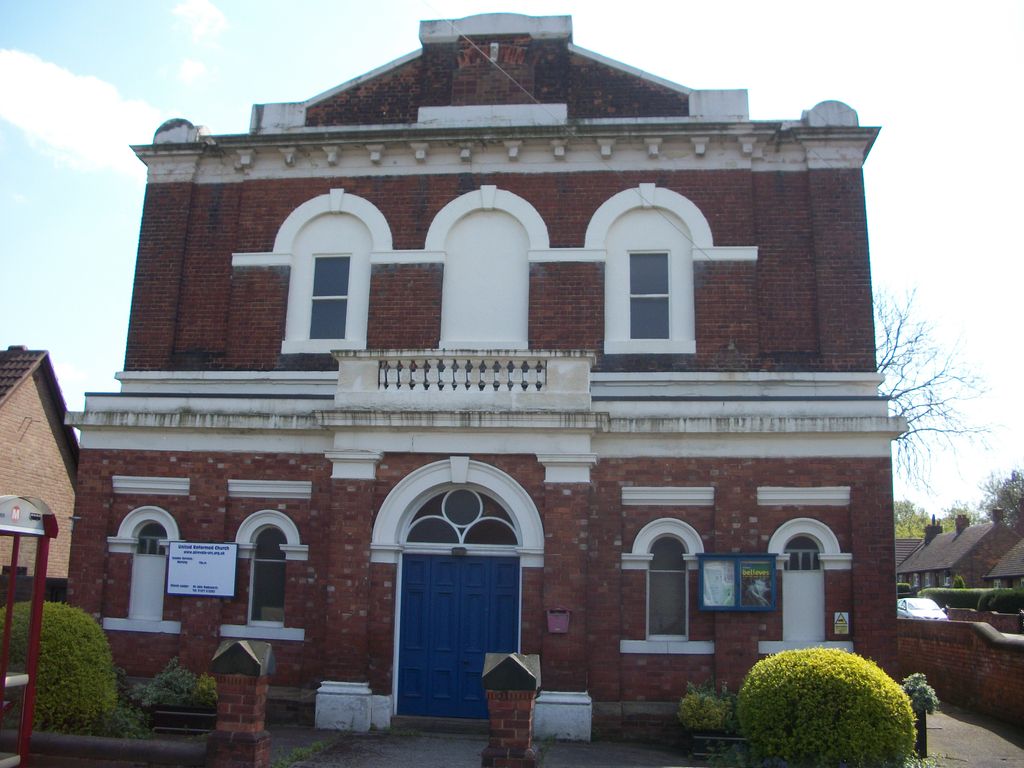
Where is United Reformed Churchyard?
United Reformed Churchyard is located at Willow Road Knottingley, Metropolitan Borough of Wakefield ,West Yorkshire , WF11 9BWEngland.
-
United Reformed Churchyard cemetery's updated grave count on graveviews.com?
0 memorials
-
Where are the coordinates of the United Reformed Churchyard?
Latitude: 53.7104820
Longitude: -1.2397270
Nearby Cemetories:
1. Ropewalk Methodist Church Burial Ground
Knottingley, Metropolitan Borough of Wakefield, England
Coordinate: 53.7092850, -1.2408320
2. St. Botolph Churchyard
Knottingley, Metropolitan Borough of Wakefield, England
Coordinate: 53.7108080, -1.2441680
3. Knottingley Cemetery
Knottingley, Metropolitan Borough of Wakefield, England
Coordinate: 53.7018600, -1.2363390
4. St. Andrew's Old Churchyard
Ferrybridge, Metropolitan Borough of Wakefield, England
Coordinate: 53.7193380, -1.2748540
5. Ferrybridge Cemetery
Ferrybridge, Metropolitan Borough of Wakefield, England
Coordinate: 53.7102530, -1.2795200
6. St Edward the Confessor Churchyard
Brotherton, Selby District, England
Coordinate: 53.7259200, -1.2709600
7. Brotherton United Reformed Church
Brotherton, Selby District, England
Coordinate: 53.7277104, -1.2698131
8. St Mary Churchyard
Birkin, Selby District, England
Coordinate: 53.7325000, -1.1979000
9. St John's Priory of Pontefract
Pontefract, Metropolitan Borough of Wakefield, England
Coordinate: 53.6978050, -1.2987420
10. St. Luke and All Saints Churchyard
Darrington, Metropolitan Borough of Wakefield, England
Coordinate: 53.6756540, -1.2673490
11. All Saints Churchyard
Pontefract, Metropolitan Borough of Wakefield, England
Coordinate: 53.6960100, -1.3010400
12. St. Edmund's Churchyard
Kellington, Selby District, England
Coordinate: 53.7142600, -1.1710500
13. St James Churchyard
Fairburn, Selby District, England
Coordinate: 53.7426700, -1.2841000
14. Friends Burial Ground
Pontefract, Metropolitan Borough of Wakefield, England
Coordinate: 53.6924940, -1.3061380
15. Pontefract Cemetery
Pontefract, Metropolitan Borough of Wakefield, England
Coordinate: 53.6945160, -1.3108810
16. St Michael the Archangel Churchyard
Carleton, Metropolitan Borough of Wakefield, England
Coordinate: 53.6762860, -1.2934180
17. St Giles with St Mary Church
Pontefract, Metropolitan Borough of Wakefield, England
Coordinate: 53.6915100, -1.3118300
18. St Michael the Archangel Church Cemetery
Carleton, Metropolitan Borough of Wakefield, England
Coordinate: 53.6740180, -1.2951080
19. Black Friars Pontefract
Pontefract, Metropolitan Borough of Wakefield, England
Coordinate: 53.6876090, -1.3152690
20. Monk Fryston Cemetery
Monk Fryston, Selby District, England
Coordinate: 53.7604400, -1.2291700
21. St. Peter's Churchyard
Fryston, Metropolitan Borough of Wakefield, England
Coordinate: 53.7355400, -1.3151100
22. St Wilfrid’s Churchyard
Monk Fryston, Selby District, England
Coordinate: 53.7618300, -1.2349700
23. Womersley Cemetery
Womersley, Selby District, England
Coordinate: 53.6655100, -1.1967300
24. St Martin Churchyard
Womersley, Selby District, England
Coordinate: 53.6646000, -1.1959000