
| Memorials | : | 443 |
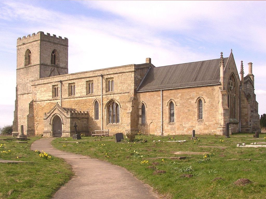
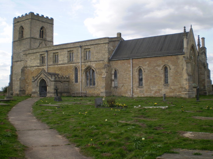
| Location | : | Kellington, Selby District, England |
| Coordinate | : | 53.7142600, -1.1710500 |
frequently asked questions (FAQ):
-
Where is St. Edmund's Churchyard?
St. Edmund's Churchyard is located at Kellington, Selby District ,North Yorkshire ,England.
-
St. Edmund's Churchyard cemetery's updated grave count on graveviews.com?
443 memorials
-
Where are the coordinates of the St. Edmund's Churchyard?
Latitude: 53.7142600
Longitude: -1.1710500
Nearby Cemetories:
1. St Mary Churchyard
Birkin, Selby District, England
Coordinate: 53.7325000, -1.1979000
2. St John The Baptist Churchyard
Chapel Haddlesey, Selby District, England
Coordinate: 53.7279200, -1.1185700
3. St Paul Churchyard
Hensall, Selby District, England
Coordinate: 53.6967500, -1.1185900
4. Knottingley Cemetery
Knottingley, Metropolitan Borough of Wakefield, England
Coordinate: 53.7018600, -1.2363390
5. United Reformed Churchyard
Knottingley, Metropolitan Borough of Wakefield, England
Coordinate: 53.7104820, -1.2397270
6. Ropewalk Methodist Church Burial Ground
Knottingley, Metropolitan Borough of Wakefield, England
Coordinate: 53.7092850, -1.2408320
7. St. Botolph Churchyard
Knottingley, Metropolitan Borough of Wakefield, England
Coordinate: 53.7108080, -1.2441680
8. Womersley Cemetery
Womersley, Selby District, England
Coordinate: 53.6655100, -1.1967300
9. St Martin Churchyard
Womersley, Selby District, England
Coordinate: 53.6646000, -1.1959000
10. Hambleton Cemetery
Hambleton, Selby District, England
Coordinate: 53.7715910, -1.1624600
11. St Mary Churchyard
Hambleton, Selby District, England
Coordinate: 53.7715910, -1.1624600
12. Monk Fryston Cemetery
Monk Fryston, Selby District, England
Coordinate: 53.7604400, -1.2291700
13. Brotherton United Reformed Church
Brotherton, Selby District, England
Coordinate: 53.7277104, -1.2698131
14. St Edward the Confessor Churchyard
Brotherton, Selby District, England
Coordinate: 53.7259200, -1.2709600
15. St Wilfrid’s Churchyard
Monk Fryston, Selby District, England
Coordinate: 53.7618300, -1.2349700
16. St. Andrew's Old Churchyard
Ferrybridge, Metropolitan Borough of Wakefield, England
Coordinate: 53.7193380, -1.2748540
17. Ferrybridge Cemetery
Ferrybridge, Metropolitan Borough of Wakefield, England
Coordinate: 53.7102530, -1.2795200
18. St. Luke and All Saints Churchyard
Darrington, Metropolitan Borough of Wakefield, England
Coordinate: 53.6756540, -1.2673490
19. St James Churchyard
Fairburn, Selby District, England
Coordinate: 53.7426700, -1.2841000
20. St Peter Churchyard
Kirk Smeaton, Selby District, England
Coordinate: 53.6436580, -1.2148560
21. St. Wilfrid's Parish Churchyard
Brayton, Selby District, England
Coordinate: 53.7718060, -1.0849010
22. St John's Priory of Pontefract
Pontefract, Metropolitan Borough of Wakefield, England
Coordinate: 53.6978050, -1.2987420
23. All Saints Churchyard
Pontefract, Metropolitan Borough of Wakefield, England
Coordinate: 53.6960100, -1.3010400
24. St Mary the Virgin Churchyard
South Milford, Selby District, England
Coordinate: 53.7771700, -1.2547300