
| Birth | : | 28 Mar 1844 Ohio, USA |
| Death | : | 22 Jun 1890 Clyde, Cloud County, Kansas, USA |
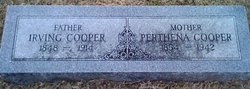
| Burial | : | Cedar Grove Cemetery, Clyde, Cloud County, USA |
| Coordinate | : | 39.5494003, -97.4056015 |
| Description | : | George Patterson Moore is the son of Benjamin B. Moore and Sarah (Randol) Moore. He served in the Civil War on the Union side. He Enlisted in Company G, Iowa 8th Infantry Regiment on 19 April 1864. George participated in the siege of Vicksburg, and the battles of Champion Hill, Jackson, Miss., Raymond, Lookout Mountain, and Port Gibson (according to his obituary). He was also with Sherman on his march to the sea. He mustered out on 20 April 1866 at Selma, AL. George was an active member of the Cornforth Grand Army of... Read More |
frequently asked questions (FAQ):
-
Where is Pvt George Patterson Moore's memorial?
Pvt George Patterson Moore's memorial is located at: Cedar Grove Cemetery, Clyde, Cloud County, USA.
-
When did Pvt George Patterson Moore death?
Pvt George Patterson Moore death on 22 Jun 1890 in Clyde, Cloud County, Kansas, USA
-
Where are the coordinates of the Pvt George Patterson Moore's memorial?
Latitude: 39.5494003
Longitude: -97.4056015
Family Members:
Parent

Spouse
Siblings
Children
Flowers:


Nearby Cemetories:
1. Cedar Grove Cemetery
Clyde, Cloud County, USA
Coordinate: 39.5494003, -97.4056015
2. Pleasant View Cemetery
Ames, Cloud County, USA
Coordinate: 39.5346985, -97.4431000
3. Saint Joseph Cemetery
Saint Joseph, Cloud County, USA
Coordinate: 39.5074941, -97.4022328
4. Mount Calvary Cemetery
Clyde, Cloud County, USA
Coordinate: 39.5917015, -97.4143982
5. Mount Hope Cemetery
Clyde, Cloud County, USA
Coordinate: 39.5969009, -97.4116974
6. Walnut Grove Cemetery
Cloud County, USA
Coordinate: 39.5699997, -97.4993973
7. Green Mound Cemetery
Rice, Cloud County, USA
Coordinate: 39.5248450, -97.5081630
8. Riverdale Cemetery
Clay County, USA
Coordinate: 39.5106010, -97.2930984
9. Iwacura Cemetery
Morganville, Clay County, USA
Coordinate: 39.4550000, -97.3510000
10. Nelson Cemetery
Rice, Cloud County, USA
Coordinate: 39.5257988, -97.5410995
11. French Presbyterian Church Cemetery
Cloud County, USA
Coordinate: 39.4395200, -97.4148290
12. Princeville Cemetery
Aurora, Cloud County, USA
Coordinate: 39.4672012, -97.5010986
13. Saint Peters Cemetery
Aurora, Cloud County, USA
Coordinate: 39.4763985, -97.5180969
14. Rice Cemetery
Rice, Cloud County, USA
Coordinate: 39.5614014, -97.5552979
15. Agenda Cemetery
Agenda, Republic County, USA
Coordinate: 39.6761017, -97.4336014
16. Hollis Cemetery
Cloud County, USA
Coordinate: 39.6383018, -97.5361023
17. Bloom Cemetery
Morganville, Clay County, USA
Coordinate: 39.4519005, -97.2778015
18. Sherman Cemetery
Morganville, Clay County, USA
Coordinate: 39.5316300, -97.2243700
19. Beck Family Cemetery
Agenda, Republic County, USA
Coordinate: 39.6818000, -97.4863000
20. Lincoln Cemetery
Clay Center, Clay County, USA
Coordinate: 39.4230995, -97.2930984
21. Sulphur Springs Cemetery
Aurora, Cloud County, USA
Coordinate: 39.4086610, -97.4986840
22. Gotland Cemetery
Sibley Township, Cloud County, USA
Coordinate: 39.6091995, -97.6125031
23. Pleasant Hill Cemetery
Huscher, Cloud County, USA
Coordinate: 39.5093994, -97.6292038
24. Norwegian Lutheran Cemetery
Clay Center, Clay County, USA
Coordinate: 39.5027900, -97.1828200