
| Birth | : | Apr 1824 Ashtabula County, Ohio, USA |
| Death | : | 13 Jan 1898 Belleville, Republic County, Kansas, USA |
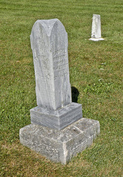
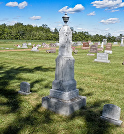
| Burial | : | Cedar Grove Cemetery, Clyde, Cloud County, USA |
| Coordinate | : | 39.5494003, -97.4056015 |
| Description | : | Sarah (Randol) Moore was born to Samuel Randol and Abigail (Lewis) Randol in Ashtabula County, Ohio in 1824. Sarah's parents moved to Hardin County, Ohio in 1840 where she met Benjamin B. Moore. She married Benjamin B. Moore on 17 November 1842 in Hardin County, Ohio. She was the mother of 13 children (children number 11 and 12 were twins). Sarah and Benjamin had the following 13 children: 1. Mary Elizabeth Moore 2. George Patterson Moore 3. Alonzo Montgomery Moore 4. John Robison Moore 5. Benjamin Curtis Moore 6. ... Read More |
frequently asked questions (FAQ):
-
Where is Sarah Randol Moore's memorial?
Sarah Randol Moore's memorial is located at: Cedar Grove Cemetery, Clyde, Cloud County, USA.
-
When did Sarah Randol Moore death?
Sarah Randol Moore death on 13 Jan 1898 in Belleville, Republic County, Kansas, USA
-
Where are the coordinates of the Sarah Randol Moore's memorial?
Latitude: 39.5494003
Longitude: -97.4056015
Family Members:
Parent
Spouse

Siblings
Children
Flowers:


Nearby Cemetories:
1. Cedar Grove Cemetery
Clyde, Cloud County, USA
Coordinate: 39.5494003, -97.4056015
2. Pleasant View Cemetery
Ames, Cloud County, USA
Coordinate: 39.5346985, -97.4431000
3. Saint Joseph Cemetery
Saint Joseph, Cloud County, USA
Coordinate: 39.5074941, -97.4022328
4. Mount Calvary Cemetery
Clyde, Cloud County, USA
Coordinate: 39.5917015, -97.4143982
5. Mount Hope Cemetery
Clyde, Cloud County, USA
Coordinate: 39.5969009, -97.4116974
6. Walnut Grove Cemetery
Cloud County, USA
Coordinate: 39.5699997, -97.4993973
7. Green Mound Cemetery
Rice, Cloud County, USA
Coordinate: 39.5248450, -97.5081630
8. Riverdale Cemetery
Clay County, USA
Coordinate: 39.5106010, -97.2930984
9. Iwacura Cemetery
Morganville, Clay County, USA
Coordinate: 39.4550000, -97.3510000
10. Nelson Cemetery
Rice, Cloud County, USA
Coordinate: 39.5257988, -97.5410995
11. French Presbyterian Church Cemetery
Cloud County, USA
Coordinate: 39.4395200, -97.4148290
12. Princeville Cemetery
Aurora, Cloud County, USA
Coordinate: 39.4672012, -97.5010986
13. Saint Peters Cemetery
Aurora, Cloud County, USA
Coordinate: 39.4763985, -97.5180969
14. Rice Cemetery
Rice, Cloud County, USA
Coordinate: 39.5614014, -97.5552979
15. Agenda Cemetery
Agenda, Republic County, USA
Coordinate: 39.6761017, -97.4336014
16. Hollis Cemetery
Cloud County, USA
Coordinate: 39.6383018, -97.5361023
17. Bloom Cemetery
Morganville, Clay County, USA
Coordinate: 39.4519005, -97.2778015
18. Sherman Cemetery
Morganville, Clay County, USA
Coordinate: 39.5316300, -97.2243700
19. Beck Family Cemetery
Agenda, Republic County, USA
Coordinate: 39.6818000, -97.4863000
20. Lincoln Cemetery
Clay Center, Clay County, USA
Coordinate: 39.4230995, -97.2930984
21. Sulphur Springs Cemetery
Aurora, Cloud County, USA
Coordinate: 39.4086610, -97.4986840
22. Gotland Cemetery
Sibley Township, Cloud County, USA
Coordinate: 39.6091995, -97.6125031
23. Pleasant Hill Cemetery
Huscher, Cloud County, USA
Coordinate: 39.5093994, -97.6292038
24. Norwegian Lutheran Cemetery
Clay Center, Clay County, USA
Coordinate: 39.5027900, -97.1828200