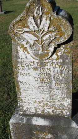
Pvt Jesse Edwin Zachry II
| Birth | : | 20 Aug 1845 Macon County, Alabama, USA |
| Death | : | 27 Nov 1908 Sevier County, Arkansas, USA |
| Burial | : | Dean Road and Manor Road Cemetery, Scarborough, Scarborough Borough, England |
| Coordinate | : | 54.2843690, -0.4184140 |
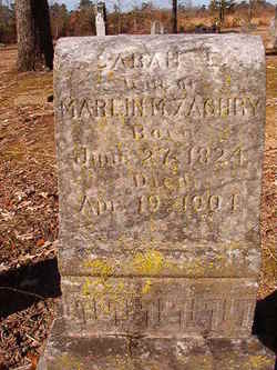
| Description | : | Private Captain CK Holman's Company Pettus' Battalion Arkansas State Troops Confederate States Army Son of Marlin Marion Zachry and Sarah Elizabeth Lyons. Jesse Edwin Zachry, II, was born Aug. 20, 1845, near Notasulga, Macon County, Alabama. He moved to Arkansas in 1859. He was enlisted in the Confederate Army in 1863 and served until the end of the War. He married Samantha Ann Sophronia Johns of Sevier County, Arkansas, about 1872. He was a devoted Christian, belonging to the Methodist church, which he joined at an early date and served consistently during the balance of his life. Jesse Edwin Zachry,... Read More |
frequently asked questions (FAQ):
-
Where is Pvt Jesse Edwin Zachry II's memorial?
Pvt Jesse Edwin Zachry II's memorial is located at: Dean Road and Manor Road Cemetery, Scarborough, Scarborough Borough, England.
-
When did Pvt Jesse Edwin Zachry II death?
Pvt Jesse Edwin Zachry II death on 27 Nov 1908 in Sevier County, Arkansas, USA
-
Where are the coordinates of the Pvt Jesse Edwin Zachry II's memorial?
Latitude: 54.2843690
Longitude: -0.4184140
Family Members:
Parent
Siblings
Children
Flowers:

Left by Anonymous on 04 Sep 2007

~~~~~ Rest In Peace ~~~~~ 2nd Cousin, 4 Generations Back
Left by Anonymous on 13 Jan 2009

Left by Anonymous on 18 Jan 2009
Left by Anonymous on 04 Oct 2010
Remembering and Honoring a True Southern Hero. A Confederate Soldier who Bravely and Proudly Fought for Southern Independence During the War of Northern Aggression. Deo Vindice.
Left by Anonymous on 07 Jun 2014
Nearby Cemetories:
1. Dean Road and Manor Road Cemetery
Scarborough, Scarborough Borough, England
Coordinate: 54.2843690, -0.4184140
2. Greyfriars Abbey
Scarborough, Scarborough Borough, England
Coordinate: 54.2850360, -0.3950300
3. Quaker House Church
Scarborough Borough, England
Coordinate: 54.2844280, -0.3941730
4. St. Mary's Churchyard
Scarborough, Scarborough Borough, England
Coordinate: 54.2864850, -0.3936260
5. Woodlands Cemetery and Crematorium
Scarborough, Scarborough Borough, England
Coordinate: 54.2766640, -0.4428030
6. Scarborough Castle
Scarborough, Scarborough Borough, England
Coordinate: 54.2875810, -0.3895485
7. St Laurence Churchyard
Scalby, Scarborough Borough, England
Coordinate: 54.2988160, -0.4507520
8. St. John the Baptist Churchyard
East Ayton, Scarborough Borough, England
Coordinate: 54.2508900, -0.4792900
9. St Martin Churchyard
Seamer, Scarborough Borough, England
Coordinate: 54.2361500, -0.4437100
10. Cloughton Church Cemetery
Cloughton, Scarborough Borough, England
Coordinate: 54.3322500, -0.4511900
11. St. John the Baptist Churchyard
Cayton, Scarborough Borough, England
Coordinate: 54.2346470, -0.3805180
12. St Peter Churchyard
Hackness, Scarborough Borough, England
Coordinate: 54.3012880, -0.5127850
13. Cayton Cemetery
Cayton, Scarborough Borough, England
Coordinate: 54.2314030, -0.3755910
14. St Matthew Churchyard
Hutton Buscel, Scarborough Borough, England
Coordinate: 54.2426410, -0.5071200
15. St. Helen’s & All Saints Churchyard
Wykeham, Scarborough Borough, England
Coordinate: 54.2372000, -0.5212000
16. St Peter Churchyard
Langdale End, Scarborough Borough, England
Coordinate: 54.3065050, -0.5557030
17. St John The Evangelist Churchyard
Folkton, Scarborough Borough, England
Coordinate: 54.2020400, -0.3865200
18. Flixton Cemetery New
Folkton, Scarborough Borough, England
Coordinate: 54.2006600, -0.3934700
19. St Margaret Churchyard
Harwood Dale, Scarborough Borough, England
Coordinate: 54.3470030, -0.5238540
20. St. Peter's Churchyard
Willerby, Ryedale District, England
Coordinate: 54.1984200, -0.4558500
21. Staintondale Churchyard
Staintondale, Scarborough Borough, England
Coordinate: 54.3752645, -0.4795295
22. All Saints Churchyard
Brompton-by-Sawdon, Scarborough Borough, England
Coordinate: 54.2262550, -0.5549320
23. All Saints Church Cemetery
Brompton-by-Sawdon, Scarborough Borough, England
Coordinate: 54.2223100, -0.5500900
24. St Margaret Churchyard (Ruins)
Harwood Dale, Scarborough Borough, England
Coordinate: 54.3558170, -0.5365790

