
| Birth | : | 19 Jun 1826 Marion County, South Carolina, USA |
| Death | : | unknown USA |
| Burial | : | St Werburgh's Church, Hanbury, East Staffordshire Borough, England |
| Coordinate | : | 52.8485000, -1.7478000 |
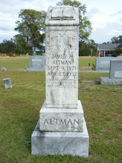
| Description | : | Pvt., Confederate States Army, Company G, 15th SC infantry. He died after 1870. Husband of Elizabeth "Betsy"/"Eliza" Richardson. |
frequently asked questions (FAQ):
-
Where is Pvt Lorenzo Cleland “Clee” Altman's memorial?
Pvt Lorenzo Cleland “Clee” Altman's memorial is located at: St Werburgh's Church, Hanbury, East Staffordshire Borough, England.
-
When did Pvt Lorenzo Cleland “Clee” Altman death?
Pvt Lorenzo Cleland “Clee” Altman death on unknown in USA
-
Where are the coordinates of the Pvt Lorenzo Cleland “Clee” Altman's memorial?
Latitude: 52.8485000
Longitude: -1.7478000
Family Members:
Spouse

Children
Flowers:

Left by Anonymous on 19 Oct 2011
Left by Anonymous on 10 Feb 2013
Left by Anonymous on 22 Sep 2013
Your sacrifice has not been forgotten!
Left by Anonymous on 23 Sep 2013

Left by Anonymous on 04 Oct 2014
Left by Anonymous on 02 Jun 2017

Left by Anonymous on 29 May 2018

Tell it as you may, It never can be told Sing it as you will, It never can be sung, The story of the glory Of the men who wore the Gray.
Left by Anonymous on 03 May 2020

Left by Anonymous on 12 Nov 2020

Lorenzo, It is my honor to leave this wreath for you today 19 Dec 2020 on Wreaths Across America Day. We can never Thank You enough for your service to Our Great Country...May you never be forgotten...
Left by Anonymous on 20 Dec 2020

Requiéscat In Pace, Soldier of the South.
Left by Anonymous on 08 May 2021

Left by Anonymous on 27 Sep 2021

Left by Anonymous on 12 Nov 2021

It is an Honor to leave this wreath for you on Wreaths Across America Day, 18 Dec 2021, I pray you will never be forgotten. Thank You for your Service...
Left by Anonymous on 19 Dec 2021


Nearby Cemetories:
1. St Werburgh's Church
Hanbury, East Staffordshire Borough, England
Coordinate: 52.8485000, -1.7478000
2. RAF Fauld
Hanbury, East Staffordshire Borough, England
Coordinate: 52.8474200, -1.7303500
3. St. Paul's Churchyard Extension
Scropton, South Derbyshire District, England
Coordinate: 52.8687230, -1.7133750
4. Holy Trinity Churchyard
Anslow, East Staffordshire Borough, England
Coordinate: 52.8216926, -1.7079807
5. Priory Church of St. Mary the Virgin
Tutbury, East Staffordshire Borough, England
Coordinate: 52.8590900, -1.6877900
6. St Peter's Churchyard
Marchington, East Staffordshire Borough, England
Coordinate: 52.8738278, -1.7967917
7. All Saints Churchyard
Newborough, East Staffordshire Borough, England
Coordinate: 52.8259013, -1.8003185
8. All Saints Churchyard
Sudbury, Derbyshire Dales District, England
Coordinate: 52.8867660, -1.7667510
9. Newchurch, Christchurch-in-Needwood
Hoar Cross, East Staffordshire Borough, England
Coordinate: 52.8083859, -1.7811304
10. All Saints Churchyard
Rangemore, East Staffordshire Borough, England
Coordinate: 52.8040800, -1.7337000
11. Rolleston Cemetery
Rolleston-on-Dove, East Staffordshire Borough, England
Coordinate: 52.8483757, -1.6643849
12. St. Mary's Churchyard
Rolleston-on-Dove, East Staffordshire Borough, England
Coordinate: 52.8465144, -1.6519844
13. Marston-on-Dove Cemetery
Marston-on-Dove, South Derbyshire District, England
Coordinate: 52.8640550, -1.6552780
14. St Mary's
Marston-on-Dove, South Derbyshire District, England
Coordinate: 52.8633910, -1.6547730
15. The Holy Angels Churchyard
Hoar Cross, East Staffordshire Borough, England
Coordinate: 52.8047974, -1.8161691
16. St Michael and All Angels Churchyard
Church Broughton, South Derbyshire District, England
Coordinate: 52.9009460, -1.6962610
17. St. Michael and All Angels Churchyard
Tatenhill, East Staffordshire Borough, England
Coordinate: 52.7958170, -1.6968150
18. Dove Evangelical Free Church, Somersal Herbert
Doveridge, Derbyshire Dales District, England
Coordinate: 52.9109200, -1.7905560
19. Saint John the Divine Churchyard
Horninglow, East Staffordshire Borough, England
Coordinate: 52.8237520, -1.6426170
20. St. Mary's Churchyard, Dunstall
Tatenhill, East Staffordshire Borough, England
Coordinate: 52.7809957, -1.7236464
21. Catholic Church of Saint Francis of Sales
Yoxall, East Staffordshire Borough, England
Coordinate: 52.7844140, -1.7909000
22. St. John the Baptist Churchyard
Boylestone, Derbyshire Dales District, England
Coordinate: 52.9195410, -1.7313190
23. St. Cuthbert's Churchyard
Doveridge, Derbyshire Dales District, England
Coordinate: 52.9042368, -1.8317361
24. St Mary's Churchyard
Stretton, South Staffordshire Borough, England
Coordinate: 52.8336500, -1.6253400