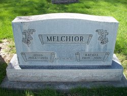
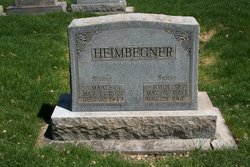
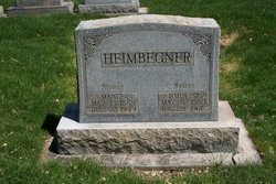
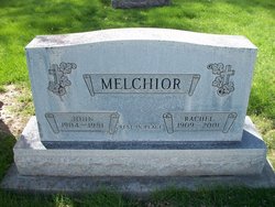
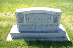
Rachel Heimbegner Melchior
| Birth | : | 23 Jun 1909 Sedgwick, Sedgwick County, Colorado, USA |
| Death | : | 25 Oct 2001 Sterling, Logan County, Colorado, USA |
| Burial | : | Redhill Cemetery, Arnold, Nottingham Unitary Authority, England |
| Coordinate | : | 53.0066910, -1.1382950 |
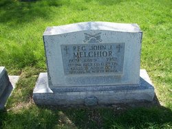
| Description | : | Rachel Melchior, 92, of Sterling, passed away Wednesday, Oct. 25, 2001 in Sterling. Visitation will be held from 10 a.m. until 6 p.m. on Tuesday, Oct. 30, at Chaney-Reager Funeral Home. Funeral services will be held at 2 p.m. on Wednesday, Oct. 31, at Chaney-Reager Funeral Home with Rev. Spencer Green officiating. Burial will be at Riverside Cemetery. Mrs. Melchior was born June 23, 1909 to John and Marie Barbara (Heimbechner) Heimbegner in Sedgwick. On April 10, 1928 she married John Melchior in Holyoke. After farming several years in the Sedgwick County area, they moved to Las Animas, where they farmed... Read More |
frequently asked questions (FAQ):
-
Where is Rachel Heimbegner Melchior's memorial?
Rachel Heimbegner Melchior's memorial is located at: Redhill Cemetery, Arnold, Nottingham Unitary Authority, England.
-
When did Rachel Heimbegner Melchior death?
Rachel Heimbegner Melchior death on 25 Oct 2001 in Sterling, Logan County, Colorado, USA
-
Where are the coordinates of the Rachel Heimbegner Melchior's memorial?
Latitude: 53.0066910
Longitude: -1.1382950
Family Members:
Parent
Spouse
Siblings
Children
Flowers:
Nearby Cemetories:
1. Redhill Cemetery
Arnold, Nottingham Unitary Authority, England
Coordinate: 53.0066910, -1.1382950
2. St. John's Carrington Churchyard
Nottingham, Nottingham Unitary Authority, England
Coordinate: 52.9755350, -1.1506790
3. Basford Cemetery
Old Basford, Nottingham Unitary Authority, England
Coordinate: 52.9799700, -1.1725900
4. St. Leodegarius Churchyard
Old Basford, Nottingham Unitary Authority, England
Coordinate: 52.9794240, -1.1778650
5. Gedling Cemetery
Gedling, Gedling Borough, England
Coordinate: 52.9806930, -1.0870670
6. St. Paul's Churchyard
Nottingham Unitary Authority, England
Coordinate: 52.9667590, -1.1172140
7. Northern Cemetery
Bulwell, Nottingham Unitary Authority, England
Coordinate: 52.9979840, -1.2077900
8. Hucknall Cemetery
Hucknall, Ashfield District, England
Coordinate: 53.0293427, -1.1988190
9. Nottingham Church Cemetery
Nottingham, Nottingham Unitary Authority, England
Coordinate: 52.9649830, -1.1558070
10. All Hallows Churchyard
Gedling, Gedling Borough, England
Coordinate: 52.9769400, -1.0805130
11. Hardy Street Jewish Cemetery
Nottingham, Nottingham Unitary Authority, England
Coordinate: 52.9619500, -1.1665900
12. Carlton Cemetery
Nottingham, Nottingham Unitary Authority, England
Coordinate: 52.9682820, -1.0900230
13. St. Mary Rest Ground
Nottingham, Nottingham Unitary Authority, England
Coordinate: 52.9568310, -1.1406580
14. Nottingham General Cemetery
Nottingham, Nottingham Unitary Authority, England
Coordinate: 52.9575370, -1.1594236
15. Woodborough Cemetery
Woodborough, Gedling Borough, England
Coordinate: 53.0272840, -1.0600540
16. St. Mary Magdalene Churchyard
Hucknall, Ashfield District, England
Coordinate: 53.0390630, -1.2058330
17. General Cemetery
Nottingham, Nottingham Unitary Authority, England
Coordinate: 52.9561430, -1.1615420
18. St. Peter Churchyard Old Radford
Nottingham, Nottingham Unitary Authority, England
Coordinate: 52.9601830, -1.1789620
19. Cathedral Church of St. Barnabas
Nottingham, Nottingham Unitary Authority, England
Coordinate: 52.9546750, -1.1570460
20. National Ice Centre
Nottingham, Nottingham Unitary Authority, England
Coordinate: 52.9527790, -1.1394460
21. St Mary's Burial Grounds
Nottingham, Nottingham Unitary Authority, England
Coordinate: 52.9527860, -1.1419160
22. St Peters Church Yard
Nottingham, Nottingham Unitary Authority, England
Coordinate: 52.9522800, -1.1486940
23. National Justice Museum High Pavement Nottingham
Nottingham Unitary Authority, England
Coordinate: 52.9510680, -1.1443050
24. St Nicholas Churchyard
Nottingham, Nottingham Unitary Authority, England
Coordinate: 52.9504780, -1.1509220

