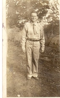
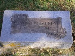
Raymond Henry Mundy
| Birth | : | 10 Oct 1912 Burlingame, Osage County, Kansas, USA |
| Death | : | 1 Jan 1944 Topeka, Shawnee County, Kansas, USA |
| Burial | : | Scroggsfield Cemetery, Scroggsfield, Carroll County, USA |
| Coordinate | : | 40.5748980, -80.9652890 |
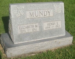
| Description | : | Parents: Henry Evard Mundy & Elizabeth May Griffin Mundy |
frequently asked questions (FAQ):
-
Where is Raymond Henry Mundy's memorial?
Raymond Henry Mundy's memorial is located at: Scroggsfield Cemetery, Scroggsfield, Carroll County, USA.
-
When did Raymond Henry Mundy death?
Raymond Henry Mundy death on 1 Jan 1944 in Topeka, Shawnee County, Kansas, USA
-
Where are the coordinates of the Raymond Henry Mundy's memorial?
Latitude: 40.5748980
Longitude: -80.9652890
Family Members:
Parent
Siblings
Flowers:
Nearby Cemetories:
1. Scroggsfield Cemetery
Scroggsfield, Carroll County, USA
Coordinate: 40.5748980, -80.9652890
2. Palmer Cemetery
Fox Township, Carroll County, USA
Coordinate: 40.5578003, -80.9764023
3. McGauran Cemetery
Harlem Springs, Carroll County, USA
Coordinate: 40.5522003, -80.9749985
4. Chestnut Ridge Cemetery
Harlem Springs, Carroll County, USA
Coordinate: 40.5491982, -80.9336014
5. Mount Olivet Cemetery
Carroll County, USA
Coordinate: 40.5905991, -81.0081024
6. Downing Cemetery
Carroll County, USA
Coordinate: 40.5567017, -81.0117035
7. Corinth-Mechanicstown Cemetery
Mechanicstown, Carroll County, USA
Coordinate: 40.6156006, -80.9578018
8. Moorehead Cemetery
Carroll County, USA
Coordinate: 40.5449982, -81.0033035
9. Snyder Cemetery
Carroll County, USA
Coordinate: 40.6169014, -80.9766998
10. Denver George Haddock Family Cemetery
Carrollton, Carroll County, USA
Coordinate: 40.5443880, -81.0227370
11. Wells-Jackman Cemetery
Carroll County, USA
Coordinate: 40.5177994, -80.9522018
12. Harlem Springs Cemetery
Harlem Springs, Carroll County, USA
Coordinate: 40.5219002, -81.0053024
13. Lee Cemetery
Carroll County, USA
Coordinate: 40.5391998, -81.0314026
14. Green Hill Cemetery
Carroll County, USA
Coordinate: 40.5303001, -81.0246964
15. Greenbrier-West Union Cemetery
Carroll County, USA
Coordinate: 40.5696983, -80.8728027
16. Brush Creek Baptist Cemetery
Carroll County, USA
Coordinate: 40.5624008, -80.8715973
17. Bergholz Cemetery
Bergholz, Jefferson County, USA
Coordinate: 40.5155983, -80.8955994
18. Crawford Cemetery
Lee Township, Carroll County, USA
Coordinate: 40.4935030, -80.9578650
19. West Grove Cemetery
Brush Creek Township, Jefferson County, USA
Coordinate: 40.5985985, -80.8613968
20. Herrington Bethel Cemetery
Carroll County, USA
Coordinate: 40.6493988, -81.0128021
21. Stuller Cemetery
Carroll County, USA
Coordinate: 40.6302986, -81.0513992
22. Aller Family Cemetery
Carrollton, Carroll County, USA
Coordinate: 40.5879760, -81.0771540
23. Dunbar Family Cemetery
Monroeville, Jefferson County, USA
Coordinate: 40.5878080, -80.8514680
24. County Home Cemetery
Carroll County, USA
Coordinate: 40.6175003, -81.0674973

