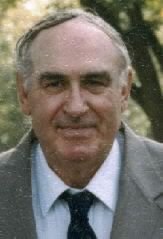
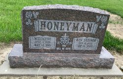
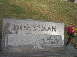
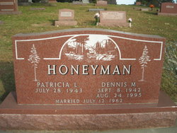
Rev Steiner S. Honeyman
| Birth | : | 11 Sep 1935 Mills County, Iowa, USA |
| Death | : | 13 Sep 2005 Red Oak, Montgomery County, Iowa, USA |
| Burial | : | Saint Thomas the Martyr Churchyard, Oxford, City of Oxford, England |
| Coordinate | : | 51.7512222, -1.2679445 |
| Plot | : | 2nd Addition, Lot 184 |
| Inscription | : | In 1956 Steiner joined the Air Force and served for three years. |
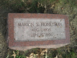
| Description | : | Steiner S. Honeyman, age 70, of Red Oak, Iowa passed away Tuesday, September 13, 2005 at the Montgomery County Memorial Hospital. Steiner Stuart Honeyman was born September 11, 1935 the son of Marvin and Dorothy (Steiner) Honeyman. He graduated from Wales Lincoln High School in 1952 and attended Commercial Extension School in Omaha. He later attended Bible College in Springfield, Missouri. In 1956 Steiner joined the Air Force and served for three years. He was united in marriage to Willicene Kunze on April 13, 1957 in San Antonio, Texas. They were stationed in Germany for 18 months and then Arizona.... Read More |
frequently asked questions (FAQ):
-
Where is Rev Steiner S. Honeyman's memorial?
Rev Steiner S. Honeyman's memorial is located at: Saint Thomas the Martyr Churchyard, Oxford, City of Oxford, England.
-
When did Rev Steiner S. Honeyman death?
Rev Steiner S. Honeyman death on 13 Sep 2005 in Red Oak, Montgomery County, Iowa, USA
-
Where are the coordinates of the Rev Steiner S. Honeyman's memorial?
Latitude: 51.7512222
Longitude: -1.2679445
Family Members:
Parent
Spouse
Siblings
Children
Flowers:
Nearby Cemetories:
1. Saint Thomas the Martyr Churchyard
Oxford, City of Oxford, England
Coordinate: 51.7512222, -1.2679445
2. St Thomas the Martyr
Oxford, City of Oxford, England
Coordinate: 51.7518100, -1.2683430
3. Osney Cemetery
Oxford, City of Oxford, England
Coordinate: 51.7505310, -1.2703040
4. Osney Cathedral
Oxford, City of Oxford, England
Coordinate: 51.7497220, -1.2700000
5. Oxford Castle and Prison Cemetery
Oxford, City of Oxford, England
Coordinate: 51.7521453, -1.2631165
6. Rewley Abbey
Oxford, City of Oxford, England
Coordinate: 51.7543810, -1.2675170
7. St Frideswide Churchyard
Oxford, City of Oxford, England
Coordinate: 51.7521560, -1.2748350
8. Saint Peter le Bailey Churchyard
Oxford, City of Oxford, England
Coordinate: 51.7516980, -1.2600300
9. St Ebbe Churchyard
Oxford, City of Oxford, England
Coordinate: 51.7504200, -1.2596030
10. St Martin's Church, Carfax (Defunct)
Oxford, City of Oxford, England
Coordinate: 51.7513500, -1.2581700
11. St. Michael at the North Gate Church
Oxford, City of Oxford, England
Coordinate: 51.7537210, -1.2583950
12. St. Mary Magdalene's Churchyard
Oxford, City of Oxford, England
Coordinate: 51.7546250, -1.2588340
13. Martyrs' Memorial
Oxford, City of Oxford, England
Coordinate: 51.7550900, -1.2590100
14. Saint Barnabas Church
Oxford, City of Oxford, England
Coordinate: 51.7579620, -1.2697600
15. Blackfriars
Oxford, City of Oxford, England
Coordinate: 51.7561210, -1.2602060
16. St Johns College
Oxford, City of Oxford, England
Coordinate: 51.7560820, -1.2589910
17. Jesus College Chapel
Oxford, City of Oxford, England
Coordinate: 51.7536130, -1.2566180
18. Balliol College Chapel
Oxford, City of Oxford, England
Coordinate: 51.7547800, -1.2572240
19. University Church of St Mary the Virgin
Oxford, City of Oxford, England
Coordinate: 51.7523990, -1.2556000
20. All Saints Churchyard
Oxford, City of Oxford, England
Coordinate: 51.7525000, -1.2555560
21. Exeter College Chapel
Oxford, City of Oxford, England
Coordinate: 51.7539460, -1.2561170
22. Trinity College Chapel
Oxford, City of Oxford, England
Coordinate: 51.7552360, -1.2569620
23. Christ Church Cathedral
Oxford, City of Oxford, England
Coordinate: 51.7500620, -1.2547160
24. St Paul's Oxford Cemetery
Oxford, City of Oxford, England
Coordinate: 51.7594590, -1.2648470

