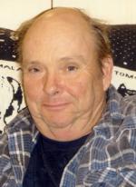
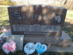
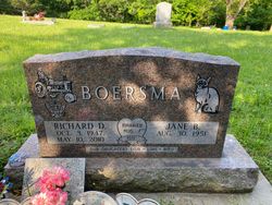
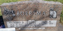
Richard Dean Boersma
| Birth | : | 3 Oct 1947 Boone, Boone County, Iowa, USA |
| Death | : | 10 May 2010 Des Moines, Polk County, Iowa, USA |
| Burial | : | Gedling Cemetery, Gedling, Gedling Borough, England |
| Coordinate | : | 52.9806930, -1.0870670 |
| Description | : | Richard Dean Boersma, age 62, died May 10, 2010, at the VA Medical Center in Des Moines. Burial with full military honors conducted by the Boone Veterans Council will be at the Bluff Creek Cemetery, rural Boone. Richard was born in Boone on October 3, 1947, the son of Pete and Mabel (Fairchild) Boersma. He graduated from Ogden High School in 1966, and served with the United States Army during the Vietnam War. Richard married Jane Stumbo on August 7, 1971, in Boone. He was employed at Pritchard Brothers Plumbing and Heating in Boone for 33 years, first as... Read More |
frequently asked questions (FAQ):
-
Where is Richard Dean Boersma's memorial?
Richard Dean Boersma's memorial is located at: Gedling Cemetery, Gedling, Gedling Borough, England.
-
When did Richard Dean Boersma death?
Richard Dean Boersma death on 10 May 2010 in Des Moines, Polk County, Iowa, USA
-
Where are the coordinates of the Richard Dean Boersma's memorial?
Latitude: 52.9806930
Longitude: -1.0870670
Family Members:
Parent
Siblings
Flowers:
Nearby Cemetories:
1. Gedling Cemetery
Gedling, Gedling Borough, England
Coordinate: 52.9806930, -1.0870670
2. All Hallows Churchyard
Gedling, Gedling Borough, England
Coordinate: 52.9769400, -1.0805130
3. Carlton Cemetery
Nottingham, Nottingham Unitary Authority, England
Coordinate: 52.9682820, -1.0900230
4. St. Paul's Churchyard
Nottingham Unitary Authority, England
Coordinate: 52.9667590, -1.1172140
5. Burton Joyce Cemetery
Burton Joyce, Gedling Borough, England
Coordinate: 52.9863100, -1.0370710
6. St. Helen's Churchyard
Burton Joyce, Gedling Borough, England
Coordinate: 52.9866700, -1.0365400
7. St Luke's Churchyard
Stoke Bardolph, Gedling Borough, England
Coordinate: 52.9680500, -1.0389300
8. St. Luke's Churchyard
Stoke Bardolph, Gedling Borough, England
Coordinate: 52.9659896, -1.0404380
9. St. John's Carrington Churchyard
Nottingham, Nottingham Unitary Authority, England
Coordinate: 52.9755350, -1.1506790
10. St. Mary Rest Ground
Nottingham, Nottingham Unitary Authority, England
Coordinate: 52.9568310, -1.1406580
11. Redhill Cemetery
Arnold, Nottingham Unitary Authority, England
Coordinate: 53.0066910, -1.1382950
12. National Ice Centre
Nottingham, Nottingham Unitary Authority, England
Coordinate: 52.9527790, -1.1394460
13. SS Peter & Paul Churchyard
Shelford, Rushcliffe Borough, England
Coordinate: 52.9745600, -1.0161200
14. St Mary's Burial Grounds
Nottingham, Nottingham Unitary Authority, England
Coordinate: 52.9527860, -1.1419160
15. St Mary Churchyard
Radcliffe-on-Trent, Rushcliffe Borough, England
Coordinate: 52.9464660, -1.0419420
16. Nottingham Church Cemetery
Nottingham, Nottingham Unitary Authority, England
Coordinate: 52.9649830, -1.1558070
17. Radcliffe-on-Trent Cemetery
Radcliffe-on-Trent, Rushcliffe Borough, England
Coordinate: 52.9459200, -1.0409700
18. National Justice Museum High Pavement Nottingham
Nottingham Unitary Authority, England
Coordinate: 52.9510680, -1.1443050
19. St Peters Church Yard
Nottingham, Nottingham Unitary Authority, England
Coordinate: 52.9522800, -1.1486940
20. St Nicholas Churchyard
Nottingham, Nottingham Unitary Authority, England
Coordinate: 52.9504780, -1.1509220
21. Woodborough Cemetery
Woodborough, Gedling Borough, England
Coordinate: 53.0272840, -1.0600540
22. Nottingham General Cemetery
Nottingham, Nottingham Unitary Authority, England
Coordinate: 52.9575370, -1.1594236
23. Cathedral Church of St. Barnabas
Nottingham, Nottingham Unitary Authority, England
Coordinate: 52.9546750, -1.1570460
24. General Cemetery
Nottingham, Nottingham Unitary Authority, England
Coordinate: 52.9561430, -1.1615420

