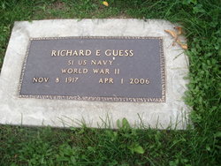
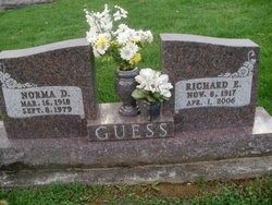
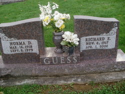
Richard Earl “Dick” Guess
| Birth | : | 6 Nov 1917 Athens, Athens County, Ohio, USA |
| Death | : | 1 Apr 2006 Coshocton, Coshocton County, Ohio, USA |
| Burial | : | Darling Run Cemetery, Nellie, Coshocton County, USA |
| Coordinate | : | 40.3436012, -82.0505981 |
| Description | : | - Richard E. "Dick" Guess, 88, of 45251 U.S. 36, died Saturday, April 1, 2006, at the Coshocton County Memorial Hospital. He was born Nov. 8, 1917, in Athens, to Mae (Dailey) and Thomas Guess. He served in the United States Navy during WWII, was a member of American Legion Post 65, retired from the Buckeye Fabric Finishing Co. and enjoyed hunting, fishing and spending time with family. On Sept. 17, 1938, he married Norma J. (Stone) Guess.She preceded him in death Sept. 8, 1979. He is survived by a son, Richard L. (Darlene) Guess; a daughter, Linda (Bill) Bowen, both of Coshocton; two... Read More |
frequently asked questions (FAQ):
-
Where is Richard Earl “Dick” Guess's memorial?
Richard Earl “Dick” Guess's memorial is located at: Darling Run Cemetery, Nellie, Coshocton County, USA.
-
When did Richard Earl “Dick” Guess death?
Richard Earl “Dick” Guess death on 1 Apr 2006 in Coshocton, Coshocton County, Ohio, USA
-
Where are the coordinates of the Richard Earl “Dick” Guess's memorial?
Latitude: 40.3436012
Longitude: -82.0505981
Family Members:
Parent
Spouse
Siblings
Flowers:
Nearby Cemetories:
1. Darling Run Cemetery
Nellie, Coshocton County, USA
Coordinate: 40.3436012, -82.0505981
2. Butler East Cemetery
Nellie, Coshocton County, USA
Coordinate: 40.3514580, -82.0818970
3. Mohawk Methodist Church Cemetery
Mohawk Village, Coshocton County, USA
Coordinate: 40.3182290, -82.0724610
4. Bethel Cemetery
Warsaw, Coshocton County, USA
Coordinate: 40.3615800, -82.0165150
5. Valley View Cemetery
Warsaw, Coshocton County, USA
Coordinate: 40.3255997, -82.0139008
6. Jefferson Presbyterian Cemetery
Warsaw, Coshocton County, USA
Coordinate: 40.3200690, -82.0165291
7. Butler West Cemetery
Nellie, Coshocton County, USA
Coordinate: 40.3523620, -82.0961490
8. Bateman Cemetery
Warsaw, Coshocton County, USA
Coordinate: 40.3483840, -81.9876370
9. Saint Elizabeth Mission Cemetery
Spring Mountain, Coshocton County, USA
Coordinate: 40.3817900, -82.0108300
10. Honey Run Cemetery
Walhonding, Coshocton County, USA
Coordinate: 40.3711014, -82.1175003
11. Christian Church Cemetery
Warsaw, Coshocton County, USA
Coordinate: 40.3250000, -82.1230000
12. Antioch Cemetery
Coshocton County, USA
Coordinate: 40.3046989, -81.9933014
13. Weatherwax Cemetery
Clark, Coshocton County, USA
Coordinate: 40.3839560, -81.9918080
14. Spring Mountain Cemetery
Spring Mountain, Coshocton County, USA
Coordinate: 40.4053800, -82.0439000
15. Bucklew Cemetery
Metham, Coshocton County, USA
Coordinate: 40.3849983, -81.9858017
16. McKee Cemetery
Walhonding, Coshocton County, USA
Coordinate: 40.3817123, -82.1190115
17. Mikesell Cemetery
West Bedford, Coshocton County, USA
Coordinate: 40.2882500, -82.0963240
18. Blooming Grove Cemetery
Randle, Coshocton County, USA
Coordinate: 40.3017006, -81.9843979
19. Mohawk Baptist Church Cemetery
Nellie, Coshocton County, USA
Coordinate: 40.2941380, -82.1107120
20. Wilson Chapel Cemetery
Nellie, Coshocton County, USA
Coordinate: 40.3017690, -82.1207660
21. Walhonding Cemetery
Walhonding, Coshocton County, USA
Coordinate: 40.3627800, -82.1411700
22. Dutch Run Cemetery
Tiverton Township, Coshocton County, USA
Coordinate: 40.4021988, -82.1072006
23. Mount Zion Methodist Church Cemetery
Metham, Coshocton County, USA
Coordinate: 40.3559580, -81.9522140
24. Blissfield Cemetery
Blissfield, Coshocton County, USA
Coordinate: 40.3927994, -81.9728012


