
| Memorials | : | 38 |
| Location | : | Clark, Coshocton County, USA |
| Coordinate | : | 40.3839560, -81.9918080 |
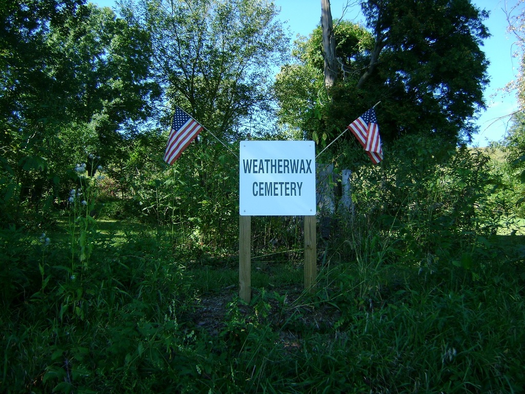
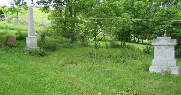
| Description | : | The cemetery is located on the northwest side of County Road 49 about 0.2 mile southwest of its intersection with Township Road 32. The cemetery is 0.5 acres in size. The cemetery is located in Clark Township, Coshocton County, Ohio, and is # 2214 (Weatherwax Cemetery) in “Ohio Cemeteries 1803-2003”, compiled by the Ohio Genealogical Society. The U.S. Geological Survey (USGS) Geographic Names Information System (GNIS) feature ID for the cemetery is 1964146 (Weatherwax Cemetery). |
frequently asked questions (FAQ):
-
Where is Weatherwax Cemetery?
Weatherwax Cemetery is located at County Road 49 Clark, Coshocton County ,Ohio , 43844USA.
-
Weatherwax Cemetery cemetery's updated grave count on graveviews.com?
38 memorials
-
Where are the coordinates of the Weatherwax Cemetery?
Latitude: 40.3839560
Longitude: -81.9918080
Nearby Cemetories:
1. Bucklew Cemetery
Metham, Coshocton County, USA
Coordinate: 40.3849983, -81.9858017
2. Saint Elizabeth Mission Cemetery
Spring Mountain, Coshocton County, USA
Coordinate: 40.3817900, -82.0108300
3. Blissfield Cemetery
Blissfield, Coshocton County, USA
Coordinate: 40.3927994, -81.9728012
4. Bethel Cemetery
Warsaw, Coshocton County, USA
Coordinate: 40.3615800, -82.0165150
5. Dutch Meeting House Cemetery
Warsaw, Coshocton County, USA
Coordinate: 40.3796207, -81.9459337
6. Bateman Cemetery
Warsaw, Coshocton County, USA
Coordinate: 40.3483840, -81.9876370
7. Pleasant Hill Cemetery
Coshocton County, USA
Coordinate: 40.4225006, -82.0038986
8. Mount Zion Methodist Church Cemetery
Metham, Coshocton County, USA
Coordinate: 40.3559580, -81.9522140
9. Fox Cemetery
Blissfield, Coshocton County, USA
Coordinate: 40.4035988, -81.9424973
10. Spring Mountain Cemetery
Spring Mountain, Coshocton County, USA
Coordinate: 40.4053800, -82.0439000
11. Casebeer Cemetery
Metham, Coshocton County, USA
Coordinate: 40.3629220, -81.9360840
12. Waring Cemetery
Metham, Coshocton County, USA
Coordinate: 40.3505580, -81.9470740
13. Big Run Cemetery
Layland, Coshocton County, USA
Coordinate: 40.4338989, -82.0081024
14. Clark Township Baptist Church Cemetery
Clark, Coshocton County, USA
Coordinate: 40.4126680, -81.9229260
15. Darling Run Cemetery
Nellie, Coshocton County, USA
Coordinate: 40.3436012, -82.0505981
16. Valley View Cemetery
Warsaw, Coshocton County, USA
Coordinate: 40.3255997, -82.0139008
17. Jefferson Presbyterian Cemetery
Warsaw, Coshocton County, USA
Coordinate: 40.3200690, -82.0165291
18. Salem Cemetery
Holmes County, USA
Coordinate: 40.4500008, -81.9480972
19. Butler East Cemetery
Nellie, Coshocton County, USA
Coordinate: 40.3514580, -82.0818970
20. Antioch Cemetery
Coshocton County, USA
Coordinate: 40.3046989, -81.9933014
21. Harmony Cemetery
Coshocton County, USA
Coordinate: 40.4277992, -82.0819016
22. Blooming Grove Cemetery
Randle, Coshocton County, USA
Coordinate: 40.3017006, -81.9843979
23. Monroe Cemetery
Coshocton County, USA
Coordinate: 40.4508018, -82.0580978
24. Austin Family Cemetery
Clark, Coshocton County, USA
Coordinate: 40.4422900, -81.9105570