
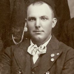
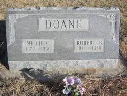

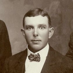
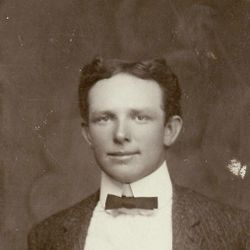
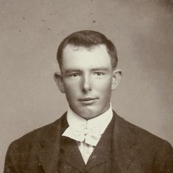
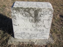
Robert Boyd Doane
| Birth | : | 6 Apr 1871 Lee County, Iowa, USA |
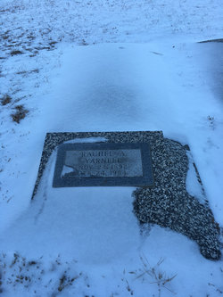
| Death | : | 23 Feb 1936 Stockton, Rooks County, Kansas, USA |
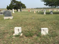
| Burial | : | Woodlawn Cemetery, Independence, Jackson County, USA |
| Coordinate | : | 39.0856018, -94.4107971 |
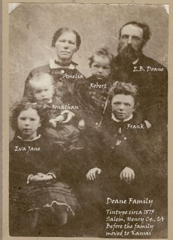
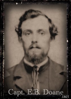
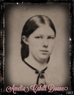
| Description | : | Born in Cottonwood, IA, the son of Amelia Cahill and Eleazer Bales Doane(8), Robert(7), Jesse(6), John(5), Joseph(4), Daniel(3), Daniel(2), Deacon John Doane(1). Married to Camelia "Millie" Goodin on 03 Sep 1888. Mr. Doane was a birthright member of the Friends Church. He lived in Osborne Co, KS until 1916 when he moved to Arlington, CO because of his failing health, returning to KS in 1920. He was a loving father and a devoted companion. |
frequently asked questions (FAQ):
-
Where is Robert Boyd Doane's memorial?
Robert Boyd Doane's memorial is located at: Woodlawn Cemetery, Independence, Jackson County, USA.
-
When did Robert Boyd Doane death?
Robert Boyd Doane death on 23 Feb 1936 in Stockton, Rooks County, Kansas, USA
-
Where are the coordinates of the Robert Boyd Doane's memorial?
Latitude: 39.0856018
Longitude: -94.4107971
Family Members:
Parent
Spouse

Siblings
Children
Flowers:


Nearby Cemetories:
1. Woodlawn Cemetery
Independence, Jackson County, USA
Coordinate: 39.0856018, -94.4107971
2. Trinity Episcopal Church Columbarium
Independence, Jackson County, USA
Coordinate: 39.0952300, -94.4166400
3. Harry S. Truman Library and Museum
Independence, Jackson County, USA
Coordinate: 39.1035200, -94.4213900
4. Hedrick Cemetery
Independence, Jackson County, USA
Coordinate: 39.1072006, -94.3914032
5. Mound Grove Cemetery
Independence, Jackson County, USA
Coordinate: 39.1128006, -94.4281006
6. Hill Park Cemetery
Independence, Jackson County, USA
Coordinate: 39.0835991, -94.4539032
7. Tucker Cemetery
Independence, Jackson County, USA
Coordinate: 39.1224300, -94.4021600
8. Luttrell Cemetery
Independence, Jackson County, USA
Coordinate: 39.0504700, -94.3839300
9. Oak Ridge Memory Gardens
Independence, Jackson County, USA
Coordinate: 39.1046982, -94.3638992
10. Staples Family Cemetery
East Independence, Jackson County, USA
Coordinate: 39.1201400, -94.3797800
11. Saint Michael's Memorial Garden
Independence, Jackson County, USA
Coordinate: 39.0468200, -94.3877300
12. Long Cemetery
Independence, Jackson County, USA
Coordinate: 39.1284700, -94.4097700
13. Reed Cemetery
Independence, Jackson County, USA
Coordinate: 39.1097400, -94.4593900
14. Blue Ridge Lawn Memorial Gardens
Kansas City, Jackson County, USA
Coordinate: 39.0760002, -94.4717026
15. Campground Cemetery
Raytown, Jackson County, USA
Coordinate: 39.0380000, -94.4295700
16. Highland Cemetery
Kansas City, Jackson County, USA
Coordinate: 39.0853004, -94.4760971
17. Pitcher Cemetery
Independence, Jackson County, USA
Coordinate: 39.0635986, -94.4702988
18. Kehilath Israel Blue Ridge Cemetery
Independence, Jackson County, USA
Coordinate: 39.0875015, -94.4766998
19. Mount Washington Cemetery
Independence, Jackson County, USA
Coordinate: 39.0957985, -94.4757996
20. Lincoln Cemetery
Kansas City, Jackson County, USA
Coordinate: 39.0946999, -94.4805984
21. Smiley Cemetery
Sugar Creek, Jackson County, USA
Coordinate: 39.1411000, -94.3941900
22. Noland Cemetery
Kansas City, Jackson County, USA
Coordinate: 39.0265700, -94.4005700
23. House & McMonigle Cemetery
Independence, Jackson County, USA
Coordinate: 39.0250300, -94.4152710
24. Webb Cemetery
Independence, Jackson County, USA
Coordinate: 39.1138600, -94.3403200