
| Memorials | : | 0 |
| Location | : | Independence, Jackson County, USA |
| Coordinate | : | 39.0635986, -94.4702988 |
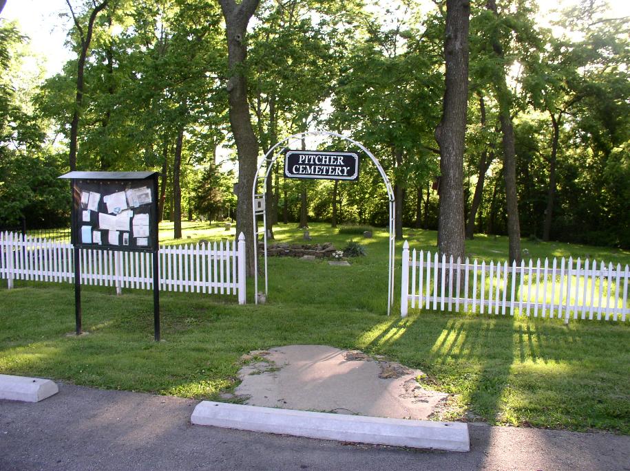
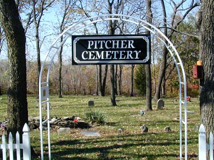
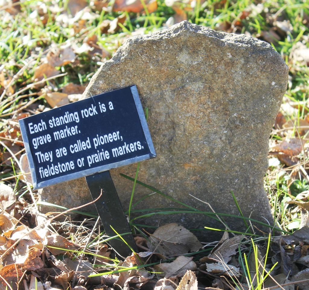
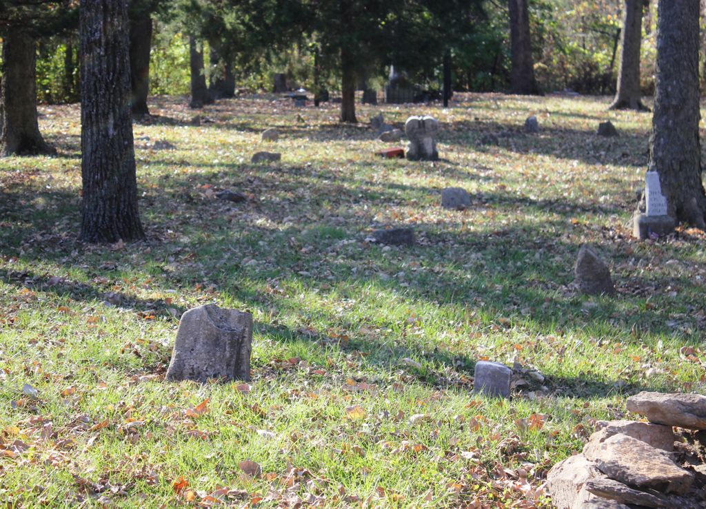
| Description | : | Established in 1830, Pitcher Cemetery is not just a family burial plot, it is also the final resting place for pioneers, a Revolutionary War soldier, and the site of two mass graves. Located at 3306 Blue Ridge Blvd. in Independence, Missouri, this small half-acre graveyard was originally established for the Colonel Thomas Pitcher family and is possibly the burial site of up to 200 people. Most of the grave markers are simple standing rocks without engraving. Colonel Pitcher was a local pioneer and Civil War veteran who is believed to be buried in the cemetery's "mystery grave" along with his wife,... Read More |
frequently asked questions (FAQ):
-
Where is Pitcher Cemetery?
Pitcher Cemetery is located at Independence, Jackson County ,Missouri ,USA.
-
Pitcher Cemetery cemetery's updated grave count on graveviews.com?
0 memorials
-
Where are the coordinates of the Pitcher Cemetery?
Latitude: 39.0635986
Longitude: -94.4702988
Nearby Cemetories:
1. Blue Ridge Lawn Memorial Gardens
Kansas City, Jackson County, USA
Coordinate: 39.0760002, -94.4717026
2. Highland Cemetery
Kansas City, Jackson County, USA
Coordinate: 39.0853004, -94.4760971
3. Hill Park Cemetery
Independence, Jackson County, USA
Coordinate: 39.0835991, -94.4539032
4. Kehilath Israel Blue Ridge Cemetery
Independence, Jackson County, USA
Coordinate: 39.0875015, -94.4766998
5. Leeds Cemetery
Kansas City, Jackson County, USA
Coordinate: 39.0433100, -94.4957500
6. Lincoln Cemetery
Kansas City, Jackson County, USA
Coordinate: 39.0946999, -94.4805984
7. Mount Washington Cemetery
Independence, Jackson County, USA
Coordinate: 39.0957985, -94.4757996
8. Brooking Cemetery
Raytown, Jackson County, USA
Coordinate: 39.0269012, -94.4597015
9. Cole Cemetery
Kansas City, Jackson County, USA
Coordinate: 39.0331000, -94.4992400
10. Campground Cemetery
Raytown, Jackson County, USA
Coordinate: 39.0380000, -94.4295700
11. Mount Carmel Cemetery
Raytown, Jackson County, USA
Coordinate: 39.0228004, -94.4705963
12. Collings Cemetery
Kansas City, Jackson County, USA
Coordinate: 39.0206200, -94.4908000
13. Reed Cemetery
Independence, Jackson County, USA
Coordinate: 39.1097400, -94.4593900
14. Rice Cemetery
Kansas City, Jackson County, USA
Coordinate: 39.0193400, -94.4955700
15. Woodlawn Cemetery
Independence, Jackson County, USA
Coordinate: 39.0856018, -94.4107971
16. Trinity Episcopal Church Columbarium
Independence, Jackson County, USA
Coordinate: 39.0952300, -94.4166400
17. Sheffield Cemetery
Kansas City, Jackson County, USA
Coordinate: 39.1082993, -94.5083008
18. Elmwood Cemetery
Kansas City, Jackson County, USA
Coordinate: 39.0960999, -94.5255966
19. Harry S. Truman Library and Museum
Independence, Jackson County, USA
Coordinate: 39.1035200, -94.4213900
20. Mount Saint Mary Catholic Cemetery
Kansas City, Jackson County, USA
Coordinate: 39.0856018, -94.5357971
21. West Fork Baptist Cemetery
Bristol, Jackson County, USA
Coordinate: 39.0110100, -94.4443700
22. House & McMonigle Cemetery
Independence, Jackson County, USA
Coordinate: 39.0250300, -94.4152710
23. Mound Grove Cemetery
Independence, Jackson County, USA
Coordinate: 39.1128006, -94.4281006
24. West Family Cemetery
Raytown, Jackson County, USA
Coordinate: 39.0020900, -94.4729600