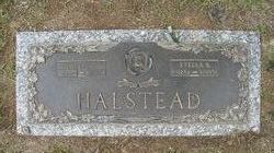
Robert Lee Halstead
| Birth | : | 2 Feb 1918 Virginia, USA |
| Death | : | 27 Mar 2000 Chesapeake City, Virginia, USA |
| Burial | : | All Saints Churchyard, Appleton Roebuck, Selby District, England |
| Coordinate | : | 53.8734600, -1.1580870 |
| Description | : | Virginian-Pilot, The (Norfolk, VA) - 29 & 31 Mar 2000 ROBERT LEE HALSTEAD, 82, [b 2 Feb 1918] of the 700 block of Oak Grove Road, died March 27, 2000, at Chesapeake General Hospital. Born in old Norfolk County, Mr. Halstead was the son of the late John Simon and Annie Seebo Halstead. He was predeceased by his wife, Stella Leona Batts Halstead. He was a member of Rosemont Christian Church. Early in his life, he was one of the first professional fire fighters and ambulance driver for the then-town of Portlock [section of Chesapeake]. A funeral was... Read More |
frequently asked questions (FAQ):
-
Where is Robert Lee Halstead's memorial?
Robert Lee Halstead's memorial is located at: All Saints Churchyard, Appleton Roebuck, Selby District, England.
-
When did Robert Lee Halstead death?
Robert Lee Halstead death on 27 Mar 2000 in Chesapeake City, Virginia, USA
-
Where are the coordinates of the Robert Lee Halstead's memorial?
Latitude: 53.8734600
Longitude: -1.1580870
Family Members:
Parent
Spouse
Siblings
Flowers:
Nearby Cemetories:
1. Nun Appleton Priory
Appleton Roebuck, Selby District, England
Coordinate: 53.8525000, -1.1561110
2. St John Churchyard
Acaster Selby, Selby District, England
Coordinate: 53.8614750, -1.1283740
3. All Saints Churchyard
Bolton Percy, Selby District, England
Coordinate: 53.8649780, -1.1929000
4. All Saints Churchyard
Ryther, Selby District, England
Coordinate: 53.8478600, -1.1576100
5. St Paul Churchyard
Colton, Selby District, England
Coordinate: 53.8964660, -1.1773770
6. St Helen Churchyard
Stillingfleet, Selby District, England
Coordinate: 53.8618710, -1.0994760
7. Moor Lane Burial Ground
Copmanthorpe, York Unitary Authority, England
Coordinate: 53.9096890, -1.1449400
8. Rythergate Cemetery
Cawood, Selby District, England
Coordinate: 53.8356000, -1.1347700
9. St Giles Churchyard
Copmanthorpe, York Unitary Authority, England
Coordinate: 53.9149240, -1.1410420
10. St James Churchyard
Bilbrough, Selby District, England
Coordinate: 53.9119110, -1.1945130
11. St John the Baptist Churchyard
Kirkby Wharfe, Selby District, England
Coordinate: 53.8627400, -1.2320400
12. All Saints Churchyard
Cawood, Selby District, England
Coordinate: 53.8331970, -1.1235660
13. St John the Baptist Churchyard Extension
Kirkby Wharfe, Selby District, England
Coordinate: 53.8602100, -1.2321200
14. Holy Trinity Churchyard
Acaster Malbis, York Unitary Authority, England
Coordinate: 53.9052480, -1.0975170
15. St Matthew Churchyard
Naburn, York Unitary Authority, England
Coordinate: 53.9009520, -1.0899200
16. St Mary Churchyard
Askham Richard, York Unitary Authority, England
Coordinate: 53.9254100, -1.1836800
17. St Nicholas Churchyard
Askham Bryan, York Unitary Authority, England
Coordinate: 53.9294600, -1.1581240
18. St Mary the Virgin Churchyard
Church Fenton, Selby District, England
Coordinate: 53.8243100, -1.2203500
19. Dringhouses Cemetery
York, York Unitary Authority, England
Coordinate: 53.9297740, -1.1156780
20. St. Andrew's Old Churchyard
Bishopthorpe, York Unitary Authority, England
Coordinate: 53.9221490, -1.0929640
21. St Andrew Churchyard
Bishopthorpe, York Unitary Authority, England
Coordinate: 53.9236690, -1.0955320
22. St Mary the Virgin Churchyard
Tadcaster, Selby District, England
Coordinate: 53.8852300, -1.2624100
23. Inghamite Chapel
Tadcaster, Selby District, England
Coordinate: 53.8843580, -1.2644470
24. York Crematorium
York, York Unitary Authority, England
Coordinate: 53.9264970, -1.0936130


