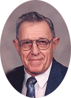
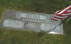
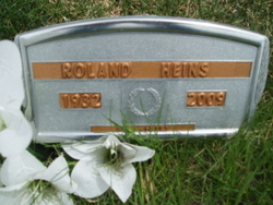
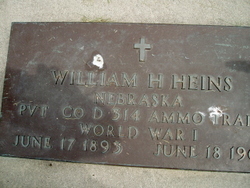
Roland Heins
| Birth | : | 20 Nov 1932 Platte Center, Platte County, Nebraska, USA |
| Death | : | 23 Mar 2009 Columbus, Platte County, Nebraska, USA |
| Burial | : | Oak Hill Cemetery, Estherville, Emmet County, USA |
| Coordinate | : | 43.3986015, -94.8518982 |
| Description | : | Son of William & Helena (Muth) Heins. He attended Platte County District #22 Grade School and Platte Center High School. On February 26, 1953, Roland entered the United States Army serving in Germany. He was honorably discharged on February 27, 1955. Upon his return to Platte Center, Roland went to work for Werner Hake. He later went to school at the Radio Engineering Institute in Omaha. Roland moved to Wayne, Nebraska, where he did radio and TV repair work for McNatts Hardware. On January 31, 1960, Roland was united in marriage to Aleta Bokelman at Trinity... Read More |
frequently asked questions (FAQ):
-
Where is Roland Heins's memorial?
Roland Heins's memorial is located at: Oak Hill Cemetery, Estherville, Emmet County, USA.
-
When did Roland Heins death?
Roland Heins death on 23 Mar 2009 in Columbus, Platte County, Nebraska, USA
-
Where are the coordinates of the Roland Heins's memorial?
Latitude: 43.3986015
Longitude: -94.8518982
Family Members:
Parent
Siblings
Flowers:
Nearby Cemetories:
1. East Side Cemetery
Estherville, Emmet County, USA
Coordinate: 43.4068985, -94.8264008
2. Saint Patricks Cemetery
Estherville, Emmet County, USA
Coordinate: 43.3843994, -94.8283005
3. East Side Memorial Cemetery
Estherville, Emmet County, USA
Coordinate: 43.4267750, -94.8265600
4. Norwegian Cemetery
Estherville, Emmet County, USA
Coordinate: 43.4291992, -94.8261032
5. Estherville Lutheran Cemetery
Estherville, Emmet County, USA
Coordinate: 43.4298000, -94.8263000
6. Prosser Cemetery
Estherville, Emmet County, USA
Coordinate: 43.4422000, -94.7783000
7. Superior Township Cemetery
Superior, Dickinson County, USA
Coordinate: 43.4399986, -94.9533005
8. Wallingford Lutheran Cemetery
Wallingford, Emmet County, USA
Coordinate: 43.3128014, -94.7731018
9. Union State Line Cemetery
Dickinson County, USA
Coordinate: 43.4928017, -94.9156036
10. Richland Township Cemetery
Terril, Dickinson County, USA
Coordinate: 43.3565323, -94.9927821
11. Fairview Cemetery
Terril, Dickinson County, USA
Coordinate: 43.2977982, -94.9349976
12. Center Township Cemetery
Emmet County, USA
Coordinate: 43.3608000, -94.6790000
13. Petersburg Cemetery
Jackson County, USA
Coordinate: 43.5224991, -94.9182968
14. Ellsworth Cemetery
Emmet County, USA
Coordinate: 43.5005989, -94.7249985
15. Saint Johns Lutheran Cemetery
Petersburg, Jackson County, USA
Coordinate: 43.5442009, -94.8780975
16. High Lake Jack Creek Cemetery
Wallingford, Emmet County, USA
Coordinate: 43.3006500, -94.7000620
17. Graettinger City Cemetery
Graettinger, Palo Alto County, USA
Coordinate: 43.2550011, -94.7722015
18. Saint Jacobs Cemetery
Graettinger, Palo Alto County, USA
Coordinate: 43.2546997, -94.7705994
19. Swan Lake Township Cemetery
Maple Hill, Emmet County, USA
Coordinate: 43.3850746, -94.6381378
20. Bedell Gravesite
Spirit Lake, Dickinson County, USA
Coordinate: 43.4128430, -95.0773690
21. Lincoln Township Cemetery
Dolliver, Emmet County, USA
Coordinate: 43.4441986, -94.6204987
22. Palestine Cemetery
Dolliver, Emmet County, USA
Coordinate: 43.4880000, -94.6408000
23. Rose Hill Cemetery (Defunct)
Spirit Lake, Dickinson County, USA
Coordinate: 43.4077600, -95.0976130
24. Lake Fremont Cemetery
Dunnell, Martin County, USA
Coordinate: 43.5691986, -94.7746964

