
| Birth | : | 20 Jun 1918 Thayer County, Nebraska, USA |
| Death | : | 29 Mar 1997 Rossville, Shawnee County, Kansas, USA |
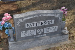
| Burial | : | Hubbell Cemetery, Rose Creek Township, Republic County, USA |
| Coordinate | : | 40.0000790, -97.5002770 |
| Description | : | (KS) Belleville Telescope April 3, 1997 Rosie Anna James, daughter of Arthur Bruce and Jessie Kitty Shoup Stierwalt was born June 20, 1918, at Williams, Nebraska, and died March 29, 1997, at Rossville Retirement Manor in Rossville, Kansas, at the age of 78 years, nine months and nine days. She graduated from Hubbell High School. She was raised around the Williams and Hubbell, Nebraska area. She was a homemaker and in later years worked as a cook at the Scandia High School and as a waitress at different restaurants. She was also a babysitter for many families, and was known as Grandma Rosie... Read More |
frequently asked questions (FAQ):
-
Where is Rosie Anna Stierwalt James's memorial?
Rosie Anna Stierwalt James's memorial is located at: Hubbell Cemetery, Rose Creek Township, Republic County, USA.
-
When did Rosie Anna Stierwalt James death?
Rosie Anna Stierwalt James death on 29 Mar 1997 in Rossville, Shawnee County, Kansas, USA
-
Where are the coordinates of the Rosie Anna Stierwalt James's memorial?
Latitude: 40.0000790
Longitude: -97.5002770
Family Members:
Parent

Spouse
Siblings
Children
Flowers:


Nearby Cemetories:
1. Hubbell Cemetery
Rose Creek Township, Republic County, USA
Coordinate: 40.0000790, -97.5002770
2. Maple Grove Cemetery
Narka, Republic County, USA
Coordinate: 39.9728012, -97.4550018
3. Zion Lutheran Cemetery
Hubbell, Thayer County, USA
Coordinate: 40.0437400, -97.4629400
4. Williams Cemetery
Thayer County, USA
Coordinate: 40.0321999, -97.4349976
5. Ida Cemetery
Rose Creek Township, Republic County, USA
Coordinate: 39.9375000, -97.5000000
6. Rose Creek Cemetery
Munden, Republic County, USA
Coordinate: 39.9468994, -97.5663986
7. Saint Johns Lutheran Cemetery
Chester, Thayer County, USA
Coordinate: 40.0167007, -97.5942001
8. Chester Cemetery
Chester, Thayer County, USA
Coordinate: 40.0228004, -97.6121979
9. Shepard Cemetery
Liberty Township, Republic County, USA
Coordinate: 39.9643717, -97.6227674
10. Bethel Cemetery
Munden, Republic County, USA
Coordinate: 39.9002550, -97.5311280
11. Saint Paul's Lutheran Church Cemetery
Gilead, Thayer County, USA
Coordinate: 40.1108000, -97.4449000
12. National Cemetery
Narka, Republic County, USA
Coordinate: 39.8931007, -97.4255981
13. Rose Creek Cemetery
Rose Creek Township, Thayer County, USA
Coordinate: 40.0705986, -97.3694000
14. Dan Schafer Family Farm Cemetery
Hebron, Thayer County, USA
Coordinate: 40.1181500, -97.5437200
15. Stephenson Cemetery
Liberty Township, Republic County, USA
Coordinate: 39.9281006, -97.6438980
16. Saint Georges Cemetery
Munden, Republic County, USA
Coordinate: 39.8711014, -97.5372009
17. New Tabor Cemetery
Cuba, Republic County, USA
Coordinate: 39.8636017, -97.5167007
18. Saint Paul Lutheran Cemetery - Stoddard
Chester, Thayer County, USA
Coordinate: 40.0760300, -97.6515300
19. Spring Hill Cemetery
Belleville, Republic County, USA
Coordinate: 39.8996500, -97.6270900
20. Union Cemetery
Gilead, Thayer County, USA
Coordinate: 40.1319008, -97.4047012
21. King David Fisher Gravesite
Hebron, Thayer County, USA
Coordinate: 40.1509440, -97.5438060
22. Huber Cemetery
Reynolds, Jefferson County, USA
Coordinate: 40.0493000, -97.3085000
23. Thayer County Poor Farm Cemetery
Hebron, Thayer County, USA
Coordinate: 40.1585900, -97.5173370
24. Saint Mark Evangelical Lutheran Cemetery
Thayer County, USA
Coordinate: 40.1331500, -97.6205900