
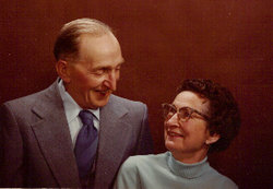
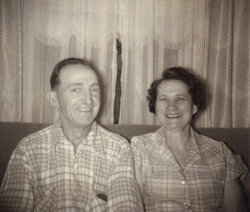
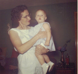
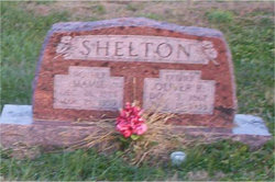
Ruth H. Shelton LaRue
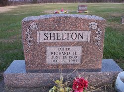
| Birth | : | 5 Jun 1907 Bronson, Bourbon County, Kansas, USA |
| Death | : | Jan 1994 Wenatchee, Chelan County, Washington, USA |
| Burial | : | St. Mary's Churchyard, Riccall, Selby District, England |
| Coordinate | : | 53.8330620, -1.0601630 |
| Plot | : | North Section, Block 5, Row 9, Lot 31, Plot 1 |
frequently asked questions (FAQ):
-
Where is Ruth H. Shelton LaRue's memorial?
Ruth H. Shelton LaRue's memorial is located at: St. Mary's Churchyard, Riccall, Selby District, England.
-
When did Ruth H. Shelton LaRue death?
Ruth H. Shelton LaRue death on Jan 1994 in Wenatchee, Chelan County, Washington, USA
-
Where are the coordinates of the Ruth H. Shelton LaRue's memorial?
Latitude: 53.8330620
Longitude: -1.0601630
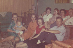
Family Members:
Parent
Spouse

Siblings
Flowers:


Nearby Cemetories:
1. All Saints Churchyard
Wistow, Selby District, England
Coordinate: 53.8134750, -1.1014755
2. St. Helen's Churchyard
Skipwith, Selby District, England
Coordinate: 53.8386300, -1.0022900
3. All Saints Churchyard
Barlby, Selby District, England
Coordinate: 53.7987840, -1.0415840
4. St Helen Churchyard
Stillingfleet, Selby District, England
Coordinate: 53.8618710, -1.0994760
5. All Saints Churchyard
Cawood, Selby District, England
Coordinate: 53.8331970, -1.1235660
6. Rythergate Cemetery
Cawood, Selby District, England
Coordinate: 53.8356000, -1.1347700
7. St. Helen's Churchyard
Escrick, Selby District, England
Coordinate: 53.8805200, -1.0460990
8. Selby Abbey
Selby, Selby District, England
Coordinate: 53.7840990, -1.0670270
9. St John Churchyard
Acaster Selby, Selby District, England
Coordinate: 53.8614750, -1.1283740
10. Selby Cemetery
Selby, Selby District, England
Coordinate: 53.7766610, -1.0775960
11. All Saints Churchyard
Ryther, Selby District, England
Coordinate: 53.8478600, -1.1576100
12. Nun Appleton Priory
Appleton Roebuck, Selby District, England
Coordinate: 53.8525000, -1.1561110
13. St. Wilfrid's Parish Churchyard
Brayton, Selby District, England
Coordinate: 53.7718060, -1.0849010
14. St Matthew Churchyard
Naburn, York Unitary Authority, England
Coordinate: 53.9009520, -1.0899200
15. All Saints Churchyard
Appleton Roebuck, Selby District, England
Coordinate: 53.8734600, -1.1580870
16. St Helen Churchyard
Thorganby, Selby District, England
Coordinate: 53.8666100, -0.9530300
17. All Saints Churchyard
Aughton, East Riding of Yorkshire Unitary Authority, England
Coordinate: 53.8393490, -0.9352200
18. Holy Trinity Churchyard
Acaster Malbis, York Unitary Authority, England
Coordinate: 53.9052480, -1.0975170
19. St Mary and St Lawrence Churchyard
Ellerton, East Riding of Yorkshire Unitary Authority, England
Coordinate: 53.8499000, -0.9347520
20. St Mary the Virgin Churchyard
Hemingbrough, Selby District, England
Coordinate: 53.7672100, -0.9796300
21. All Saints Churchyard
Bubwith, East Riding of Yorkshire Unitary Authority, England
Coordinate: 53.8170680, -0.9200130
22. All Saints Churchyard
Bolton Percy, Selby District, England
Coordinate: 53.8649780, -1.1929000
23. St Helen Churchyard
Wheldrake, York Unitary Authority, England
Coordinate: 53.8965340, -0.9626520
24. Quaker Cemetery
East Cottingwith, East Riding of Yorkshire Unitary Authority, England
Coordinate: 53.8746050, -0.9327040