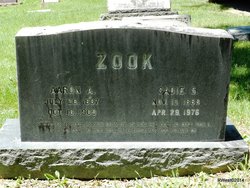
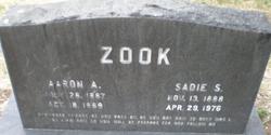
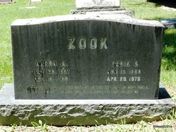
Sadie S. Yoder Zook
| Birth | : | 13 Nov 1888 McPherson County, Kansas, USA |
| Death | : | 29 Apr 1976 Colorado Springs, El Paso County, Colorado, USA |
| Burial | : | St. Michael Churchyard, Liverton, Redcar and Cleveland Unitary Authority, England |
| Coordinate | : | 54.5370370, -0.9025160 |
| Plot | : | Block 3ADD1 - - 000198 |
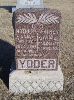
| Description | : | Zook, Sadie S., daughter of David and Fannie (Miller) Yoder, was born in McPherson Co., Kan., Nov. 13, 1888; died at St. Francis Hospital, Colorado Springs, Colo., Apr. 29, 1976; aged 87 y, On Aug. 1, 1909, she was married to Aaron A. Zook, who preceded her in death on Oct. 18, 1969. Surviving are 3 sons (Eldon, Paul, and Leland), 3 daughters (Elsie Mrs. Henry Yoder, Ruby Mrs Robert Donner, and IdaBelle Mrs. Clarence Boshart), 21 grandchildren, 29 great-grandchildren, one great-great-grandchild, one sister (Mrs. Saloma Showalter), and 2 brothers (Frank and Edward Yoder). She was a... Read More |
frequently asked questions (FAQ):
-
Where is Sadie S. Yoder Zook's memorial?
Sadie S. Yoder Zook's memorial is located at: St. Michael Churchyard, Liverton, Redcar and Cleveland Unitary Authority, England.
-
When did Sadie S. Yoder Zook death?
Sadie S. Yoder Zook death on 29 Apr 1976 in Colorado Springs, El Paso County, Colorado, USA
-
Where are the coordinates of the Sadie S. Yoder Zook's memorial?
Latitude: 54.5370370
Longitude: -0.9025160
Family Members:
Parent
Spouse
Siblings
Children
Flowers:
Nearby Cemetories:
1. St. Michael Churchyard
Liverton, Redcar and Cleveland Unitary Authority, England
Coordinate: 54.5370370, -0.9025160
2. St Leonard Churchyard
Loftus, Redcar and Cleveland Unitary Authority, England
Coordinate: 54.5532560, -0.8855250
3. Loftus Cemetery
Loftus, Redcar and Cleveland Unitary Authority, England
Coordinate: 54.5532380, -0.8716350
4. St Mary Churchyard
Moorsholm, Redcar and Cleveland Unitary Authority, England
Coordinate: 54.5207800, -0.9375800
5. St Helen's
Carlin How, Redcar and Cleveland Unitary Authority, England
Coordinate: 54.5673410, -0.9024120
6. St. Margaret of Antioch Church Cemetery
Brotton, Redcar and Cleveland Unitary Authority, England
Coordinate: 54.5662700, -0.9305900
7. All Saints Churchyard
Easington, Redcar and Cleveland Unitary Authority, England
Coordinate: 54.5520200, -0.8499800
8. Brotton Cemetery
Brotton, Redcar and Cleveland Unitary Authority, England
Coordinate: 54.5670800, -0.9310100
9. St Peter Churchyard
Brotton, Redcar and Cleveland Unitary Authority, England
Coordinate: 54.5679900, -0.9316200
10. St Margaret of Antioch Churchyard
Brotton, Redcar and Cleveland Unitary Authority, England
Coordinate: 54.5691380, -0.9358330
11. Boosbeck Cemetery
Boosbeck, Redcar and Cleveland Unitary Authority, England
Coordinate: 54.5434900, -0.9779200
12. St Aidan Churchyard
Boosbeck, Redcar and Cleveland Unitary Authority, England
Coordinate: 54.5428560, -0.9786800
13. St Nicholas Churchyard
Roxby, Scarborough Borough, England
Coordinate: 54.5365810, -0.8256590
14. Skelton Cemetery
Skelton, Redcar and Cleveland Unitary Authority, England
Coordinate: 54.5604320, -0.9736353
15. All Saints Old Churchyard
Skelton, Redcar and Cleveland Unitary Authority, England
Coordinate: 54.5623500, -0.9927600
16. Saltburn by the Sea Cemetery
Saltburn-by-the-Sea, Redcar and Cleveland Unitary Authority, England
Coordinate: 54.5808780, -0.9880640
17. St Peter Churchyard
Commondale, Scarborough Borough, England
Coordinate: 54.4863700, -0.9766200
18. St. Andrew's Old Churchyard
Upleatham, Redcar and Cleveland Unitary Authority, England
Coordinate: 54.5656900, -1.0164700
19. St. Hilda Churchyard
Hinderwell, Scarborough Borough, England
Coordinate: 54.5422400, -0.7784600
20. Hinderwell Cemetery
Hinderwell, Scarborough Borough, England
Coordinate: 54.5430090, -0.7781630
21. Quakers Burial Ground
Castleton, Scarborough Borough, England
Coordinate: 54.4614010, -0.9478360
22. Guisborough Cemetery
Guisborough, Redcar and Cleveland Unitary Authority, England
Coordinate: 54.5448330, -1.0430940
23. St. Nicholas Churchyard
Guisborough, Redcar and Cleveland Unitary Authority, England
Coordinate: 54.5366500, -1.0482800
24. Guisborough Priory
Guisborough, Redcar and Cleveland Unitary Authority, England
Coordinate: 54.5361700, -1.0489500

