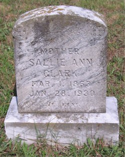
Sallie Ann Lambert Clark
| Birth | : | 3 Mar 1863 Dinwiddie County, Virginia, USA |
| Death | : | 28 Jan 1930 |
| Burial | : | All Saints Churchyard, Faringdon, Vale of White Horse District, England |
| Coordinate | : | 51.6595730, -1.5839770 |
| Plot | : | #64 |
| Inscription | : | MOTHER --- At Rest. |
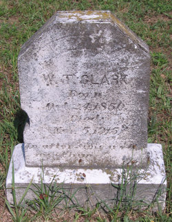
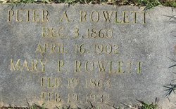
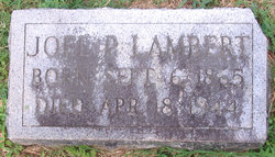
| Description | : | Daughter of Tom J. & Nannie/Nancy Lambert. In 1870, T.J. & Nancy G. lived in the Darvills Twp, Dinwiddie County. They had 6 children at home; James M.(age 9), Sallie A.(age 7), Mary P.(age 5), Joel P.(age 4), Julie E.(age 3) & Thomas E.(age 1). In 1880, Sallie A.(age 18), Mary(age 15)& Tommie E.(age 10) lived with their Uncle P.F. Rowlett, his wife Mary J., 2 sons Robert E. & Peter A. and daughter Minnie F. in Bellefonte, Nottoway, VA. Sallie A. Lambert (age 26) married W.T. Clarke on 19 Dec 1888, Nottoway Co, VA. Disinterment from the Whites Chapel Church Cemetery,... Read More |
frequently asked questions (FAQ):
-
Where is Sallie Ann Lambert Clark's memorial?
Sallie Ann Lambert Clark's memorial is located at: All Saints Churchyard, Faringdon, Vale of White Horse District, England.
-
When did Sallie Ann Lambert Clark death?
Sallie Ann Lambert Clark death on 28 Jan 1930 in
-
Where are the coordinates of the Sallie Ann Lambert Clark's memorial?
Latitude: 51.6595730
Longitude: -1.5839770
Family Members:
Parent
Spouse
Siblings
Children
Flowers:
Nearby Cemetories:
1. All Saints Churchyard
Faringdon, Vale of White Horse District, England
Coordinate: 51.6595730, -1.5839770
2. Faringdon Nonconformist Cemetery
Faringdon, Vale of White Horse District, England
Coordinate: 51.6576700, -1.5907200
3. St. Mary's Churchyard
Little Coxwell, Vale of White Horse District, England
Coordinate: 51.6398280, -1.5941840
4. Littleworth Cemetery
Littleworth, Vale of White Horse District, England
Coordinate: 51.6722500, -1.5492500
5. St. Giles Churchyard
Great Coxwell, Vale of White Horse District, England
Coordinate: 51.6389520, -1.6114148
6. St. Faith Churchyard
Shellingford, Vale of White Horse District, England
Coordinate: 51.6394270, -1.5407780
7. Church of Saint Michael and All Angels
Eaton Hastings, Vale of White Horse District, England
Coordinate: 51.6852000, -1.6212000
8. St John the Evangelist Churchyard
Fernham, Vale of White Horse District, England
Coordinate: 51.6251600, -1.5777100
9. Buscot Park
Faringdon, Vale of White Horse District, England
Coordinate: 51.6684973, -1.6518000
10. St George's Parish Church
Hatford, Vale of White Horse District, England
Coordinate: 51.6510000, -1.5120000
11. St Mary the Virgin Parish Churchyard
Longcot, Vale of White Horse District, England
Coordinate: 51.6146420, -1.6056320
12. St. George's Churchyard
Kelmscott, West Oxfordshire District, England
Coordinate: 51.6925550, -1.6408780
13. All Saints Churchyard
Coleshill, Vale of White Horse District, England
Coordinate: 51.6422960, -1.6611320
14. St Nicholas Churchyard
Baulking, Vale of White Horse District, England
Coordinate: 51.6142910, -1.5431850
15. St Deny's Churchyard
Stanford-in-the-Vale, Vale of White Horse District, England
Coordinate: 51.6399960, -1.5062800
16. St George Roman Catholic Churchyard
Buckland, Vale of White Horse District, England
Coordinate: 51.6804300, -1.5068720
17. St Mary Churchyard
Buckland, Vale of White Horse District, England
Coordinate: 51.6819730, -1.5060150
18. St. Stephen's Churchyard
Clanfield, West Oxfordshire District, England
Coordinate: 51.7174060, -1.5911740
19. St Mary Churchyard
Uffington, Vale of White Horse District, England
Coordinate: 51.6018480, -1.5649000
20. St. Mary's Churchyard
Buscot, Vale of White Horse District, England
Coordinate: 51.6815710, -1.6736770
21. Watchfield Military Cemetery
Watchfield, Vale of White Horse District, England
Coordinate: 51.6110800, -1.6469400
22. Watchfield Cemetery
Watchfield, Vale of White Horse District, England
Coordinate: 51.6109220, -1.6467980
23. St. Thomas Churchyard
Watchfield, Vale of White Horse District, England
Coordinate: 51.6107409, -1.6468265
24. All Saints Church
Pusey, Vale of White Horse District, England
Coordinate: 51.6663890, -1.4801330

