
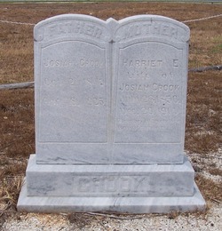
| Birth | : | 7 Jul 1887 |
| Death | : | 2 Oct 1966 |
| Burial | : | McPherson Cemetery, McPherson, McPherson County, USA |
| Coordinate | : | 38.3630981, -97.6430969 |
| Description | : | Wife of J. Frank Belk |
frequently asked questions (FAQ):
-
Where is Sallie E Crook Belk's memorial?
Sallie E Crook Belk's memorial is located at: McPherson Cemetery, McPherson, McPherson County, USA.
-
When did Sallie E Crook Belk death?
Sallie E Crook Belk death on 2 Oct 1966 in
-
Where are the coordinates of the Sallie E Crook Belk's memorial?
Latitude: 38.3630981
Longitude: -97.6430969
Family Members:
Parent

Spouse

Siblings
Children
Flowers:


Nearby Cemetories:
1. McPherson Cemetery
McPherson, McPherson County, USA
Coordinate: 38.3630981, -97.6430969
2. McPherson Town Museum
McPherson, McPherson County, USA
Coordinate: 38.3697100, -97.6504160
3. Company D 2nd Kansas Infantry World War I Memorial
McPherson, McPherson County, USA
Coordinate: 38.3700500, -97.6696000
4. New Gottland Cemetery
McPherson County, USA
Coordinate: 38.4390520, -97.6098990
5. Suncrest Mennonite Cemetery
Galva, McPherson County, USA
Coordinate: 38.3685500, -97.5378000
6. Crestwood Memorial Park
McPherson, McPherson County, USA
Coordinate: 38.4500008, -97.6583023
7. Empire Cemetery
Galva, McPherson County, USA
Coordinate: 38.3403015, -97.5192032
8. Dunkard Church Cemetery
Galva, McPherson County, USA
Coordinate: 38.3497009, -97.5006027
9. Emmanuel Bible Church Cemetery
Moundridge, McPherson County, USA
Coordinate: 38.2868200, -97.5264200
10. Groveland Cemetery
McPherson County, USA
Coordinate: 38.3182983, -97.7869034
11. United Center Church Cemetery
Galva, McPherson County, USA
Coordinate: 38.4069810, -97.4821720
12. Eden Mennonite Church Cemetery
Moundridge, McPherson County, USA
Coordinate: 38.2329890, -97.5940630
13. Lone Tree Cemetery
Moundridge, McPherson County, USA
Coordinate: 38.2846985, -97.5002975
14. Monitor Church of the Brethren Cemetery
McPherson, McPherson County, USA
Coordinate: 38.3334750, -97.8141640
15. Koons Cemetery
Lindsborg, McPherson County, USA
Coordinate: 38.5072100, -97.6298900
16. Fairview Cemetery
McPherson County, USA
Coordinate: 38.4389000, -97.8058014
17. Inman North Cemetery
Inman, McPherson County, USA
Coordinate: 38.2472000, -97.7791977
18. Hopefield Church Cemetery
Moundridge, McPherson County, USA
Coordinate: 38.2105180, -97.5858040
19. Zion Mennonite Cemetery
Inman, McPherson County, USA
Coordinate: 38.2596140, -97.8115820
20. Inman Sam Burial Site
Inman, McPherson County, USA
Coordinate: 38.2314408, -97.7762868
21. Canton Township Cemetery
Canton, McPherson County, USA
Coordinate: 38.3974170, -97.4280350
22. Ensz Family Cemetery
Inman, McPherson County, USA
Coordinate: 38.2535900, -97.8177100
23. Immanuel Lutheran Church Cemetery
Canton, McPherson County, USA
Coordinate: 38.2755330, -97.4473030
24. Windom Cemetery
Windom, McPherson County, USA
Coordinate: 38.3842010, -97.8694000