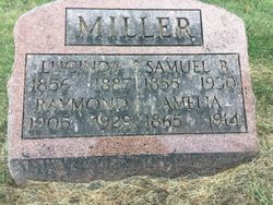
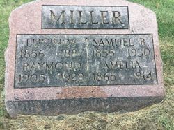
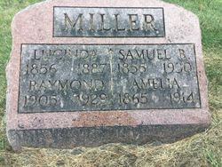
Samuel B Miller
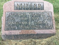
| Birth | : | 18 May 1855 Johnson County, Iowa, USA |
| Death | : | 24 Feb 1930 Eureka, Woodford County, Illinois, USA |
| Burial | : | Lower Deer Creek Cemetery, Johnson County, USA |
| Coordinate | : | 41.5381012, -91.7985992 |
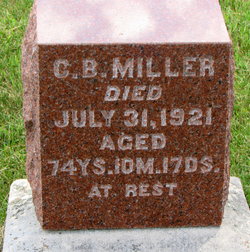
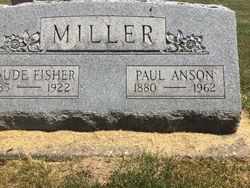
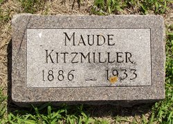
| Description | : | MILLER. Samuel B. Miller, was born May 18, 1855, in Johnson Co., Iowa; died at Eureka, Ill., Feb. 24, 1930; aged 74 y. 9 m. 6 d. In his youth he united with the Mennonite Church in which faith he lived and died, and at the time of his death was a member of the East Union congregation. He was married Dec. 21, 1879, to Lacinda Beachy, who died July 16, 1887. To this union 5 children were born (Anson, Mrs. B. J. Kauffman, Mrs. Wm. Kitsmiler, Max, and Mrs. C. P. Webber deceased). On Oct. 24, 1889,... Read More |
frequently asked questions (FAQ):
-
Where is Samuel B Miller's memorial?
Samuel B Miller's memorial is located at: Lower Deer Creek Cemetery, Johnson County, USA.
-
When did Samuel B Miller death?
Samuel B Miller death on 24 Feb 1930 in Eureka, Woodford County, Illinois, USA
-
Where are the coordinates of the Samuel B Miller's memorial?
Latitude: 41.5381012
Longitude: -91.7985992
Family Members:
Parent
Spouse
Siblings
Children
Flowers:
Nearby Cemetories:
1. Pleasant Hill Cemetery
Johnson County, USA
Coordinate: 41.5346170, -91.7884060
2. Schottler Cemetery
Amish, Johnson County, USA
Coordinate: 41.5348950, -91.8118270
3. Wertz Cemetery
Amish, Johnson County, USA
Coordinate: 41.5486500, -91.7939000
4. Upper Deer Creek Mennonite Church Cemetery
Iowa County, USA
Coordinate: 41.5408300, -91.8398500
5. Brenneman Cemetery
Amish, Johnson County, USA
Coordinate: 41.5166702, -91.7611084
6. West Union Mennonite Cemetery
Parnell, Iowa County, USA
Coordinate: 41.5631866, -91.8408966
7. Bethel Cemetery
Johnson County, USA
Coordinate: 41.5835991, -91.8082962
8. Haven Cemetery
Johnson County, USA
Coordinate: 41.5558080, -91.7320500
9. Angels Rest Cemetery
Washington Township, Johnson County, USA
Coordinate: 41.5896000, -91.7648000
10. Coffman Cemetery
English River Township, Washington County, USA
Coordinate: 41.4889045, -91.7585030
11. Frytown Cemetery
Johnson County, USA
Coordinate: 41.5718000, -91.7355000
12. Wassonville Cemetery
Daytonville, Washington County, USA
Coordinate: 41.4846992, -91.8317032
13. South Gingerich Mennonite Cemetery
Kalona, Washington County, USA
Coordinate: 41.5076294, -91.7227936
14. McArtor Cemetery
Holbrook, Iowa County, USA
Coordinate: 41.5520134, -91.8852692
15. Sharon Bethel Cemetery
Williamstown, Johnson County, USA
Coordinate: 41.5558000, -91.7086000
16. Snider Cemetery
Kalona, Washington County, USA
Coordinate: 41.4997386, -91.7196131
17. East Union Mennonite Cemetery
Sharon Center, Johnson County, USA
Coordinate: 41.5258179, -91.7049484
18. Graper Farm Cemetery
Iowa City, Johnson County, USA
Coordinate: 41.5904360, -91.7317740
19. North Gingerich Sharon Cemetery
Johnson County, USA
Coordinate: 41.5553017, -91.7024994
20. Windham Cemetery
Johnson County, USA
Coordinate: 41.6116982, -91.7667007
21. Wellman Mennonite Cemetery
Wellman, Washington County, USA
Coordinate: 41.4658012, -91.8478012
22. Sharon Hill Cemetery
Kalona, Washington County, USA
Coordinate: 41.4928017, -91.7071991
23. Wellman Cemetery
Wellman, Washington County, USA
Coordinate: 41.4636002, -91.8475037
24. Saint Peters Cemetery
Windham, Johnson County, USA
Coordinate: 41.6091995, -91.7407990

